Gathercole Reserve


This year our annual visit to the amazing nature hotspot of Wongan Hills took us to the Gathercole Reserve which is a 141 hectare granite out crop 10Km east of the Wongan Hills townsite. At the centre of the reserve is a large granite outcrop, but what makes this one so interesting is that it is unlike most others in Western Australia. Usually granite outcrops are devoid of vegetation but Gathercole has a rich variety of vegetation that forms a fringe around the rock – Rock Sheoak, Silver Princess, Sea-urchin Hakea, Scarlet Honey  Myrtle are just a few of the species – and other plants such as  Granite Kunzea that have adapted to actually live on the rock outcrop drawing their water and nutrients from the very shallow pockets of soil found in cracks and depressions. It all sounded wonderful, but with this years very dry winter the local flora wasn’t putting on much of a show. We then decided to concentrate on doing the walk trail which is an easy 2 hour walk around the rock. There are 12 interpretive panels on the trail to tell you what you are looking at. These explain how the rock outcrop was formed, how it was shaped by wind and rain, and details of the fauna and flora found there.
 

Gathercole Reserve Walk Trail by Paul Amyes on 500px.com
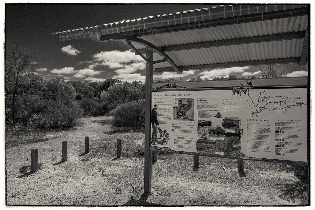
The information board at the start of the Gathercole Reserve Walk Trail in Western Australia.


Gathercole Reserve Walk Trail by Paul Amyes on 500px.com
The Gathercole Reserve Walk Trail is a 3.1 km walk throgh the Gathercole Reserve and explores the granite outcrop.


Gathercole Reserve Walk Trail by Paul Amyes on 500px.com
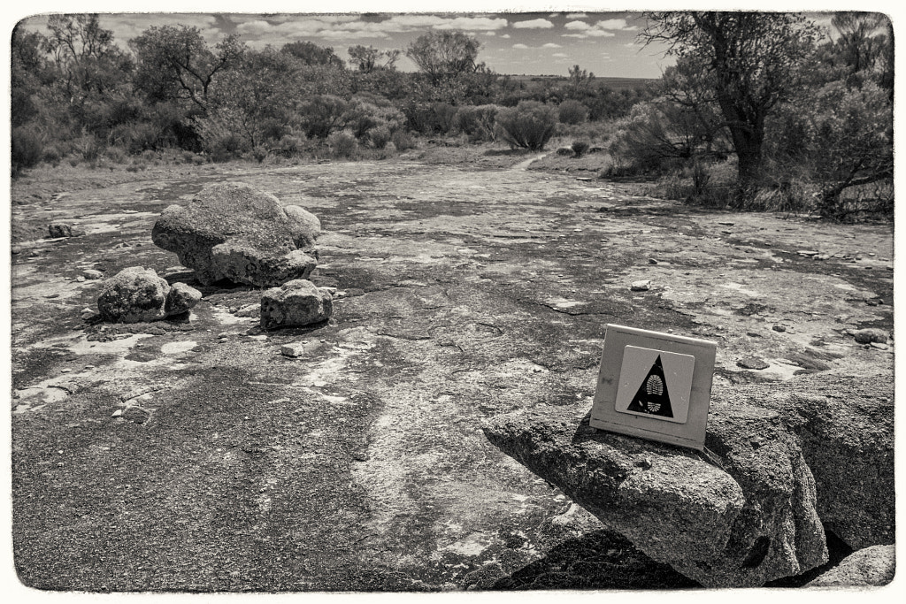
The walk trail is clearly sign posted and it is easy to follow.


Gathercole Reserve Walk Trail by Paul Amyes on 500px.com
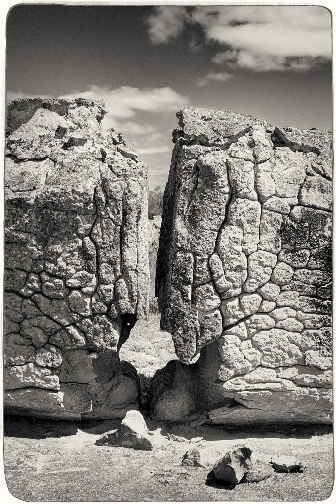
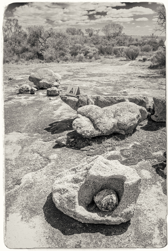
As you walk over the granite outcrop you can see different rock formations. This was caused by rapidly cooling molten rock and millenia of exposure to the elements.


Gathercole Reserve Walk Trail by Paul Amyes on 500px.com
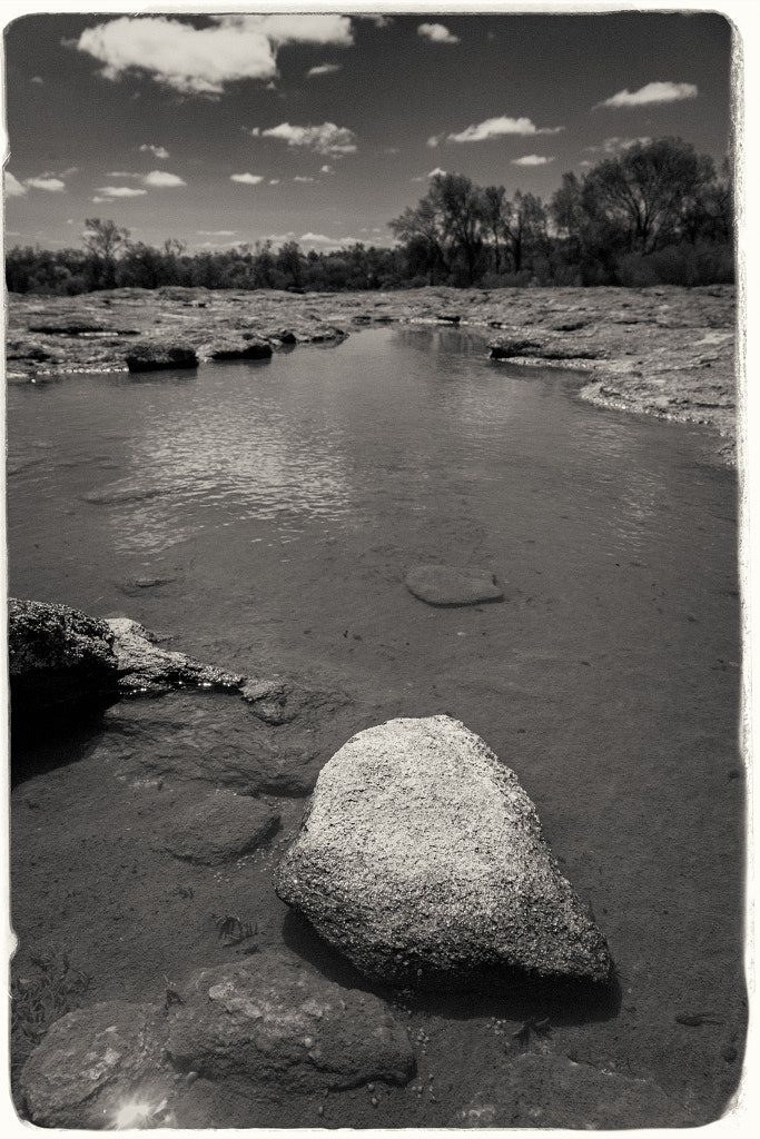
On the top of the granite outcrop water collects in the hollows during winter. These pools form the habitat for tadpoles and freshwater shrimp.


Gathercole Reserve Walk Trail by Paul Amyes on 500px.com

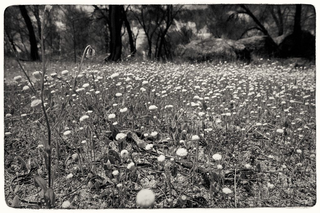
In spring the reserve puts on a spectacular show of wildflowers as evidenced by the everlasting shown here.


Photographically I felt in a bit of a rut so I decided to ditch the normal approach and just take a DSLR and one lens and shoot everything in black and white. Back in the film days I was particularly enamoured by Ilford SFX. It’s a bit of an odd ball film in that due to its extended sensitivity into the red spectrum of light it gave a mild “infrared” look without all the hassles of using infrared film which makes it ideal for day to day use. When I printed it I used glossy  Ilford Multigrade FB Warmtone paper which produced a luxuriously rich image.  I’ve not shot any film in over a decade and I’ve not had access to a darkroom for nearly twenty years so I decided to shoot digitally and emulate the look in Exposure 7. It doesn’t look quite right but it has made me think about shooting some film again. I’ve still got a couple of film cameras all I’ll need to do is find a way of scanning the negatives as I don’t want to get an enlarger and start printing again at this stage.

Walks With Emus

Thursday was my first trip into the Perth Metro in ages – I’d gone to get the car serviced and so had a day to kill. The weather was horrid, lots of rain and not very warm so killing time was not a thrilling prospect. Usually I walk over the Causeway Bridge, around Heirisson Island and then into the Perth CBD. With the rain falling and nearby construction work making a racket I didn’t expect to see much so imagine my surprise when I literally bumped into an Emu.  Now people living overseas expect that we have kangaroos running down the high streets koalas hanging out of every tree and sharks and crocodiles waiting to eat people in every small pool of water. Well it’s just not like that, and seeing an emu wandering round the metro area is pretty unusual occurrence. Poor thing didn’t look very well – it had a very large open wound on its left side. Emus can be a little bit intimidating as they’re not adverse to walking right up to you and looking you in the eye and some of the ones I’ve met do this by looking down at me. Well this one played pretty cool and just walked with me for about 500m and every time I stopped to take a picture it stopped and waited. We met up with a couple of kangaroos who were very wary of the emu. They kept a very close eye on it – didn’t pay me any attention at all. Once we got past the lake it decided it had had enough and walked back up the track making that odd sound of theirs which sound like someone has turned a plastic bucket upside down and is banging on it like drum.


Wetj by Paul Amyes on 500px.com
My companion for a walk on Heirisson Island.


Yongka by Paul Amyes on 500px.com
The girls are too impressed with their new neighbour and were content to remain at a distance and watch.


Djidi-djidi by Paul Amyes on 500px.com
A willie wagtail hunkered down against the rain.


As I walked back to the Causeway I was joined by a young female kangaroo. She was very curious and wanted to know if I had anything to eat. She did did this by pawing at my hand – obviously other visitor have been feeding them so they can get selfies. She didn’t seemed fussed when no food appeared and she was content to follow me round to the gate and watch me leave.


Yongka by Paul Amyes on 500px.com

My companion for the walk to the exit.

The Ascent of Mount Trio

Some places get all the attention and others are seldom mentioned. In the Sterling Range National Park everyone concentrates on climbing Bluff Knoll, but there is as I’ve said on previous occasions a lot more than Bluff Knoll. Believe it or not Bluff Knoll is one of the easier climbs in the park. Another one is Mount Trio. Climbing up Bluff Knoll is not a wilderness experience as there are far too many people. With Mount Trio if you see more than two other people its a very busy day.


Mount Trio by Paul Amyes on 500px.com
The sun sets behind Mount Trio in the Stirling Ranges of Western Australia.


The Ascent of Mount Trio by Paul Amyes on 500px.com
Helen at the start of the Mount Trio walking trail in Sterling Range National Park.


Mt Trio comprises three peaks and was once known by its Aboriginal name Warrungup, meaning “three become”. It is 3.7Km to the top and back with an ascent of 418m. The first third of the walk is very steep with irregularly spaced steps. Wildflowers, including the endemic mountain bells (Darwinia leiostyla), are a feature of this walk. Montane thicket on the upper levels of the peaks puts on a colourful display of wildflowers in spring and early summer although we didn’t see this as the area was still recovering from a devastating bushfire and was like walking through a landscape of charcoal sticks. 


The Ascent of Mount Trio by Paul Amyes on 500px.com
The first third of the walk trail is up a steep section with irregularly spaced steps which makes the going quite hard.


The Common Mountain Bell (Darwinia lejostyla) grows in the eastern and central Stirling Range, and can be readily seen on Bluff Knoll and Mount Trio.


Silky Blue Orchid by Paul Amyes on 500px.com
Silky Blue Orchid, Cyanicula sericea. Mount Trio, Western Australia.


The going gets easier once you hit the saddle between the east peak and the north peak. The saddle between the cols is covered in Drumsticks (Kingia australis). These grass trees were often called Black Gin trees, a derogatory racist term now not used. The Nyoongar name for them is Pulonok. The track then follows a more gentle slope to the highest (northern) point at 856 metres. At the summit there is a small cairn of stones which people add to on getting there. From the summit on a clear day you get views of Mt Toolbrunup the second highest peak in the range at 1052m. Then all it is a matter of retracing your footsteps back to the start.


The Ascent of Mount Trio by Paul Amyes on 500px.com
The saddle between the cols is covered in Drumsticks (Kingia australis). The Nyoongar name is Pulonok.


The Ascent of Mount Trio by Paul Amyes on 500px.com
A closer look at some Drumsticks (Kingia australis).


The Ascent of Mount Trio by Paul Amyes on 500px.com
Helen placing another stone on the cairn at the summit of Mount Trio.


The Ascent of Mount Trio by Paul Amyes on 500px.com
Looking out at Mt Toolbrunup from the summit of Mount Trio.


Climbing up was pretty taxing on the legs muscles – all those steps were like a sadistic form of step aerobics. Those steps were even more murderous on the way down. It was the muscles that were complaining this time it was my knee joints. At about 500m from the end my knees announced that they were going to divorce me on the basis of cruelty. Thankfully from this point we could clearly see the car in the car park below us and it spurred us on to one last final effort.


A Path Less Travelled

Nancy Peak by Paul Amyes on 500px.com

The Nancy Peak Circuit takes you through dense Karri forest and up on to the granite dome of the Porongurups.


Last week I wrote about walking uptown Castle Rock and the Granite Skywalk in Porongurup National Park, this post is about the Nancy Peak Circuit also in the Porongurups.


The Porongurup National Park is 359km (or 4 hours) south of Perth near Mt Barker. This 5.5 Km walk starts at the Tree-in-the-Rock car parking area which can be accessed via Bolganup Road which is a turn off from the main Porongurup Road. Until the opening of the Granite Skywalk this used to be the main entrance to the park and where the visitors came. When we went the other week the car park was deserted and we only saw one other walker on the trail. At the information area take the path for the Nancy Peak Circuit and walk on past the Tree In The Rock through the Karri Forest.


Nancy Peak by Paul Amyes on 500px.com

The walk takes you past the Tree in The Rock. Impressive that a tree so big could grow out of a crack in the rock.


Nancy Peak by Paul Amyes on 500px.com

Karri trees can easily grow up to 60m in height, some have been known to reach 90m.


Nancy Peak by Paul Amyes on 500px.com

Some of the Karri trees along the trail have been damaged by bush fires. This one has had its trunk hollowed out and yet amazingly it continues to grow.


The forest was almost like a temperate rainforest – moist with a thick understory that supports mosses ferns and a huge number of fungi. It is not something you typically associate with Western Australia. In fact it felt more like Tasmania once it started raining! After about an hour you emerge from the forest onto granite ridge which connects to Nancy Peak and Morgans Peak.Once you climb up to the peaks they afford fantastic views  to the Stirling Ranges in the north and Southern Ocean to the south. Of course this depends upon the weather, and as luck would have when we came out of the forest we were greeted by white out conditions caused by low lying cloud and could only see about 5m in front of us. As we slowly made our way up to Nancy Peak the clouds did part and grant us glimpses of the views.


Nancy Peak by Paul Amyes on 500px.com

Russula persanguinea in Porongurup National Park, Western Australia.


Nancy Peak by Paul Amyes on 500px.com

Pausing for a breather in whiteout conditions on the way up to Nancy Peak.


Nancy Peak by Paul Amyes on 500px.com

Looking back from Nancy Peak towards Castle Rock in the distance during a rare break in the cloud.


Carrying along the ridge from Nancy Peak across the granite outcrops, then descend into a steep valley between Nancy Peak and Devils Slide. Eventually you’ll hit a fire road that takes you back through the karri forest and on to the car park. This will take about 4 hours depending on the weather. It rained pretty hard on and off when we did the walk and this made sections of the granite incredibly slippery – it was like walking on ice – and this slowed us down a lot. The highlight of the walk was watching two wedge tailed eagles ride the thermals below us as we stood on the summit.


Nancy Peak by Paul Amyes on 500px.com

Granite boulders on top of Nancy’s Peak.


Porongurup National Park by Paul Amyes on 500px.com

Helen enjoying the view from Nancy Peak back in 2004.

Tomato Lake


Tomato Lake by Paul Amyes on 500px.com
Situated in Kewdale, Tomato Lake Reserve contains a wetland, a central lake, 1.6km walking trail, nature sanctuary island and boardwalk across the lake. The gazebo on the boardwalk is popular for watching the birds on the lake and it also used as a wedding venue.


Tomato Lake is situated in the Perth suburb of Kewdale and has like many places in Western Australia been known by an assortment of names. On settlement it was called Smith’s Swamp because it was owned by a Mr Smith. Come the early 1900’s it became known as Craig’s Swamp because it was owned by a Mr Stephen Craig and it continued this way until the 1960’s when it became known by its current name Tomato Lake. No it isn’t owned by Mr Tomato! It got the name Tomato Lake because Mr Craig grew tomatoes there. Urban clearing around the lake meant it eventually dried up and became no good for market gardening and the whole place got really neglected and riddled with duckweed, an imported feral species, which choked the remaining water killing off native flora and fauna. By the mid 1970’s a local action group formed to rehabilitate the lake and now it is an important nature reserve as well as being a very popular recreational facility. 


Tomato Lake by Paul Amyes on 500px.com
Tomato Lake in the Perth suburb of Kewdale is a popular spot with walkers.


So what’s there? Well the lake is in the middle of a large reserve and it is bisected by a broad walk with pergola. There is an island in the lake which provides a breeding area for the waterbirds. The lake is circumnavigated by a 1.6 Km paved path. There are also some unpaved trails through different parts of the reserve which I added to the walk to make a 2.5Km loop. At the top of the park on the corner of Oats Street and Scenic Drive there is a cafe, BBQs and playground. The southern end of the lake is where you’ll see the bushbirds while the waterfowl can be seen over the entire lake. According to EBird Australia 83 different species of bird have been sighted there which is quite a number for such a small area. As it can be very busy at weekends, especially in wedding season, it would be best to visit midweek early in the morning or an hour before sundown.


Karak by Paul Amyes on 500px.com
A pair of Red-tailed Black Cockatoos (Calyptorhynchus banksii subs samueli). Tomato Lake, Western Australia.


Wodjalok by Paul Amyes on 500px.com
Wodjalok called the red wattle bird (Anthochaera carunculata subs woodwardi) by European settlers.


Yet by Paul Amyes on 500px.com
Yet called the pacific black duck (Anas superciliosa) by colonialists. Tomato Lake, Western Australia.


Dooromdorom by Paul Amyes on 500px.com
Dooromdorom called the Singing Honeyeater (Lichenostomus virescens virescens) by colonialists. Tomato Lake, Western Australia.


Kwilom by Paul Amyes on 500px.com
Kwilom or purple swamp hen (Porphyrio porphyrio). Tomato Lake, Western Australia.


Wyooda by Paul Amyes on 500px.com
Wyooda aka the Hoary-headed Grebe (Poliocephalus poliocephalus). Tomato Lake, Western Australia.


Little Egret by Paul Amyes on 500px.com
Little Egret, Egretta garzetta subsp. nigripes. Tomato Lake, Western Australia.

Ashfield Flats

Ashfield Flats by Paul Amyes on 500px.com
A tranquil spot by the Swan River at Ashfield Flats in Western Australia.


Ashfield Flats by Paul Amyes on 500px.com
The dual use paths along the river at Ashfield are popular with cyclists and walkers alike

This 6Km walk takes you through the area between Sandy Beach Reserve and Claughton Reserve. Heading out westwards from Sandy Beach Reserve the walk takes you through areas of open grassland and salt marsh interspersed with stands of paperbarks and bulrushes. When you get to Claughton Reserve you will see grasslands and mature flooded gums. At the weekends it is a popular recreational area attracting walkers, cyclists, and various paddle sports.


SUP at Ashfiled by Paul Amyes on 500px.com
The Swan River by Ashfiled Flats is a popular location for canoeists and stand up paddle boarders.


The best time to visit and see wildlife is early morning midweek and take time to explore the stands of trees and scrub off of the trail. What can you expect to see? Well EBird Australia have a list of 95 different species that have been recorded in the area. Birds that are regularly seen include:

  • Pacific Black Duck
  • White-faced Heron
  • Red Wattle Bird
  • Singing Honeyeater
  • Brown Honeyeater
  • Great Egret
  • Black-shouldered Kite
  • Nankeen Kestrel
  • Galah
  • Australian Ringneck
  • Sacred Kingfisher
  • Magpie-lark
  • Black-faced Cuckoo-shrike
  • Grey Butcherbird
  • Richard’s Pipit
  • Welcome Swallow
  • Silvereye

On my visit I managed to spot 18 different species on a busy Saturday morning so I was happy with that and I’ll try and get back earlier in the morning midweek next time.


Fishing by Paul Amyes on 500px.com
Great egret (Ardea alba modesta) fishing at Ashfield Flats, Western Australia.


Madi by Paul Amyes on 500px.com
Australian Pied Cormorant,Phalacrocorax various. Ashfield Flats, Western Australia.


Kokoko by Paul Amyes on 500px.com
Little pied cormorant, Microcarbo melanoleucos, drying out in the sun. Ashfield Flats, Western Australia.


Dilabot by Paul Amyes on 500px.com
Magpie-lark, Grallina cyanoleuca. Ashfielde Flats, Western Australia.


Biako by Paul Amyes on 500px.com
A pair of Galahs, Eolophus roseicapilla, at Ashfield Fats, Western Australia.


Dooromdorom by Paul Amyes on 500px.com
Singing Honeyeater, Lichenostomus virescens virescens. Ashfield Flats, Western Australia.


Rufous Whistler by Paul Amyes on 500px.com
A female Rufous Whistler, Pachycephala rufiventris, at Ashfield Flats, Western Australia.


Karbanga by Paul Amyes on 500px.com
Karbanga or great cormorant (Phalacrocorax carbo subsp. carboides) , sunning itself. Ashfield Flats, Western Australia.


Rufous Whistler by Paul Amyes on 500px.com
A male Rufous Whistler, Pachycephala rufiventris, singing. Ashfield Flats, Western Australia.


Djitidjiti by Paul Amyes on 500px.com
Willie Wagtail, Rhipidura leucophrys leucophrys, singing. Ashfield Flats, Western Australia.


Karak by Paul Amyes on 500px.com

Red-tailed Black Cockatoo, Calyptorhynchus banksii subs samueli. Ashfield Flats, Western Australia.

The Werillyiup Trail


Werillyiup Trail by Paul Amyes on 500px.com

Follow the blue poles for the Werillyiup Trail in Whiteman Park.


The Werrillyiup Trail in Whiteman Park is a 3Km jaunt around an area called Horse Swamp. So called because back in the early days of the Swan River Colony if horses escaped they invariably ended up at the swamp. The word Werrillyiup is is Nyoongar for “a swampy place” so from all this you’d expect to see quite a bit of water. Well for much of the year it is dry and really only fills in June with the coming of the winter rains. Each time I’ve been it’s been akin to walking around a large puddle. That’s not to detract anything away from  it, it is just a statement of fact. What you will see though is an important wildlife refuge in a large ever-growing city. Western Grey Kangaroos are the most visible residents but there is a huge variety of birdlife here particularly in winter, spring and early summer. I’ve had more luck seeing raptors here than at any other location in Perth. EBird Australia has a listing of 101 species that can be seen at various times of the year around the swamp.


Yongka by Paul Amyes on 500px.com

Western Grey Kangaroo, macropus fuliginosus, Whiteman Park, Western Australia.


Australian Hobby by Paul Amyes on 500px.com

Australian Hobby (Falco longipennis longipennis). Whiteman Park, Western Australia.


Djando by Paul Amyes on 500px.com
A pair of Whistling Kites seen flying round the aviaries on the edge of Whiteman Park.


Wyan by Paul Amyes on 500px.com

A white-faced heron looks out from its tree top perch over Horse Swamp. Whiteman Park, Western Australia.


Australian Shelduck by Paul Amyes on 500px.com
Australian Shelduck, Tadorna tadornoides, Whiteman Park, Western Australia.


After your leisurely walk around the swamp you can be revived at the excellent Guerrilla Hub Kiosk with a great coffee and some of their wonderful food. And if after all that you feel as if you’ve not communed enough with the wildlife you can always nip up to Caversham Wildlife Park and have your picture taken with a wombat.


Refreshment after a hard mornings walking and bird watching at the Guerrilla Hub kiosk in Whiteman Park.


Yours truly with one of Caversham Wildlife Park’s staff and a wombat.