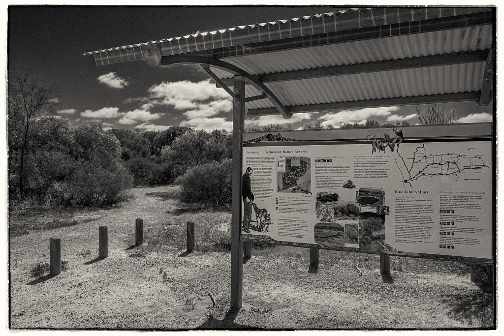
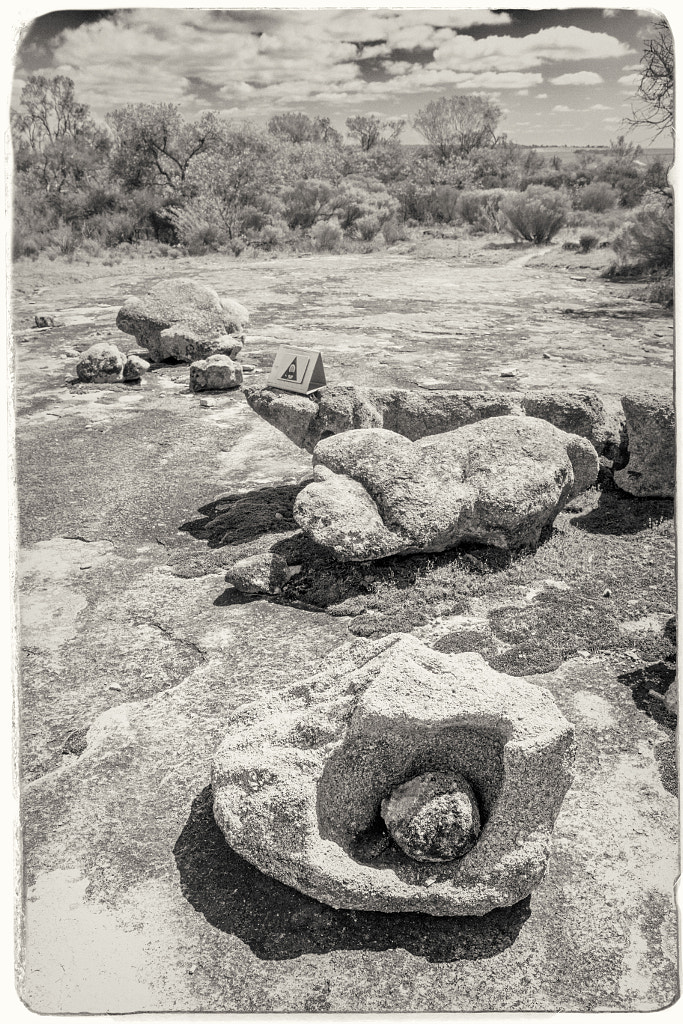
This year our annual visit to the amazing nature hotspot of Wongan Hills took us to the Gathercole Reserve which is a 141 hectare granite out crop 10Km east of the Wongan Hills townsite. At the centre of the reserve is a large granite outcrop, but what makes this one so interesting is that it is unlike most others in Western Australia. Usually granite outcrops are devoid of vegetation but Gathercole has a rich variety of vegetation that forms a fringe around the rock – Rock Sheoak, Silver Princess, Sea-urchin Hakea, Scarlet Honey Myrtle are just a few of the species – and other plants such as Granite Kunzea that have adapted to actually live on the rock outcrop drawing their water and nutrients from the very shallow pockets of soil found in cracks and depressions. It all sounded wonderful, but with this years very dry winter the local flora wasn’t putting on much of a show. We then decided to concentrate on doing the walk trail which is an easy 2 hour walk around the rock. There are 12 interpretive panels on the trail to tell you what you are looking at. These explain how the rock outcrop was formed, how it was shaped by wind and rain, and details of the fauna and flora found there.
The information board at the start of the Gathercole Reserve Walk Trail in Western Australia.
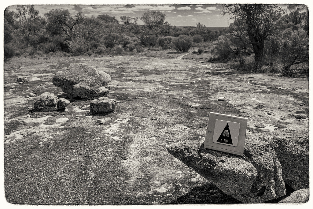
The Gathercole Reserve Walk Trail is a 3.1 km walk throgh the Gathercole Reserve and explores the granite outcrop.
The walk trail is clearly sign posted and it is easy to follow.
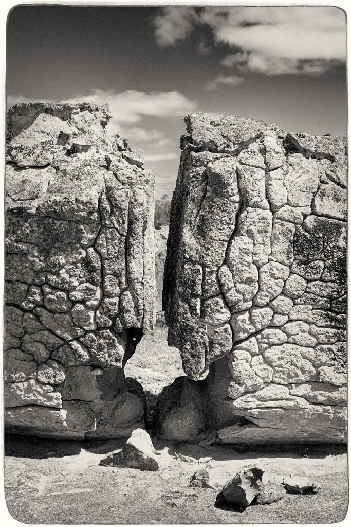
As you walk over the granite outcrop you can see different rock formations. This was caused by rapidly cooling molten rock and millenia of exposure to the elements.
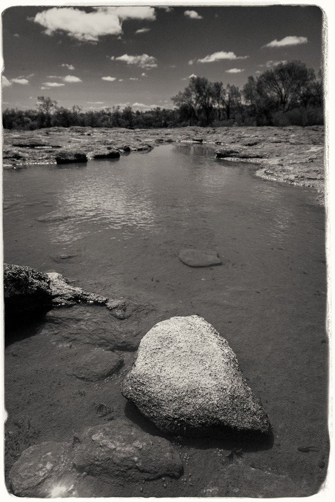
On the top of the granite outcrop water collects in the hollows during winter. These pools form the habitat for tadpoles and freshwater shrimp.
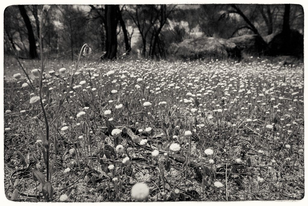
In spring the reserve puts on a spectacular show of wildflowers as evidenced by the everlasting shown here.
Photographically I felt in a bit of a rut so I decided to ditch the normal approach and just take a DSLR and one lens and shoot everything in black and white. Back in the film days I was particularly enamoured by Ilford SFX. It’s a bit of an odd ball film in that due to its extended sensitivity into the red spectrum of light it gave a mild “infrared” look without all the hassles of using infrared film which makes it ideal for day to day use. When I printed it I used glossy Ilford Multigrade FB Warmtone paper which produced a luxuriously rich image. I’ve not shot any film in over a decade and I’ve not had access to a darkroom for nearly twenty years so I decided to shoot digitally and emulate the look in Exposure 7. It doesn’t look quite right but it has made me think about shooting some film again. I’ve still got a couple of film cameras all I’ll need to do is find a way of scanning the negatives as I don’t want to get an enlarger and start printing again at this stage.
Helen starting the walk up to the summit of Boyagin Rock.
There’s no shortage of granite outcrops to walk up in the Wheatbelt of Western Australia. This time we chose to go to Boyagin Rock. The journey there was a bit eventful as the navigator in charge had me drive up a very steep, narrow and heavily rutted gravel track in the belief that it was the turn off to take us to Boyagin Rock. After a couple of kilometres the track deteriorated even further and it was obviously not the way. With no way of turning round I had to reverse back down the hill avoiding the larger holes all while the navigator in charge was warning me of our impending doom. After a few tense moments we got back onto Boyagin Road, whilst it is also a gravel road it was as smooth as a billiard table compared to what we’d just come down. After a couple more kilometres the sign for the turn off for the rock was visible and we got to the car park and picnic area with no further dramas.
It’s not the first time we’ve visited, but this time it wasn’t wet which made walking across the granite a lot easier because when it is wet it’s like walking across an ice rink . The bush around the base looked terrific with lots of flowers out and birds calling from the trees. We were hoping to see dragon lizards basking on the rock itself, but there was a slight nip to air that was enough to keep the lizards in the shelter of the crevices. We flushed some Australian Pipits as we walked up, unfortunately I didn’t have a long enough lens to photograph them. As we walked up onto the granite Helen had a close encounter of the spiny kind with an echidna – it was a bit on the shy side and curled up in a ball at the bottom of a tree.
Everlastings form in smasll patches of grass between the trees.
Lemon scented orchids could be found growing among the yellow everlastings.
A well earned rest on a convenient rock.
It’s not a difficult walk and the Nyoongar people, who call it “Boogin”, believe that if you walk to the top of the rock without stopping you will live a long life. We’ve now done it twice so we should live to a very ripe old age. When we got to the top I was surprised to see a pool of water, it must be fed totally by rainfall. Even more surprising was the number of tadpoles swimming in it. Australian frogs never cease to surprise me – you find them in all sorts of strange places and you can’t help but wonder how they survive.
The rock pile in the middle of the pool on the top of Boyagin Rock.
Helen celebrates reaching the summit.
A quick jaunt down the rock retracing our tracks and we were back at the car. A leisurely picnic followed and we discussed where we will go for our next trip.
The Nancy Peak Circuit takes you through dense Karri forest and up on to the granite dome of the Porongurups.
Last week I wrote about walking uptown Castle Rock and the Granite Skywalk in Porongurup National Park, this post is about the Nancy Peak Circuit also in the Porongurups.
The Porongurup National Park is 359km (or 4 hours) south of Perth near Mt Barker. This 5.5 Km walk starts at the Tree-in-the-Rock car parking area which can be accessed via Bolganup Road which is a turn off from the main Porongurup Road. Until the opening of the Granite Skywalk this used to be the main entrance to the park and where the visitors came. When we went the other week the car park was deserted and we only saw one other walker on the trail. At the information area take the path for the Nancy Peak Circuit and walk on past the Tree In The Rock through the Karri Forest.
The walk takes you past the Tree in The Rock. Impressive that a tree so big could grow out of a crack in the rock.
Karri trees can easily grow up to 60m in height, some have been known to reach 90m.
Some of the Karri trees along the trail have been damaged by bush fires. This one has had its trunk hollowed out and yet amazingly it continues to grow.
The forest was almost like a temperate rainforest – moist with a thick understory that supports mosses ferns and a huge number of fungi. It is not something you typically associate with Western Australia. In fact it felt more like Tasmania once it started raining! After about an hour you emerge from the forest onto granite ridge which connects to Nancy Peak and Morgans Peak.Once you climb up to the peaks they afford fantastic views to the Stirling Ranges in the north and Southern Ocean to the south. Of course this depends upon the weather, and as luck would have when we came out of the forest we were greeted by white out conditions caused by low lying cloud and could only see about 5m in front of us. As we slowly made our way up to Nancy Peak the clouds did part and grant us glimpses of the views.
Russula persanguinea in Porongurup National Park, Western Australia.
Pausing for a breather in whiteout conditions on the way up to Nancy Peak.
Looking back from Nancy Peak towards Castle Rock in the distance during a rare break in the cloud.
Carrying along the ridge from Nancy Peak across the granite outcrops, then descend into a steep valley between Nancy Peak and Devils Slide. Eventually you’ll hit a fire road that takes you back through the karri forest and on to the car park. This will take about 4 hours depending on the weather. It rained pretty hard on and off when we did the walk and this made sections of the granite incredibly slippery – it was like walking on ice – and this slowed us down a lot. The highlight of the walk was watching two wedge tailed eagles ride the thermals below us as we stood on the summit.
Granite boulders on top of Nancy’s Peak.
Helen enjoying the view from Nancy Peak back in 2004.
Low level cloud brings white out conditions to Bluff Knoll. Even in late spring the weather can be incredibly unpredictable. The Stirling Range is one of only a few places in Western Australia where snow falls.
Stirling Range National Park lies approximately one hours drive north of Albany in Western Australia’s Great Southern region. The reason most people visit the park is to climb Bluff Knoll which they believe to be the highest peak in Western Australia. Bluff Knoll is an imposing structure – it rises dramatically above the pan flat agricultural land surrounding the park – but the highest point in Western Australia it is not. That honour goes to Mount Meharry in Karijini National Park which is 1245m compared to Bluff Knoll’s 1093m. The other reason people visit Bluff Knoll is that it is the most easily accessible walk in the park being serviced by a road, having parking and a cafe. The trail is well signposted and is comparatively well surfaced and above all despite being steep in places anyone of reasonable fitness can do it. That cannot be said of some of the other walking routes within the park. There is good reason why Australia’s Special Air Service Regiment (SASR) train there.
The road to Bluff Knoll in the Stirling Range National Park. At 1099m it is the highest peak in the Stirling Range. It is often surrounded by mist and low lying cloud.
Twilight in the Stirling Range and the peak of Bluff Knoll is being buffetted by a storm.
Highland areas such as the Stirling Range always have very variable weather and often in the extremes. The Qaaniyan and Koreng groups of the Nyoongar called Stirling Range Koikyennuruff or place of the swirling mist. Low lying cloud and mist often shroud the peaks even on bright sunny days. The Nyoongar believe Noatch, the spirit of the dead, lived in the mist and that evil witches lived on the high ridges and so tended to avoid going up onto the peaks. All I know is that it can be shorts and tee shirt weather at the base of Bluff Knoll but when you get to the top it can be very cold and wet. The fact that it is the only place where it snows with any regularity in Western Australia (any time between April and November) shows how difficult the weather can be. The weather is one of the main reasons why people get into strife when climbing Bluff Knoll, most are simply under equipped and under prepared. A Swedish acquaintance once told me there was no such thing as bad weather just poor choices of clothing and that is certainly borne out here. Things aren’t much better in summer as the park is very prone to bush fires so if you wish to visit make sure you are aware of what is happening in the park and whether the trails are open by checking with the Department of Biodiversity, Conservation and Attractions Parks Alerts System and then plan accordingly. The other reason why people get into trouble is that they leave the trail looking to find a short cut and then get disorientated and lost in the scrub.
Pausing for a quick breather by a grass tree (xanthorrhoeaceae drumondii) while trudging up Bluff Knoll on a rainy morning.
I first intended to climb Bluff Knoll with my partner back in September of 2000 to celebrate her fortieth birthday but we never did it as I was run over by car. It wasn’t until October 2008 that we finally got round to doing it. Better late than never I suppose. It was a bit of a slog in cold wet weather but it was well worth the effort. We were staying at the Stirling Range Retreat which was then run by Ayleen Sands and her husband Tony. Ayleen ran orchid spotting trips and we did one and that opened my eyes to the biodiversity of the region and more specifically the amazing orchids that are found in Western Australia and I’ve been photographing orchids ever since. It was from Ayleen that we learnt that Stirling Range is an incredible biodiversity hotspot. In spring and early summer the 1500+ species of plants that can be found within the Park’s boundaries come into bloom. To put that into perspective the 1,159 km2 of the Stirling Range National Park contains more species of wildflowers that the 315,159 km2 of the British Isles.Some of these plants, such as the mountain bell (Darwinia leiostyla), are found no where else in the world. A staggering 123 species of orchid have been found in the Stirling Range National Park which works out to be about one third of the total number of orchid species that can be found inWestern Australia. There are more than 140 bird species, approximately 20 species of native animal – the most likely to be seen are western grey kangaroos. Rottnest Island isn’t the only place with quokkas they have been seen on the slopes of Bluff Knoll. The are more than 30 species of reptile and of course it would not be Australia without poisonous snakes. I initially went to climb Bluff Knoll but found so much more and have been back since and intend to go back again and again.
Looking west towards Yungermere Peak, Mount Success, and Coyanarup Peak while walking the traverse of Bluff Knoll. In the distance some of the early morning low lying cloud can still be seen fringing the mountain tops.
The Common Mountain Bell (Darwinia leiostyla) grows in the eastern and central Stirling Range, and can be readily seen on Bluff Knoll and Mount Trio.
Western Yellow Robin, Eopsaltria griseogularis. Stirling Range National Park, Western Australia.
Grey Currawong, Strepera versicolor. Stirling Range National Park, Western Australia.
Elegant parrot, Neophema elegans subsp. carteri. Stirling Range National Park, Western Australia.
The Butterfly Orchid ((calendenia lobata)) is uncommon and rarely seen, it was first observed on Mt Toolbrunup in the Stirling Range National Park in 1991.
The sun sets behind Mount Trio in the Stirling Ranges of Western Australia. The everchanging weather in the Stirling Ranges can produce some dramatic skyscapes at sunset with spectacular cloud formations over the mountains.
OK that maybe a little bit melodramatic, but there was no doubt that getting out and about after a few weeks of lockdown was a bit of a rush! So where did I go? What did I do with this new found liberty? Well I went to Wongamine Reserve near Toodyay to look for two types of orchid and do the walk trail. Pretty sad eh?
The main entrance to Wongamine Nature Reserve, Toodyay, Western Australia.
The reserve isn’t really visited any more the gates are locked and many of the signs broken or over grown. In fact speaking of overgrown the walk trail is so overgrown in places that I suggest that if you do want to visit and walk there that you take a GPS and download the walk track from Trails WA and follow that.
The reserve was closed a while ago and many of the trails and signs have fallen into a state of disrepair. Wongamine Nature Reserve, Toodyay, Western Australia.
Some of the vehicle tracks have not been used for a long time allowing termites to build mounds on them. Wongamine Nature Reserve, Toodyay, Western Australia.
This was one of only two trail markesr on the walk trail. Wongamine Nature Reserve, Toodyay, Western Australia.
Was there anything positive about the visit? Well yes there was actually. The woodland is home to quite a variety of bird life – I didn’t photograph any as I was not carrying a suitable lens as I had gone to photograph orchids. I would expect from walking through the bush that would be quite a display of wildflowers in spring which would make the journey well worth while. There were quite a few species of dragonflies as well which at the time surprised me for some reason.
Australian Emperor Dragonfly (Anax papuensis) Wongamine Nature Reserve, Toodyay, Western Australia.
Did I find the orchids? Well the Winter Spider Orchid is only 6cm tall with a 2cm flower and the Crinkle-leafed Bunny Orchid is 10cm tall with a 9mm flower and considering that the reserve is 330 ha of bushland I think I did well to find anything at all. I didn’t find any Winter Spider Orchids, I have photographed them before at Babakin, but I found lots of the Bunny Orchids. In fact I never seen so many Crinkle-leafed Bunny Orchids before. So all in all it was a great day out.
The cover of “Australia’s Best 100 Walks” to which I was a contributor.
As a fledgling photographer many years ago I used to look at copies of National Geographic and daydream about one day being a one of their photographers. Many years later that still hasn’t happened, but I have managed Australian Geographic. I happy to announce the launch of Australia’s Best 100 Walks published by Australian Geographic for which I was a contributing photographer, writer and researcher. It is available fro good bookshops such as Boffins Books for a smidge under $40 AUD.
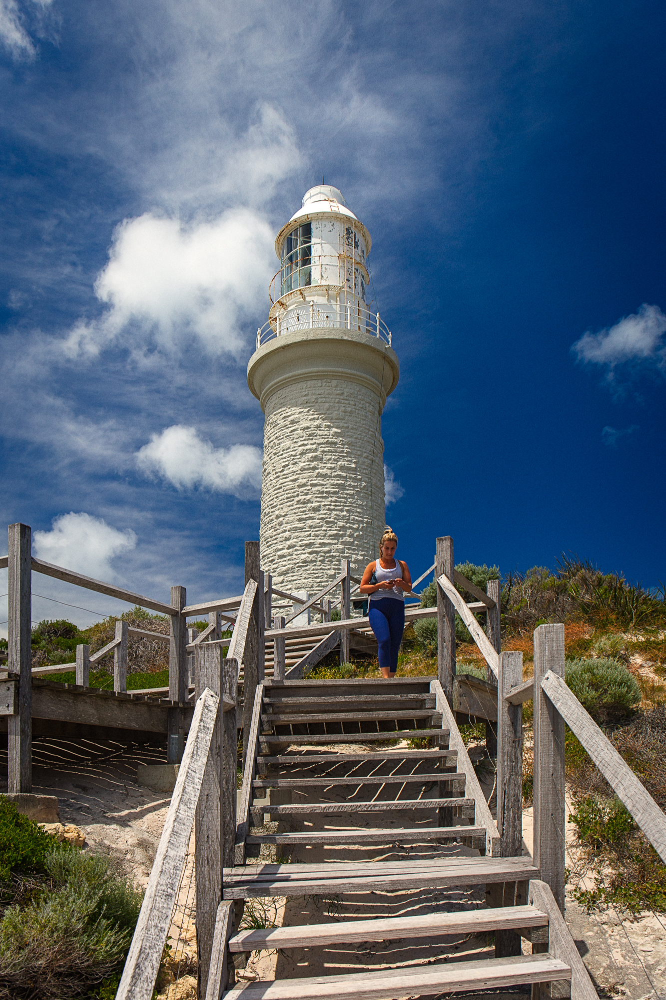
Bathurst Lighthouse on Rottnest Island, Western Australia. One of my photos from the book Australia’s Best 100 Walks.
The ubiquitous New Holland Honeyeater (Phylidonyris novaehollandiae), New Victoria Dam, Korung National Park, Western Australia.
Over the last few days my FaceBook feed has been seeing some seriously tasty bird photos from one of the groups that I belong to. The photos all come from one area– New Victoria Dam which is 30Km east of Perth on the Darling Range in Korung National Park. So when the Beloved Significant Other (BSO) announced she was competing in a croquet competition at a location just 20 minutes drive away I immediately volunteered myself as driver.
There are two starting points to the walk and which you choose will largely depend upon when you visit. If you visit outside of office hours Monday to Friday or anytime at the weekend then y ou have to use the upper carpark as your start point as the access road is shut. During office hours you can drive down to the lower carpark keeping in mind that if stay till after 5pm then you won’t be able to drive out. I started at the upper carpark which only adds 800m each way to the walk. The walk consists of a 7Km round trip down past the New Victoria Dam to the Old Victoria dam wall and the garden and picnic area. There used to be a path through the trees at the edge of the road but it has become quite overgrown and indistinct so you are best walking along the access road. As you walk down the road on your left is the gravesite of Francis Weston who died in 1876 aged two days, his parents lived in the timber workers settlement at Bickley. When you get to the lower carpark walk through it and then follow the trail markers. After walking through the forest you come to New Victoria Dam. Walk down the steps and at the bottom turn right onto the road and walk down to the remains of the Old Victoria Dam.
The gravesite of Francis Westson who died in 1876 aged two days. His parents lived in the timber workers settlement at Bickley.
The steps down to the New Victoria Dam.
The original dam was built in 1891 and pumped water via pipelines to Kings Park and a reservoir there on Mount Eliza. The dam became the first permanent water source for Perth and was operated by the private City of Perth Waterworks Company. As the water catchment area took in agricultural land and timber settlements there were fears that it would be polluted by raw sewage and excrement from livestock. Between 1895 and 1900 typhoid broke out in Perth and 425 people died. The water was tested and found to be contaminated so the government took control and made changes to prevent re-occurrence. By 1988 the concrete structure was beginning to degrade to such an extent it could no longer be repaired so in 1990 work on the new dam commenced and because of the use of roller compacted concrete it was completed by the following year. It can hold 9.5 million kilo-litres and is used to supply drinking water to Kalamunda and Lesmurdie.
The wall of the old Victoria dam and the garden beside it.
In the lee of the old dam there is a grassed picnic area and toilets. Thickets of ti-tree and one-sided bottlebrush or claw flower have been planted and the thick vegetation along the creek line provides dense cover for a number of bird species. On this trip I used the picnic gazebo as an impromptu bird hide and spent a couple of hours watching the various birds feed and drink. I sawred-eared firetails, mistletoe birds, splendid fairy wrens, western spinebills, new holland honeyeaters, white faced herons and rosellas. The dam spillway feeds water to the pond and creek that provides a year round water supply which means that the birds are always active all here. If you are there at dawn or dusk then kangaroos can be seen feeding on the grass. It is a great little spot and doesn’t require too much effort to get there.
Red-eared Firetail (Stagonopleura oculata), New Victoria Dam, Korung National Park, Western Australia.
White Faced Heron (Egretta novaehollandiae), New Victoria Dam, Korung National Park, Western Australia.
If video is more your thing there is a video review at the bottom of the page.
The Mindshift Rotation 180º Horizon 34L
Photography and bushwalking (hiking, tramping) go together like cheese and Branston Pickle. What I find strange that after all this time that there is still a dearth of bags that are both good for bushwalking and carrying photographic equipment. The average photo backpack is absolutely pants in the bush. First off the straps, harness and if you’re lucky the hip belt are really not up to snuff.They are either too thin and lacking in padding or they are poorly positioned and make no ergonomic sense at all. Then when it comes to carrying stuff the photography side is well taken care of, but there is no room for the things a bushwalker needs such as a fleece, waterproof, water and food. Photo backpacks are also unbelievably heavy. I have a LowePro one that is actually heavier than the camera and three lenses that I put in it. Finally they become instruments of torture when used for anything more than an hour. The alternative has been to use a standard walking pack and then carry your kit in pouches, or wrapped up in something soft (for many years I used a keffiyeh), inside the back pack. The benefits of this approach are you get a bag that is well suited to walking and is comfy to wear, but accessing your photo equipment is a bit of a chore. I like many others tried using camera holsters in conjunction with a back pack, but often felt like a pack-horse with lots of things strapped to me. Recently we have started to see some manufacturers introduce backpacks for the outdoor market.
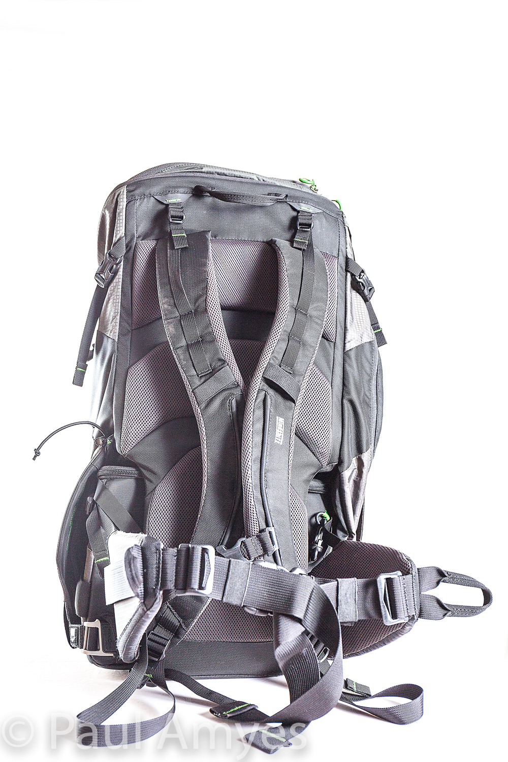
Looking at the harness of the Mindshift Rotation 180º Horizon 34L.
This is where the MindShift Rotation 180º Horizon 34L comes in. Before I start talking about the bag I’ll talk about the manufacturers. MindShift is a subsidiary of Think Tank Photo which are a company founded to produce high quality, innovative carrying solutions for professional photographers. I have been using their belt based carrying system and camera holsters for quite a while now and find them to be well made, well designed and well priced. The customer support is truly excellent – I received a faulty item and upon contacting Think Tank a replacement was quickly sent out from the USA to me in rural Western Australia. MindShift was created to provide photographers carrying systems that are suitable to use off the beaten track. So I had high hopes for this bag.
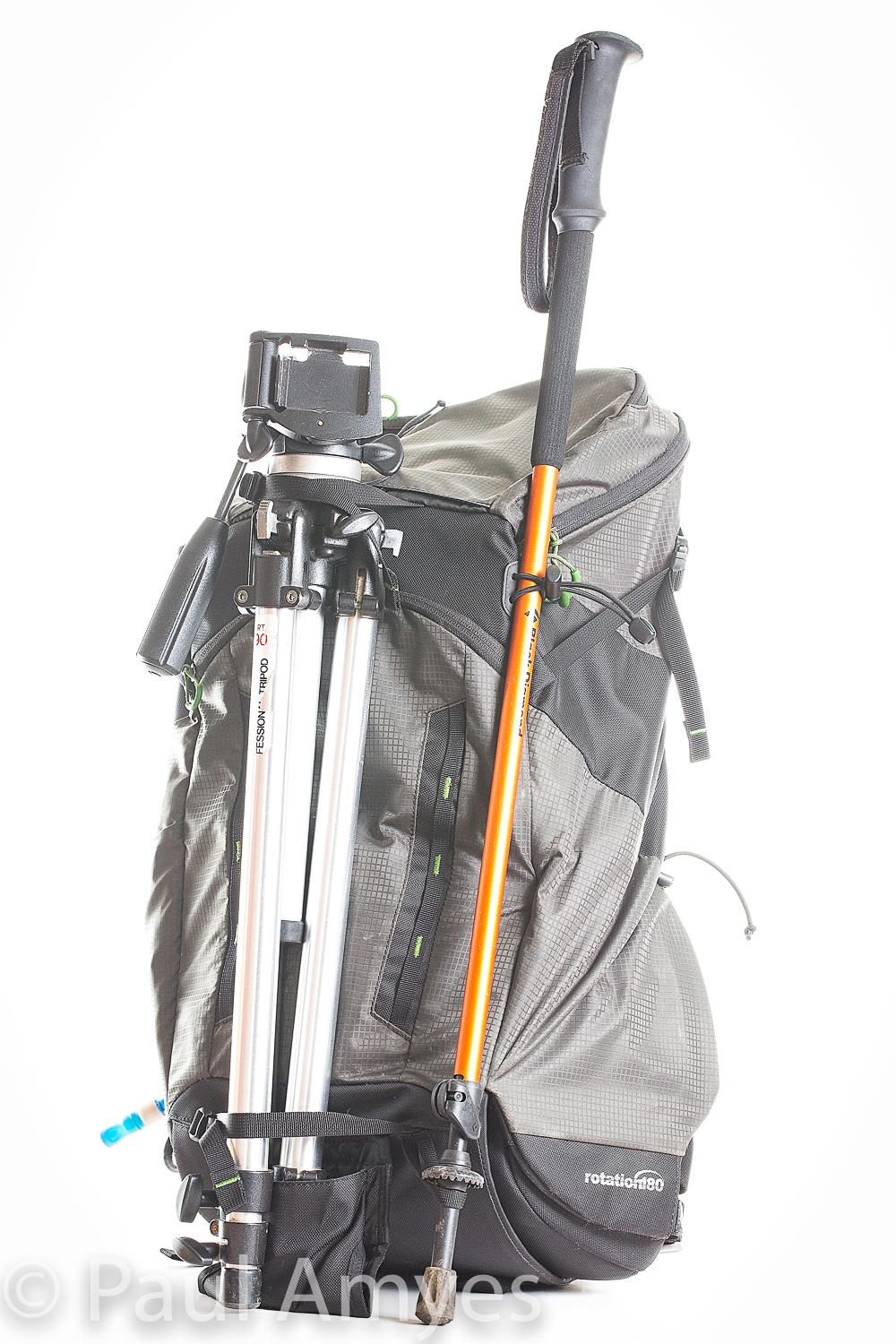
The Horizon 34L has straps on the exterior that allow you to carry a tripod and accessories such as walking poles.Showing the compartment that can hold a 3L hydration bladder and how the hose routs out and down the strap to allow access to it.
The Horizon 34L is a pack that is divided into two sections – a 7L photo section and a 27L pack. Nothing revolutionary here you say, well what sets it apart is that the lower section is affixedto a waist beltthat can rotate from it compartment at the bottom of the pack round to the front. This means you can work from the bag without having to take the pack off. The whole palaver of repeatedly taking a laden pack on and off your back and rummaging around looking for filters, memory cards etc on a long walk can become a big disincentiveto taking photos. Initially I was a little sceptical about how useful this feature would be and how well it would work in practice, but with use I was won over. It is a great idea and I’m surprised nobody thought of it before. The bag comes in blue and grey and retails for $365 AUD or $260 USD which puts it at the more expensive end of the market.
The photo compartment of the Horizon 34L mounts on the backpack’s waist belt which allows it to be rotated round to the wearer’s front to gain access.
On unpacking it I was presented with a fairly large daypack made out of a lightweight ripstop nylon with a polyurethane backing. At various points of anticipated abrasion there are reinforcing panels of Cordura pack cloth. The harness appears well made and is well padded with a good range of adjustment. I’m 1.93 m tall and have a long torso which means I usually find getting a comfortable pack quite difficult but Horizon 34L fitted well and over the last 8 months have clocked up just under 1000Km wearing it. The hip belt has padded wings and adjustable belt and does a grand job of placing the load on your hips in a comfy manner.The back of the pack has three pads with large spaces between them to promote air flow and stop you getting a sweaty back. Here in Australia they are a bit academic, especially in the warmer months, but I imagine they will be of some use in more temperate climates. In terms of exterior pockets there is one on the lid, one on the front-end on the left hand side there is a pocket that will take a 3L water bladder. There is also a pocket for a water bottle on the flap of the bladder pocket. In terms of exterior fixing points there is are straps for a tripod, walking pole and two rows of daisy chains. The top section of the pack eschews the normal walking pack type enclosures of a drawstring mouth with a large lid that buckles down in favour of a large YKK zip. While I appreciate the convenience of a zip for quick and easy access zips allow water ingress especially when they have no storm cover like this. The inside of the top compartment has a stretchy mesh pocket to hold things like maps or guide books. There is ample room to stow a gore-tex, a fleece, lunch and a first aid kit. There is no provision for carrying a laptop, but you could put an iPad in the stretchy pocket. On the lid is an exterior pocket which has a key clip inside. Its big enough to hold gloves, a hat, a personal locator beacon and some snacks. All fairly standard stuff for this type of day pack.
The photo compartment can separate from the backpack to allow it to be used as a waist pack.
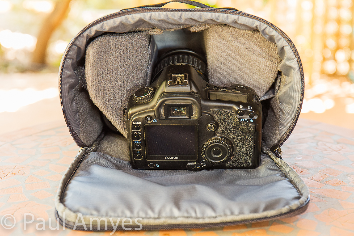
Not standard is the bottom camera compartment. Basically the bottom of the pack has a tube in which a waist pack or as our American cousins call them a ‘Fanny Pack” (snigger!). The left side of the tube (as you wear the pack) is sealed and it has a gap to allow the waist belt to pass through. The right end has a flap which is secured by a magnetic clip and this in conjunction with a leash stops the waist pack from falling out as you walk. This flap has an ingenious pop up system which allows you set the preferred tension. To rotate the waist pack to your front to gain access to it you reach behind you and open the magnetic clip, The flap pops up out of the way and then you pull on the loop on the right side of the belt and the camera compartment rotates around. You then undo the zip and lift the lid away from you. The camera compartment has two dividers that can be repositioned so as to allow you to configure the storage as you wish. I opted for a large central space to hold a camera body and lens with two smaller areas either side to hold two more lenses. The lid has a mesh pocket to allow you to stow small bits and pieces. So what will it hold. Well I used it with two different camera systems. Most commonly I used it to hold a gripped Panasonic Lumix G85 oran Olympus EM1 with grip with a mounted 12-40mm f2.8 lens. Then I would put in the side compartments a Panasonic Leica 8-18mm and an Olympus 75-300mm. Sometimes I’d swap out the wide-angle zoom for the Olympus 60mm macro. The other system I carried was either an ungripped Canon 5 or 6d with a 24-70mm f4 zoom and aCanon 75-300mm and a 100mm macro. Because I was researching a walking guide-book and needed access to a note-book, pen and handheld GPS I mounted a Lowepro Street and Field 100AW utility bag on the righthand fin of the waist belt. This held the afore-mentioned bits and also camera batteries and memory cards. If you don’t want to carry the whole shebang then you can detach the camera compartment and use it as a waist pack/fanny pack (snigger !).
There is enough room to stow a DSLR such as the Canon 5d pictured mounted with a lens, two additional lenses, a notebook, memory cards and batteries.
Showing how the weather resistant PU layer on the inside of the pack is already perishing after 8 months of use.
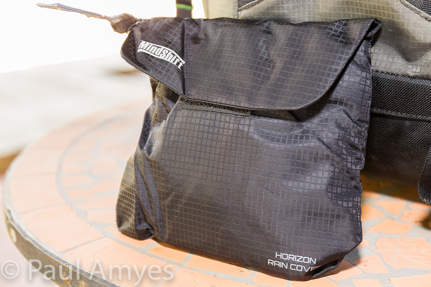
In use. The pack is very comfy and I carried it on a range of hikes for nearly 1000Km. To work from it is great. Most of the time I had my camera on strap slung across my body. If I needed to change lenses then I’d access the camera compartment. The whole thing worked really well. However, if you take the pack off while taking photos then it becomes a right royal pain in the derrière as it becomes quite clumsy to use. Pulling out the camera compartment while the rest of the back rests on the ground feels very clumsy compared to the elegance of using it while it is worn on your back. The pack isn’t very weather resistant and MindShift sell a separate rain cover for $45 AUD or $25 USD. Given the price of the Horizon 34 I think MindShift are being tighter than a fishes eyelid here especially when the Think Tank bags from the same company have them built in. The rain cover is also fiddly to affix which is not what you need when you are cold and tired as a rainstorm breaks. The pack material isn’t very durable and after 8 months of use the polyurethane backing has peeled off in m any places and the lightweight ripstop nylon that makes up most of the pack has started to wear through. I’ve got some camera pouches made by the now defunct Camera Care Systems in England that are over 30 years old and have led a very hard life and they show less wear than the Horizon 34.
The $45 AUD optional rain cover that should come as standard with the pack considering its $365 AUD price. To add insult to injury it is difficult to attach and mine has already started to have it weather resistant PU backing wear through rending it not rain resistant and therefore redundant.
In conclusion The MindShift Rotation 180º Horizon 34L is quite an innovative product that solves carrying camera equipment on day hikes into the wilderness. The concept is quite brilliant and I’m astounded that no-one has done it before. Unfortunately the execution of the product lets it down and it seems very expensive for a bag that I’ll probably end up throwing away in 12-18 months as it has worn out. I think that MindShift should construct the pack from heavier duty Cordura Pack cloth throughout and make sure that the polyurethane backing is more durable. A pack cover should be integral to the main pack body not an optional extra. If they did that it would be an excellent product. Ah well back to a proper walking pack and camera pouches.
Helen and Frida pausing for a sit down while following the Bibbulmun Track alongside Wilson Inlet, Denmark, Western Australia. iPhone panorama.
Normally summer is pretty full on here in the vast Wheatbelt Metropolis that is York – temperatures hovering around the 40 ℃ (104 ℉) mark. Consequently most people here plan on getting away to the coast during summer for some respite from temperatures more akin to a low oven setting rather than the weather. I say “normally” as this years weather is really topsy-turvy, but as we had to make the accommodation booking some 6 months in advance we went any way. Our preferred escape York/the heat destination is Denmark – no not the country, the town on the south coast of Western Australia.
Walking round Wilson Inlet on the Bibbulmun Track. Denmark, Western Australia. iPhone panorama.
We rent the same house on Wilson Inlet as it enables us to walk the Bibbulmun Track that follows the edge of the Inlet for some distance. The track has been an abiding interest for us for many years, Helen has end to ended on it, me I’ve just done one over night and lots of day walks. It is always a great pleasure to get out into the bush.
Looking Up. Walking up to Mount Hallowell on the Bibbulmun Track, Denmark, Western Australia. Olympus OMD EM1 with Olympus m.Zuiko 12-40mm f2.8 lens. Exposure: 1/100th sec, f8, at ISO 200.
For a more strenuous walk we climbed Mount Hallowell, Helen reckons it is one of the harder sections on the whole track. We managed it relatively easily – which probably has more to do with the fact that we weren’t encumbered by 10Kg back packs.
Follow the Snake – the Wagyl trail markers. Helen on the granite outcrops on Mount Hallowell. Denmark, Western Australia. Olympus OMD EM1 with Olympus m.Zuiko 12-40mm f2.8 lens. Exposure: 1/160 th sec, f4, at ISO 400.
We walked up Mount Hallowell – which is more of a big hill than a mountain, and then on to Monkey Rock, which is a granite outcrop on the southern side of the hill that gives 270 degree views over the surrounding karri forest, southern coastline and Wilson Inlet. Despite the stunning views I took no photos as the air was very hazy. Still there’s always next time!
Sun Up. The sun comes up over the peak. Mount Hallowell, Denmark, Western Australia. Olympus OMD EM1 with Olympus m.Zuiko 12-40mm f2.8 lens. Exposure: 1/400th sec, f8, at ISO 200.










You must be logged in to post a comment.