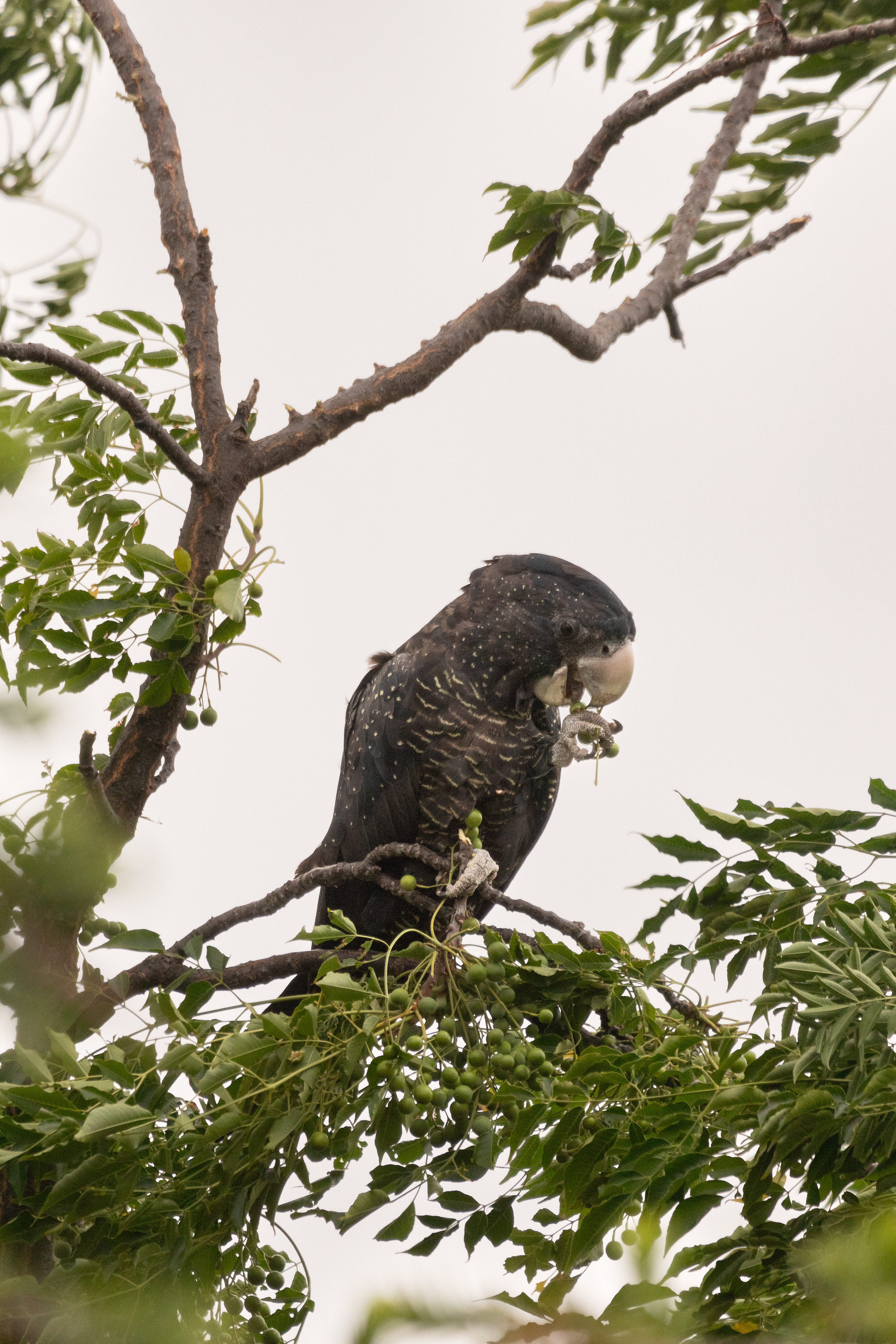
Karak or Red-tailed Black Cockatoo (Calyptorhynchus banksii subs samueli) feeding on Cape Lilac AKA WhiteCedar (Melia azedarch). York, Western Australia.
The last couple of weeks I’ve been thrilled to see Red-Tailed Cockatoos (Calyptorhynchus banksii), called Karrak by the Nyoongar, feeding in the Cape Lilac trees of our neighbours.
Karak or Red-tailed Black Cockatoo (Calyptorhynchus banksii subs samueli) feeding on Cape Lilac AKA WhiteCedar (Melia azedarch). York, Western Australia.
There are four subspecies found in Western Australia – Cb. Naso (referred to as the Forest Red-tailed Black Cockatoo), Cb. Samueli (the Inland Red-tailed Black Cockatoo), Cb. macrorhynchus (sometimes referred to as the Great-billed Cockatoo, Banksian Black-Cockatoo, or Banks’ Black-Cockatoo), and the recently discovered Cb. Escondidusa. Now which species the ones in our neighbourhood are I couldn’t tell you – probably Inland or Forest Red-Tailed Black Cockatoos. All I know that is according to the experts we shouldn’t have any, but here they are.
The Nyoongar creation story for the Red-Tailed Black Cockatoo.
Ngoolyak or Carnaby’s Black-cockatoo (Calyptorhynchus latirostris). Yanchep National Park, Western Australia.
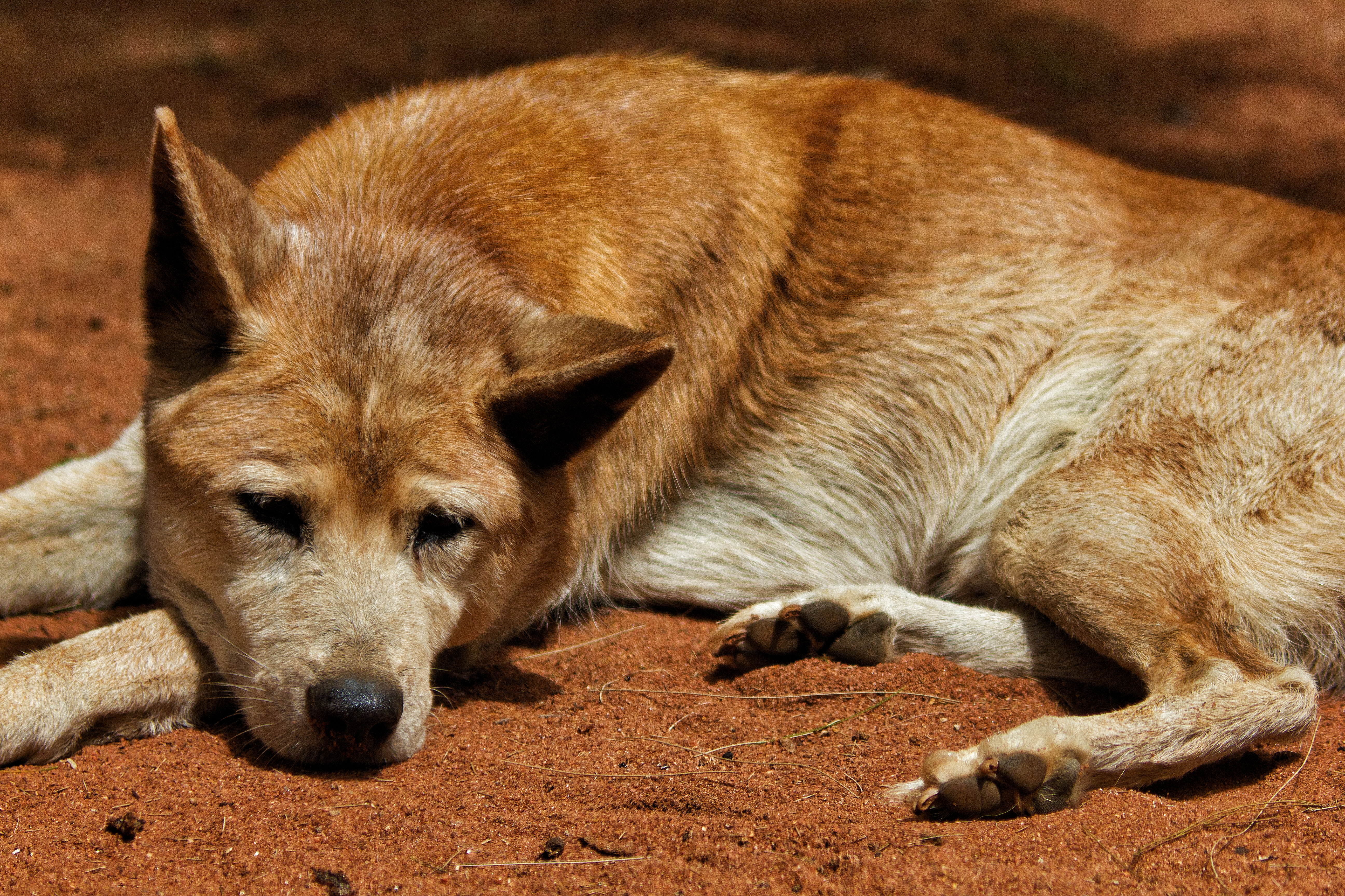
Dwert the Dingo
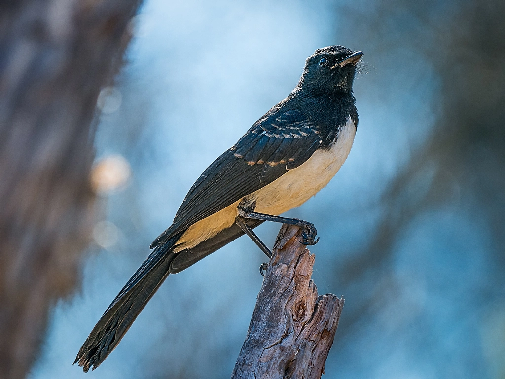
Djidi-djidi or Willie Wagtail (Rhipidura leucophrys). Avon Walk Trail, York, Western Australia.
Kwilom or purple swamp hen (Porphyrio porphyrio subsp bellus) picking over vegetation on shore of the lake. Lake Leschenaultia, Western Australia.
One day Ngoolyak the white-tailed black cockatoo saw a fight between Dwert the Dingo and Djidi-djidi the Willie Wagtail. Ngoolyak sided with Dwert and joined the fight. Kwilom the Purple Swamp Hen saw the commotion and tried to break them up. He picked some sedge and started beating Ngoolyak across his back to get him to back off. Ngoolyak started screaming and tried to fend off the blows by raising his tail. The sedge oozes red sap when it is cut and it left great red marks where it struck. As he screamed Ngoolyak’s voice became hoarse and he could no longer make his normal call of “wola” and the screeching sounded more like “Karrak!” instead, and that is how Ngoolyak the White-tailed Cockatoo became Karrak the Red-tailed Cockatoo.
Karak or Red-tailed Black Cockatoo (Calyptorhynchus banksii subs samueli) feeding on Cape Lilac AKA WhiteCedar (Melia azedarch). York, Western Australia.
Karak or Red-tailed Black Cockatoo (Calyptorhynchus banksii subs samueli) feeding on Cape Lilac AKA WhiteCedar (Melia azedarch). York, Western Australia.
Burlong Pool is about 4.5 Km south west of the Wheatbelt Metropolis of Northam and is one of the termini of the Dorntj Koorliny or Walking Together Track. The Ballardong Nyoongarbelieve that it is a significant place for the Dreamtime Wagyl or Rainbow Serpent. The Wagyl created the landscape of the South West of Western Australia, looks after the fresh water and also helps bring the rains. Burlong pool was/is the Wagyl’s summer resting place and is regarded as a sacred site.
We’ve been visiting the site for years as we often take the dog with us to Northam when we go shopping (not in summer) and we use it as a walk place for her and to stretch our legs. Every time we went we’d see a lot of wildlife and I always came away thinking I must go and take some photos. Well that time came and we headed out early one morning. On getting there we were met with raucous calling from an enormous flock of corellas. We stayed for a bit watching them and the other birds and then we started walking the Dorntj Koorliny Track towards Northam. Even though the weather was very warm it was an enjoyable walk and we saw heaps.
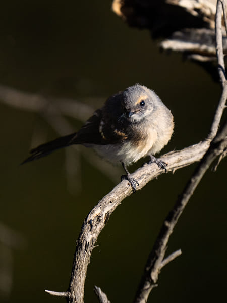
Kadjinak or Grey Fantail (Rhipidura albiscapa). Dorntj Koorliny, Burlong Park, Northam, Western Australia.
Dorntj Koorliny, Burlong Park, Northam, Western Australia.
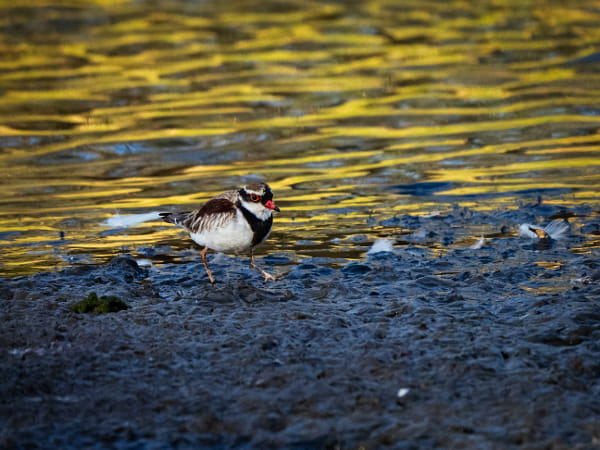
Nidoolyorong or Black-fronted Dotterel (Elseyornis melanops). Dorntj Koorliny, Burlong Park, Northam, Western Australia.
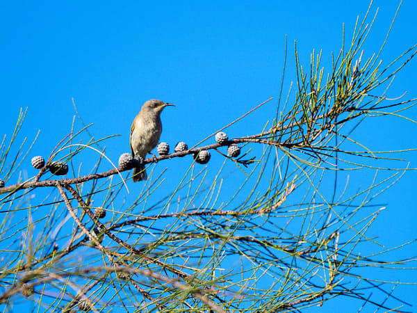
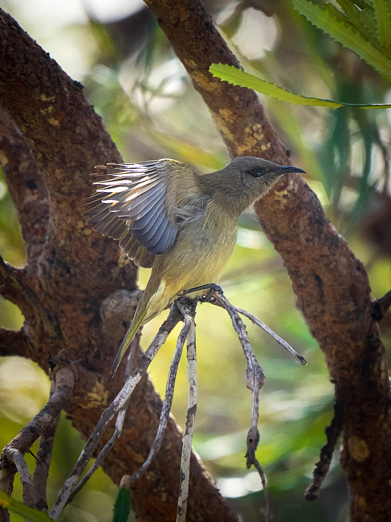
Djindjokoor or Brown Honeyeater (Lichmera indistincta). Dorntj Koorliny, Burlong Park, Northam, Western Australia.
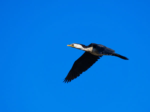
Kakak or Little Pied Cormorant (Phalacrocorax melanoleucos). Dorntj Koorliny, Burlong Park, Northam, Western Australia.
Koordjokit or Little Black Cormorant (Phalacrocorax sulcirostris). Dorntj Koorliny, Burlong Park, Northam, Western Australia.
Forrestdale Lake (originally Lake Jandakot, it was renamed in 1973) lies within the Forrestdale Lake Nature Reserve which is about 25 kilometres south of the Perth CBD on the southern fringes of the Perth metropolitan area. The lake is shallow and seasonal with a large area 220 to 245 hectares of open water when full. In June or July, Lake Forrestdale starts to fill, and about the end of September, it reaches its maximum depth which is somewhere between 200 and 500mm depending upon the winter rains and it usually dries out by mid-summer. That was not always the case as the lake used to hold a lot more water than it does now, and some years it did not dry up at all. Diminishing rainfall, and ground water extraction from government and private bores are some of the reasons for the lake’s decreasing water levels.
Before white fellas came Lake Forrestdale was a special place for the Whadjuk Nyoongar who camped around its shores and hunted long-necked turtles, waterfowl and their eggs; koonacs and gilgies, possums, kangaroos, quendas and many other animals that are now locally extinct. The first white settlers were William and Alfred Skeet in 1885 and they had a licence to fell and sell timber. Shortly after most of the land around the lake was cleared for farming and grazing despite that the lake continued to be a major breeding site, migration stop-over and semi-permanent drought refuge area for waterbirds so in 1957 the lake was gazetted as an “A” class nature reserve for the conservation of flora and fauna and to provide a location for recreational sailing. On 7 June 1990, along with Thomsons Lake 10 kilometres to the west, it designated under the Ramsar Convention as a wetland of international importance and both lakes form the Forrestdale and Thomsons Lakes Ramsar Site. It’s easy to see why. More than 20,000 waterbirds have been recorded on Forrestdale Lake. It regularly supports more than 1% of the national population of five shorebirds: red-capped plover (with up to 1,300 recorded at any one time), black-winged stilt (3,840), red-necked avocet (1,113), long-toed stint (up to 80), and curlew sandpiper (2,000). In some years it supports more than 10,000 ducks, including Australian shelduck (up to 1,650 counted), Pacific black duck (5,500), grey teal (9,000), Australasian shoveler (2,000), and hardhead (1,053). The lake is one of the few sites in Western Australia where little ringed plover and little stint have been recorded more than once, and it is the only location in the state where white-rumped sandpiper has been recorded. A comprehensive list of all the bird species seen at the reserve can be seen at eBird Australia.
The entyrance to the Forrestdale Lake Nature Reserve.
So when BSO (Beloved Significant Other) announced she was mounting a campaign to achieve croquet world domination I would use the opportunity of a weekend in Perth to have a gander at Forrestdale Lake Nature Reserve. So a quick peruse of the interwebs told me that the best place to start was was at the parking bay at the Skeet Memorial Park on Moore Street in Armadale. There I would find a comprehensive information board about the area and would also give me quick access to the bird observation platform. Having read all about all the different birds that use the lake I was expecting a birding nirvana. Unfortunately we’d had a dry winter and the water line was a good 600m from the platform which meant I had Buckley’s chance of seeing any water birds up close and personal.
The bird observation platform at Forrestdale Lake.
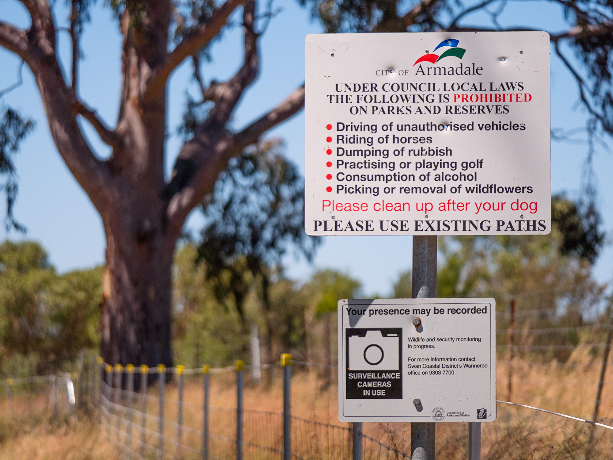
Fall back plan was to walk around the lake and just photograph what I found on the way. Once you leave the main entrance area there is little signage except for the keep out variety which is attached to the continuous fence designed to, funnily enough, keep people out. It was quite a frustrating experience – I could hear plenty of bird activity on the other side of the fence but I had no way of getting closer. For much of the walk you are in a narrow corridor of about 5 or 6 metres between two substantial fences with signs saying you are under surveillance – it’s hardly a nature experience. I’ve been to military bases which are more friendly. I feel this is a hugely wasted opportunity. Thomson’s Lake is much more accessible to visitors, and the Spectacles also makes much of it Aboriginal cultural significance. I’ve written previously that if people are having less and less opportunities to interact with nature that will create an antipathy towards the natural world and consequently they will cease to care about it. So to get people to be more aware of environmental issues they must be encouraged to reconnect with nature. There is very little opportunity for the casual visitor to interact with all that Forrestdale Lake offers so in many ways it defeats its stated purpose of raising public awareness about the importance of this chain of wetlands. Normally I am very positive about these types of reserves and have written about them in the past in glowing terms. I don’t like being negative or critical, but I really do feel that this is a waste of resources.
One of the many signs that warn you about unauthorised access.
The fence that rings the lake preventing unauthorised access.
Big brother is in full surveillance mode at Forrestdale Lake Nature Reserve.
Can I recommend the place as worth a visit? If you want a a bit of a walk with a nature experience then I would suggest that are better places and I’ve written about quite a few of them. If you are a die hard birder then I’d find out what the water levels are before visiting. There is little point in visiting if there is no water in the lake.
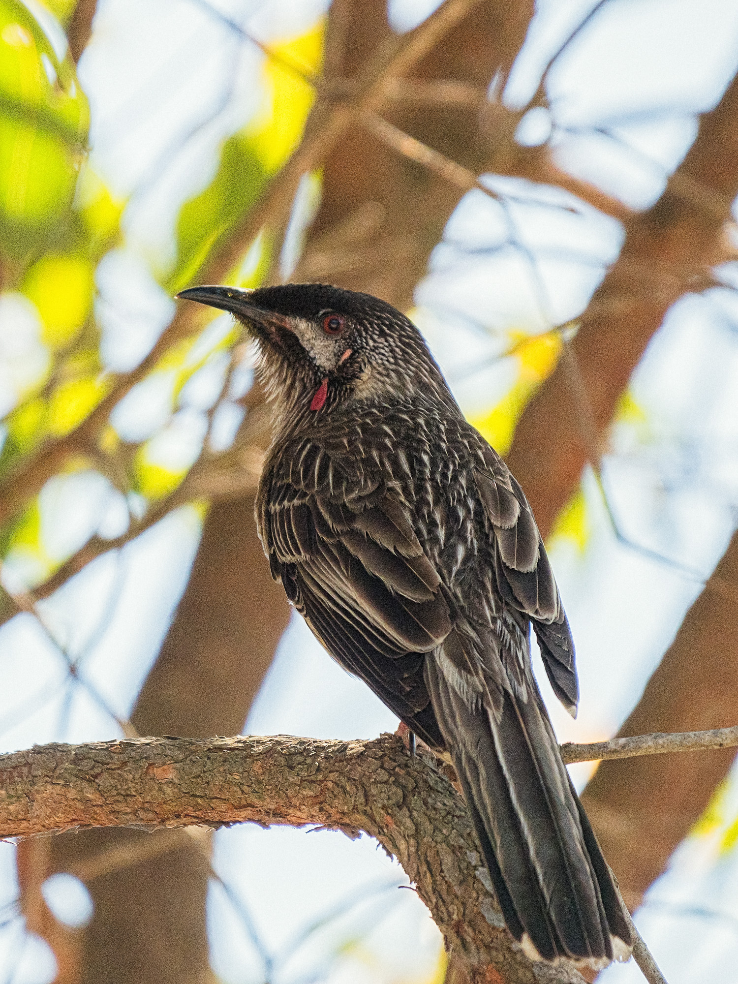
Red Wattlebird, Anthochaera carunculata subspecies woodwardi, at Forrestdale Lake Nature Reserve.
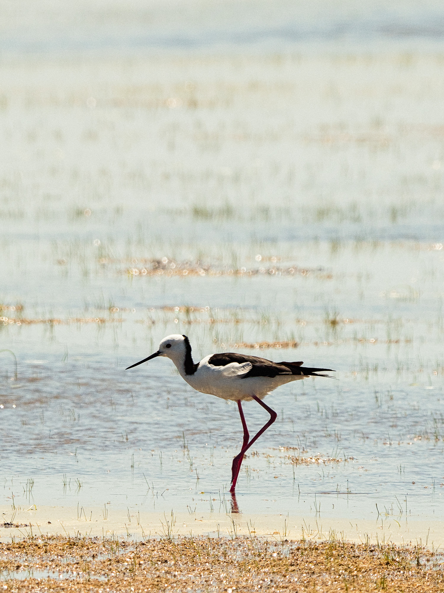
White-headed Stilt, Himantopus himantopus subsp. leucocephalus, Forrestdale Lake Nature Reserve.
Grey fantail, Rhipdiura albiscapa, Forrestdale Lake Nature Reserve.
Grey Butcherbird, Cracticus torquatus, Forrestdale Lake Nature Reserve.
Oh and BSO (Beloved Significant Other had a better time of it than I did and achieved world croquet domination – well she won the State Mixed Doubles for Golf Croquet.
2020 Croquetwest GC State Mixed Doubles. Forest Park Croquet Club, Mount Lawley, Western Australia.
2020 Croquetwest GC State Mixed Doubles. Forest Park Croquet Club, Mount Lawley, Western Australia.
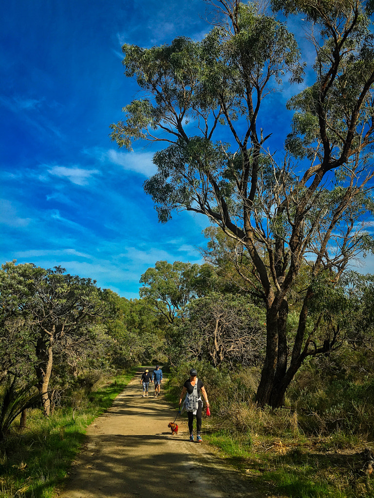
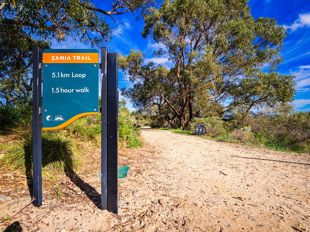
Bold park and its assorted trails are a very popular weekend destination for people living in Perth. The Zamia Trail is a 5.1Km trail that allows walkers to explore the Banksia and tuart woodland of Perth.
…where lots of people have gone boldly before.
That destination is Bold Park which is quite a unique place in the Perth Metropolitan Area. The park was established in 1936 and named after some bloke who had put in lots of time in the City of Perth local government – which is all a bitboring. Much more interesting is that it is 437 hectares of remnant bushland on the Swan Coastal Plain comprised of banksia and tuart woodland. Tuart forest (Eucalyptus gomphocephala) was once a major feature of the Swan Coastal Plain with trees of up to 40m in height and providing a unique ecosystem. On colonisation most of the tuart trees were cleared for farming and for it valuable timber which is dense, hard, water resistant and resists splintering. The last remaining tall tuarts are found in the Tuart Forest National Park. There a couple of remnants of smaller trees around the Perth Metro Area such as those found at Mindarie Dunes and Bold Park. The park is situated in City Beach just off Oceanic Drive and can be reached by public transport.To say that the park is popular is an understatement, I went on a Saturday morning and it was absolutely heaving – so this is not a wilderness experience, but an urban walk on the wild side.
The start of the Zamia Trail on Reabold Hill in Bold Park.
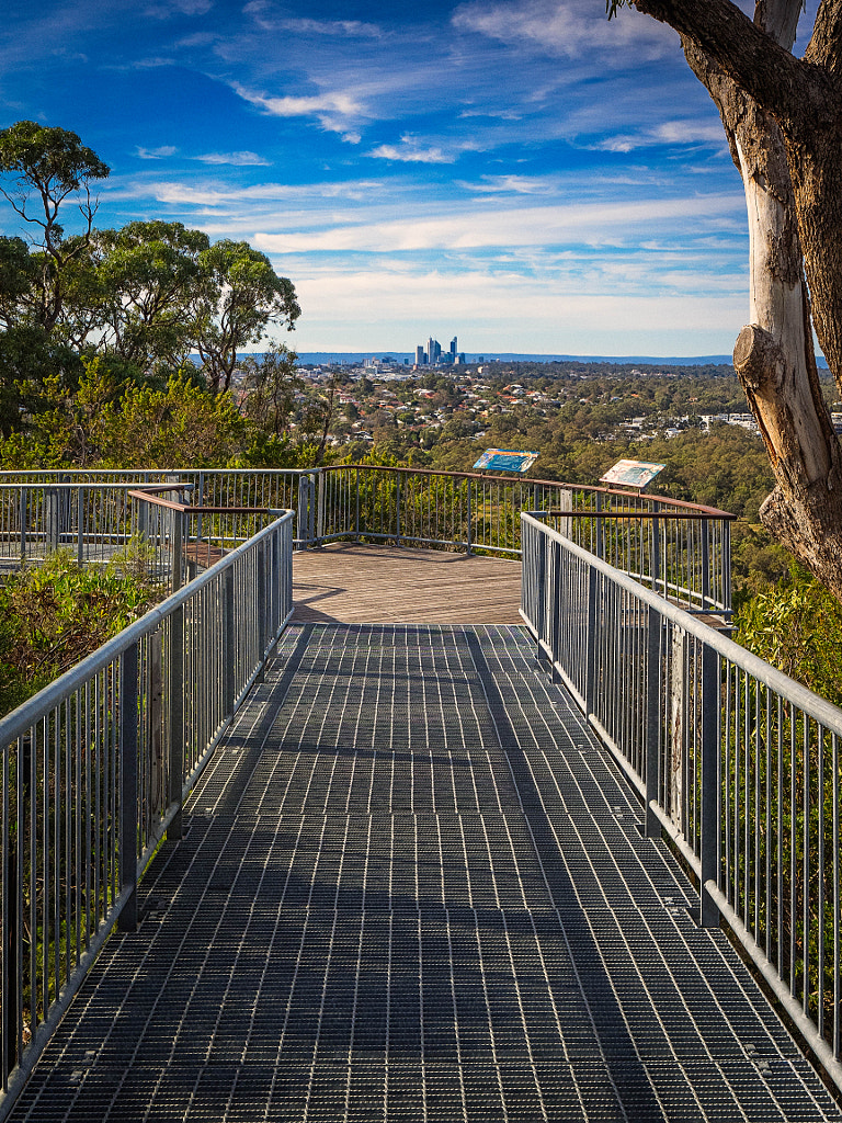
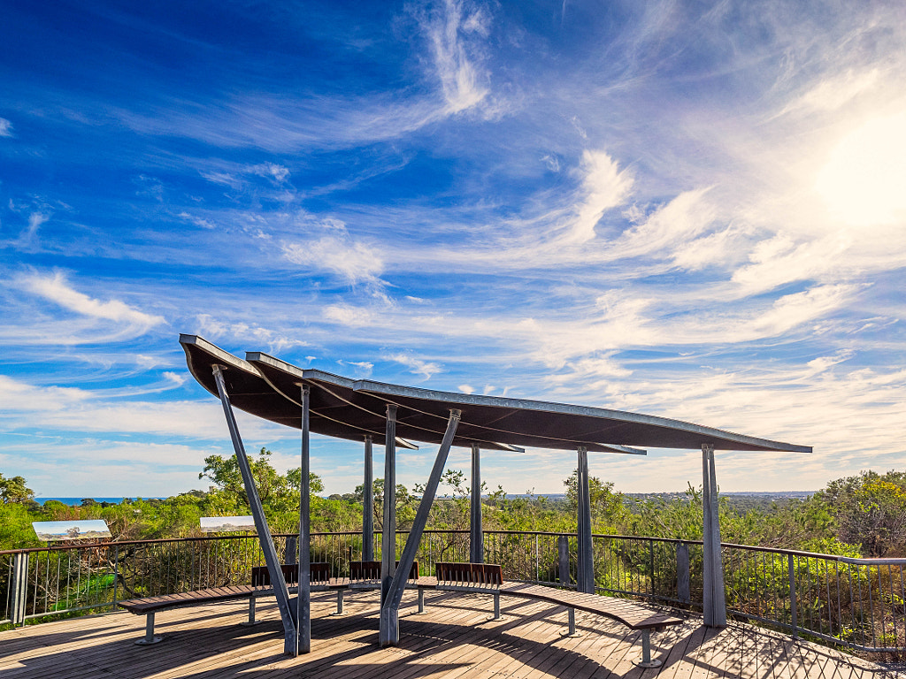
Reabold Hill is the highest natural point on the Swan Coastal Plain in the metropolitan area at 85 metres. There is a boardwalk to the summit to allow for disabled access and a sheltered viewing platform at the top. On a clear day you can see the Indian Ocean, Perth city, Rottnest Island, Kings Park and Botanic Garden, and even glimpses of the Swan River.
The shelter on the viewing platform at the top of Reabold Hill.
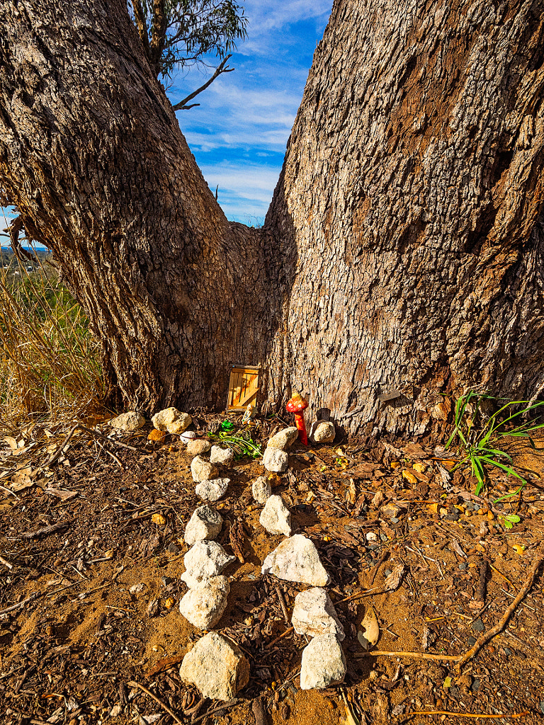
A fairy house on the path to the summit of Rebold Hill in Bold Park.
Speaking of walking there are over 15Km of walking trails of varying distances – the longest one, which I just did, is the Zamia Trail which is 5.1Km long over rolling terrain on a crushed limestone base which means you can comfortably push a stroller or pusher. If you are going to do the walk I suggest parking at Reabold Hill car park. This is a good place to commence the trail, but also it enables you to make a side trip unto the summit of the hill where there is a viewing platform. This is the highest natural point on the Swan Coastal Plain at 85 metres above sea level. This means on a nice clear day you can see the Indian Ocean, Perth CBD, Rottnest Island, Kings Park, and the Swan River. While pedestrians and cyclists can access the park at all times vehicular access is limited as follows:
1 April to 31 October – 5.30 am to 7.00 pm
1 November to 31 March – 5.30 am to 8.00 pm.
The trail is well sign posted so there is no need of a mud-map which means you can just get out and enjoy it. I walked this in winter so there weren’t many flowers out – a few banksias, grevilleas and cockies tongue. I was more interested in the bird life and the Botanic Gardens and Park Authority put out an excellent brochure you can download detailing all 91 species that can be found. There are numerous other animals such as brush-tail possums, bats, loads of reptiles including snakes of varying descriptions. Considering how many people were about I was surprised at how many different species of birds I saw. I even literally stumbled over a very sleepy and grumpy bob tailed lizard (Tiliqua rugosa), trying to warm up on the path in the sun having woken up from brumation.
Djindjoko called the Brown Honeyeater (Lichmera indistincta) by European settlers. Bold Park, Western Australia.
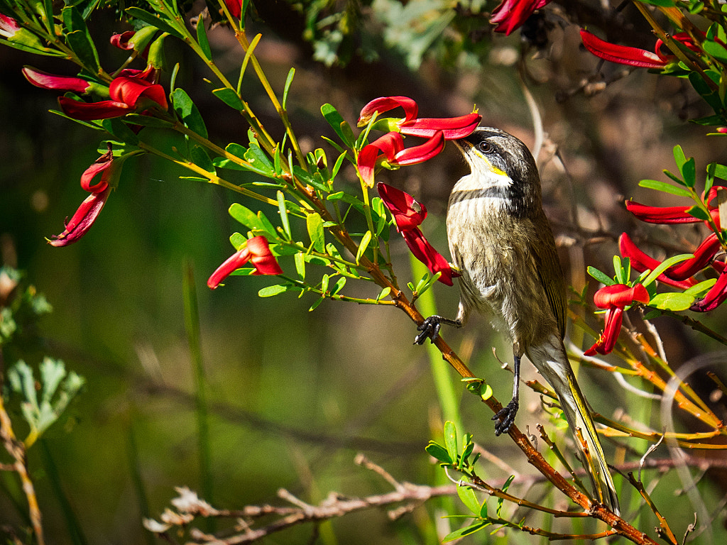
Dooromdorom or Singing Honeyeater (Lichenostomus virescens virescens) feeding on Yackal Djarr or Cockies Tongues (Templetonia retusa). Bold Park, Western Australia.
Bandin also called the White-cheeked honeyeater (Phylidonyris nigra) feeding on Menzies Banksia (Banksia menziesii) in Bold Park, Western Australia.
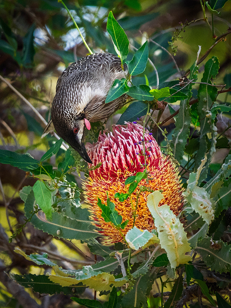
Doongorok also called the red wattlebird (Anthochaera carunculata subsp. woodwardi) feeding on Menzies Banksia (Banksia menziesii). Bold Park, Western Australia
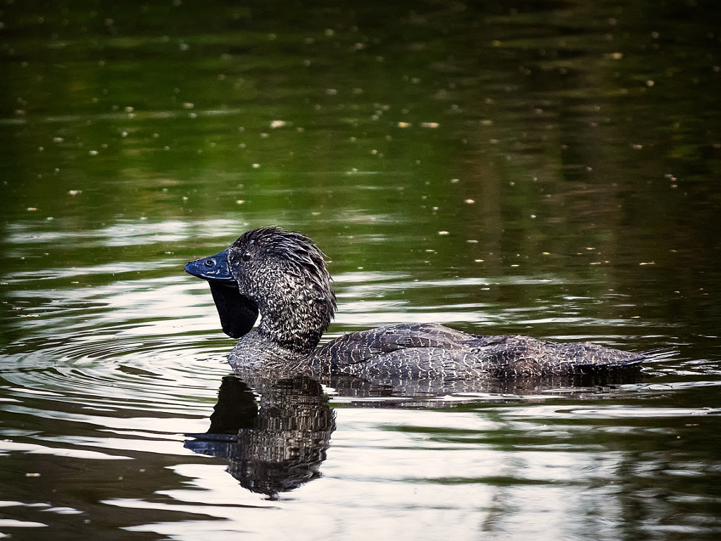
Male Musk duck (Biziura labata) at Lake Seppings, Albany, Western Australia. Olympus OMD EM1 mk ii with Panasonic Leica 100-400mm f/4-6.3 lens. Exposure: 1/1000 sec, f6.3, ISO 1600 with +0.7 stops exposure compensation
Anastasis – from Ancient Greek ἀνάστασις (anástasis, “resurrection”).
A funny name for a blog post about Lake Seppings in Albany, Western Australia, but it does describe what happened.
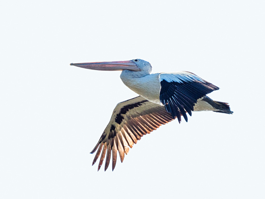
Australian Pelican, Pelecanus conspicillatus, Lake Seppings, Western Australia. Olympus OMD EM1 mk ii with Panasonic Leica 100-400mm f4-6.3 lens. Exposure 1/1000, f10, ISO 200.
Way back in the Nyittiny (creation times) the spirit Djrat walked on the earth and created south coast of Western Australia and as he walked he left a footprint which filled with water and created a freshwater lake 1.1 Km long and 400m wide. The Minang group of the Nyoongar called this place Tjuirtgellong or “place of the long necked turtle” which was an important food source for them in the summer months. The lake was surrounded by a variety of vegetation. Fringing the lake are bullrushes, sedges, and reeds reeds. Further back were Western Australian peppermint trees, spearwoods, paperbarks, native willows, wattles, banksias and melaleuca. All this provided habitatfor over 100 different bird species including Australian white ibis, yellow-billed spoonbil,white-faced heron, blue-billed duck, musk duck, black swan, hoary-headed grebe, Australian pelican, Eurasian coot, spotless crake, masked lapwing, dusky moorhen, purple swamphen and buff-banded rail.
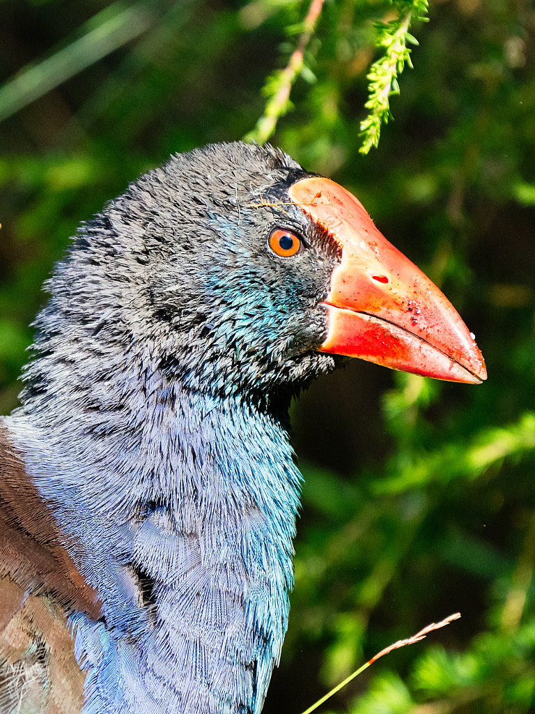
Purple swamp hen, Porphyrio porphyrio, Lake Seppings, Western Australia. Olympus OMD EM1 mk ii with Panasonic Leica 100-400mm f4-6.3 lens. Exposure: 1/1000 sec, f6.3 at ISO 2000.
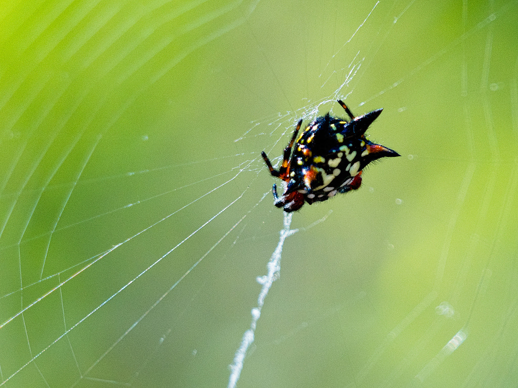
Jewel spiders (Austracantha minax) are often called Christmas spiders as they are commonly found during December and January. Lake Seppings, Western Australia. Olympus OMD EM1 mk ii with Panasonic Leica 100-400mm f4-6.3 lens. Exposure: 1/250 sec, f8, ISO 320.
All was fine and dandy until 1790 when the British explorer George Vancouver arrived. While he was mapping King George Sound he didn’t see any Minang but saw plenty of evidence that they were around and he later wrote that he found a ‘native village; fresh food remains near a well-constructed hut; a kangaroo that had apparently been killed with a blow to the head; a fish weir across what is now called the Kalgan River; and what appeared to be systematic firing of the land.’ (R. Appleyard. ‘ Vancouver’s Discovery and Exploration of King George’s Sound’ in Early Days, Journal and Proceedings of the Western Australian Historical Society, 1986, pp.86-97). That was the start of colonial settlement. As far as the lake is concerned well initially the settlers tried to do the right thing and in 1887 the Albany Municipal Council applied to the state government for permission to make the Lake and some of its surrounding bushland a botanical park. This lasted up until 1900 when it became a rubbish dump for the city of Albany. This sad state continued until 1972 when it was decided by the department of fisheries and fauna to turn the lake into a water fowl reserve.Very quickly the community got on board with initially a bird-walk being established by the Apex club of Albany in 1980. By 2004 a walk around the lake had been completed and the lake was given protected status. In 2018 there was a ‘community planting’ of some 22,000 trees and understory plants to provide a ‘biodiversity corridor’ and habitat for endangered wildlife such as the western ring tailed possum.
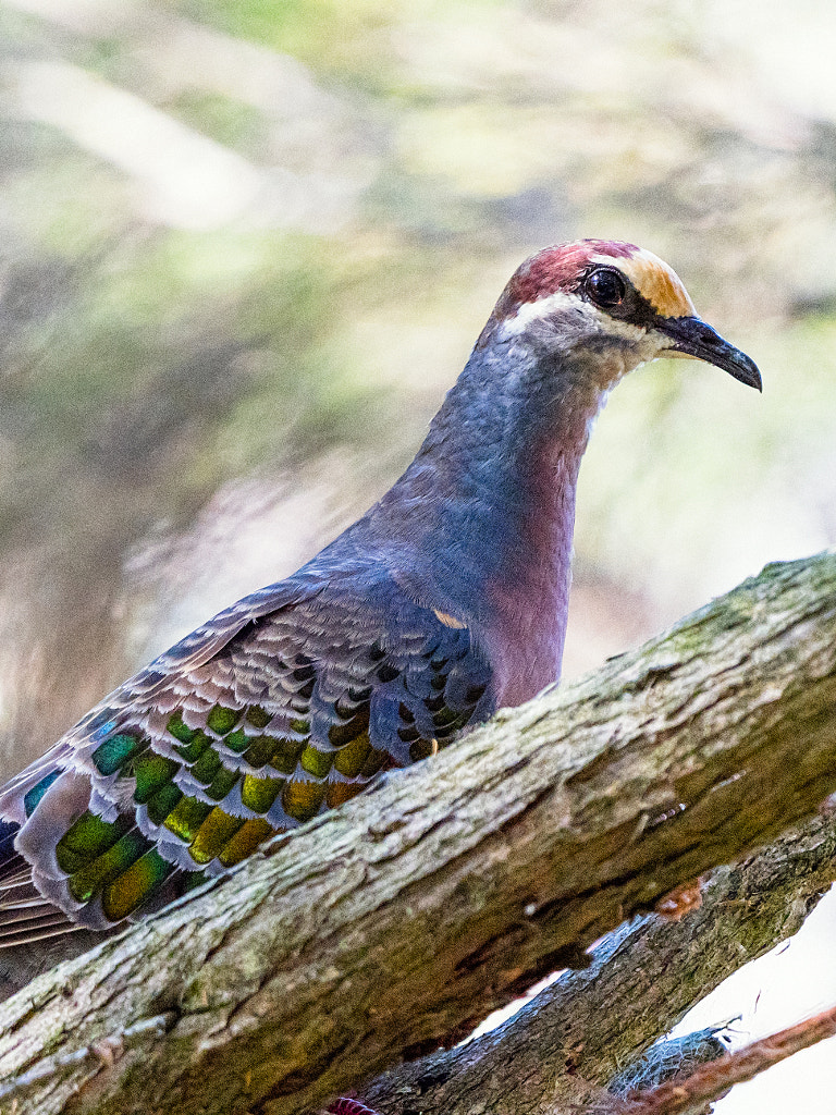
Brush Bronzeing, Phaps elegans, Lake Seppings, Western Australia. Olympus OMD EM1 mk ii with Panasonic Leica 100-400mm f4-6.3 lens. Exposure: 1/1000 sec, f5.7 at ISO 2500.
Every time we go to Albany I always visit Lake Seppings. I love walking around the edge of the lake and observing all the wildlife. I see it in many ways as a beacon of hope. The local community came together and have made a serious and worthwhile attempt to restore the lake to what it once was it still has a long way to go before it reaches its former status but it is a very good start. For the Nyoongar I hope that the recent claim for compensation for the loss of their traditional lands succeeds and can bring them some way of moving forward.
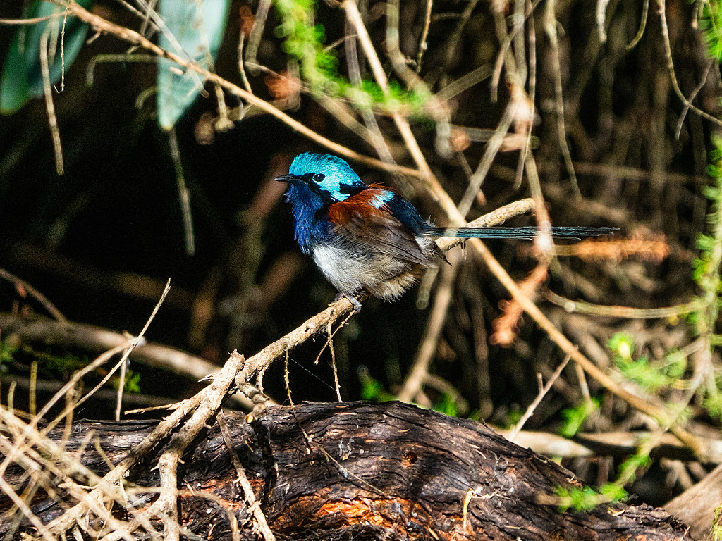
Red-winged Fairy-wren, Malarus elegans, Lake Seppings, Western Australia. Olympus OMD EM1 mk ii with Panasonic Leica 100-400mm f4-6.3 lens. Exposure: 1/1000, f7.1 at ISO 1000 with -1 stop exposure compensation.
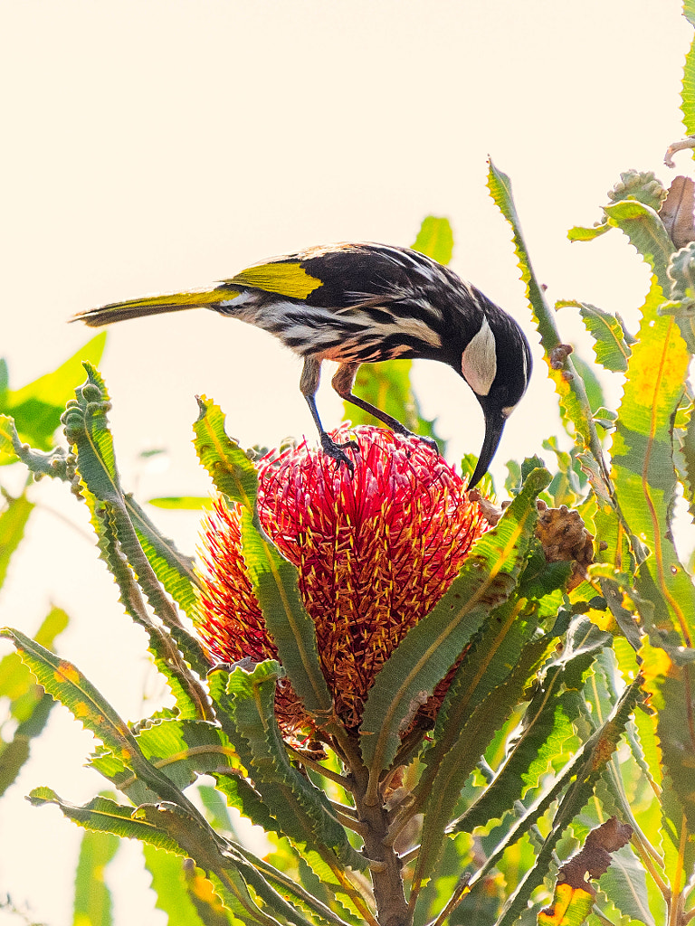
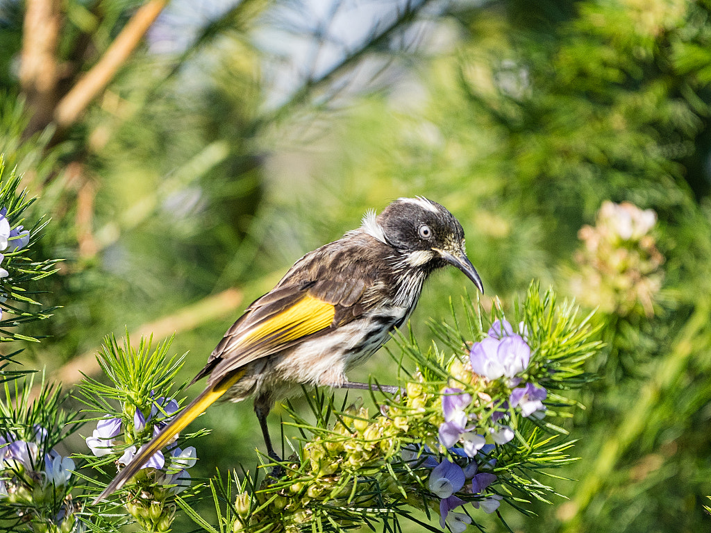
New Holland Honeyeater, Phylidonyris novaehollandiae subsp. longirostris, Lake Seppings, Western Australia. Olympus OMD EM1 mk ii with Panasonic Leica 100-400mm f4-6.3 lens. Exposure: 1/1000 sec, f6.3at ISO 800.
The djidi djidi or Willy Wagtail (Rhipidura leucophrys leucophrys). York, Western Australia. Panasonic Lumix G85 with Panasonic LEICA DG 100-400/F4.0-6.3 lens. Exposure: 1/800 sec, f6.3 at ISO 640.
Willy Wagtails or Djidi Djidi as the Nyoongar call them can be found throughout the Australian bush. They are perhaps the most common bird in Western Australia. White fellas think of them as comical bossy little birds that will swoop larger animals and people in an effort to shoo them out of their territory. This is the Nyoongar story of how they came into being.
A long time ago there was a lazy old man called Wardong. Wardong was given the job of looking after the children while everyone went hunting. Wardong would lie in the shade under a tree and shout at the children to get them to bring him food and drink. Now the children got pretty fed up with being bossed around by Wardong, and being mischievous they decided to get their own back. So while the old man was sleeping the djidi djidi (mischievous ones) they took his food away and then began to run round and round him tormenting him. This made Wardong really mad, and the madder he got the more the djidi djidi tormented him. Suddenly he couldn’t take any more and he did some magic and turned all the little children into little birds. With that Wardong went back to his tree, lay down and went to sleep with a big smile on his face. When everybody returned from hunting that evening they asked Wardong where all the children were. The children seeing their parents and grand parents started flying around and crying asking to be turned back, but there was nothing that could be done. The elders were furious and called Wardong a lazy good for nothing scavenger. One of them went even further and said “Wardong you will be a scavenger for the rest of your life!” And with that he turned Old Wardong into a crow. Wardong is the Nyoongar name for crows. Now if you go into the bush you will see that the djidi djidi can’t stand to have wardong anywhere near them and when they see him they fly round and round his head tormenting him until he goes away.
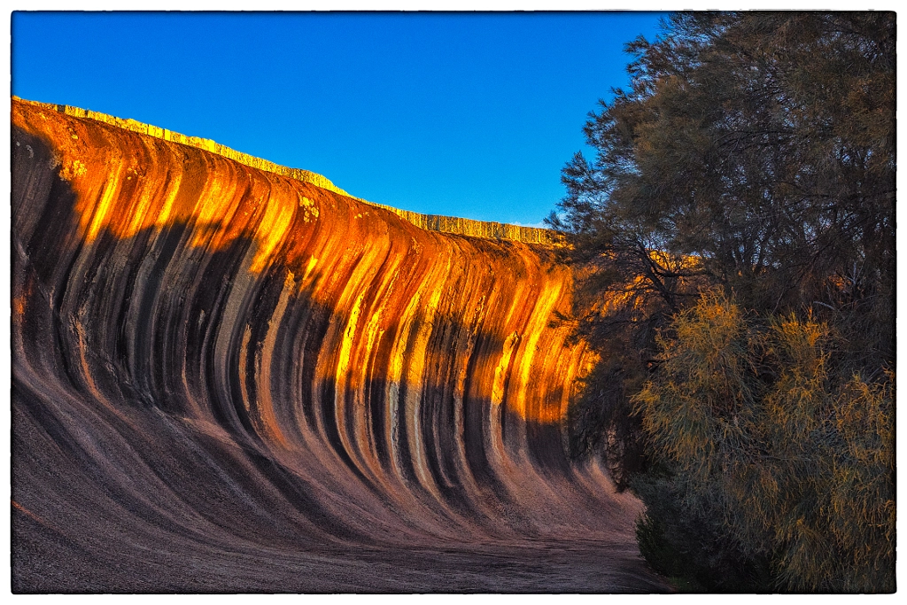
Wave Rock at sunset. Hyden, Western Australia. Olympus OMD EM1 mki with Olympus m.Zuiko 12-40 f2.8 lens. Exposure: 1/160 th sec, f5.6, ISO 200.
Every day tour buses stop over in York on their way to Wave Rock near Hyden. The Northern Territory has Uluru (formerly known as Ayres Rock) and Western Australia’s tourism industry markets Wave Rock as our equivalent. I often feel sorry for the tourists, particularly the Chinese and Japanese ones, as they drive out from Perth to the middle of nowhere to see a large rock that looks like an enormous ocean wave frozen for posterity. I wonder what they think when they get there.
A week or so ago we went out to Hyden to visit Wave Rock. It’s not the first time we’ve visited, we first went in 2008. I find it very hard to be enthusiastic about it – it is just a curved rock face. My over all feeling is that Wave Rock is more marketing than substance. What I find more interesting is the way people interact with it. The majority of people just pull up in the car park and jump out to quickly take a selfie with their phone or a couple of seconds of video on a GoPro on one of those annoying sticks that they nearly poke someones eye out with as they are too busy on making strange faces for the camera. They then jump back into their cars and race off to the next destination on their itinerary. The next group of people are harried parents herding their bored looking children around and eventually persuading them to have their photo taken while they pretend to surf the perfect stone wave. The best was a young Chinese couple – he was shooting “glamour” photos of her while she was standing halfway up the curve in skimpy attire and the most incredible high heels – the sort that you need a ladder to get into and induce vertigo. My immediate reaction was not to perv the girl, but one of how the hell did she get up their dressed like that. The answer was obvious – when he finished taking photos he threw a bag up to her and she changed into a pair of track pants, a t-shirt and trainers and slid down on her backside.
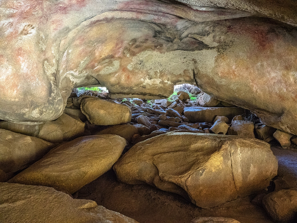
Mulka’s Cave in the Humps Nature Reserve is a site of special significance to the Nyoongar people. Apart from being the subject of local folklore it also has the largest collection of rock paintings in the south of Western Australia. Olympus OMD EM1 mki with Olympus m.Zuiko 12-40 f2.8 lens. Exposure: 1/30 sec, f5.6, ISO 3200.
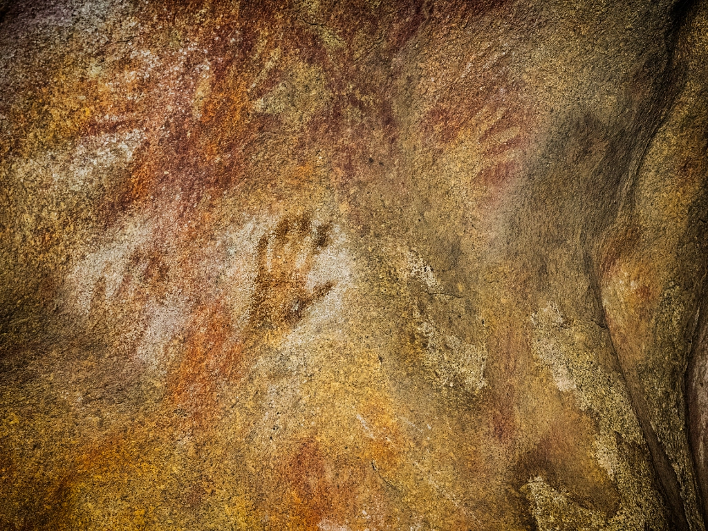
Sixteen Kilometres north-east of Wave Rocks is The Humps Nature Reserve. It’s not a very appealing name and probably doesn’t help with marketing to the tourist hordes. The Humps are a massive granite outcrop some 2 km x 1.5 km in area and rises to 80 m above the surrounding plain which was and is of huge cultural significance to the Nyoongar people. Mulka’s Cave is a gallery for 452 motifs which makes it the largest collection in southern Western Australia.It is thought that the paintings were produced over the last two or three thousand years and it feels like the people who made them are reaching out from the past to the present day. It really reinforces the impression of spirit of place and of belonging to the land. To me this is what makes The Humps more special than Wave Rock, it engenders a feeling to that felt at Uluru or Ubirr. Powerful stuff. Mulka’s Cave is named after one of its inhabitants about which there is a gruesome Dreamtime story.
‘Mulka was the illegitimate son of a woman who fell in love with a man to whom marriage was forbidden. As a result, Mulka was born with crossed eyes. Even though he grew up to be an outstandingly strong man of colossal height, his crossed eyes prevented him from aiming a spear accurately and becoming a successful hunter. Out of frustration, Mulka turned to catching and eating human children, and he became the terror of the district. He lived in Mulka’s Cave where the impressions of his hands can still be seen much higher than those of an ordinary man. His mother became increasingly concerned with Mulka and when she scolded him for his anti-social behaviour, he turned on his own mother and killed her. This disgraced him even more and he fled the cave, heading south. Aboriginal people were outraged by Mulka’s behaviour and set out to track down the man who had flouted all the rules. They finally caught him near Dumbleyung 156 km south-west of Hyden, where they speared him. Because he did not deserve a proper ritual burial, they left his body for the ants – a grim warning to those who break the law.’
R.G.Gunn, Mulka’s Cave Aboriginal rock art site: its context and content, Records of the Western Australian Museum 23: 19-41 (2006).
Nyoongar hand prints reach out from the past in Mulka’s Cave. Hyden, Western Australia. Olympus OMD EM1 mki with Olympus m.Zuiko 12-40mm f2.8 lens. Exposure: 1/100 sec, f4, ISO 1600.
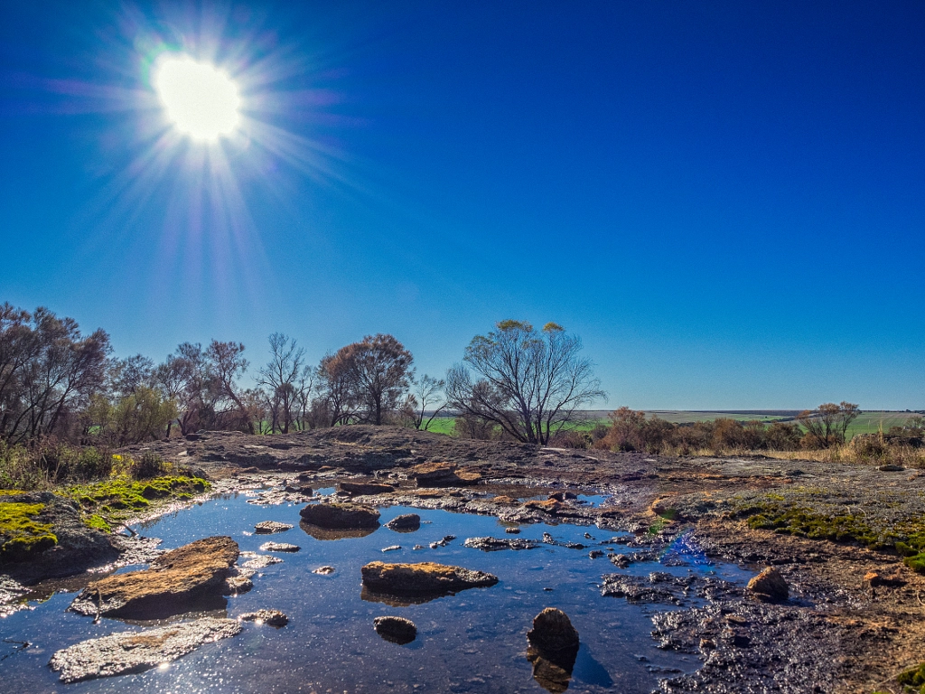
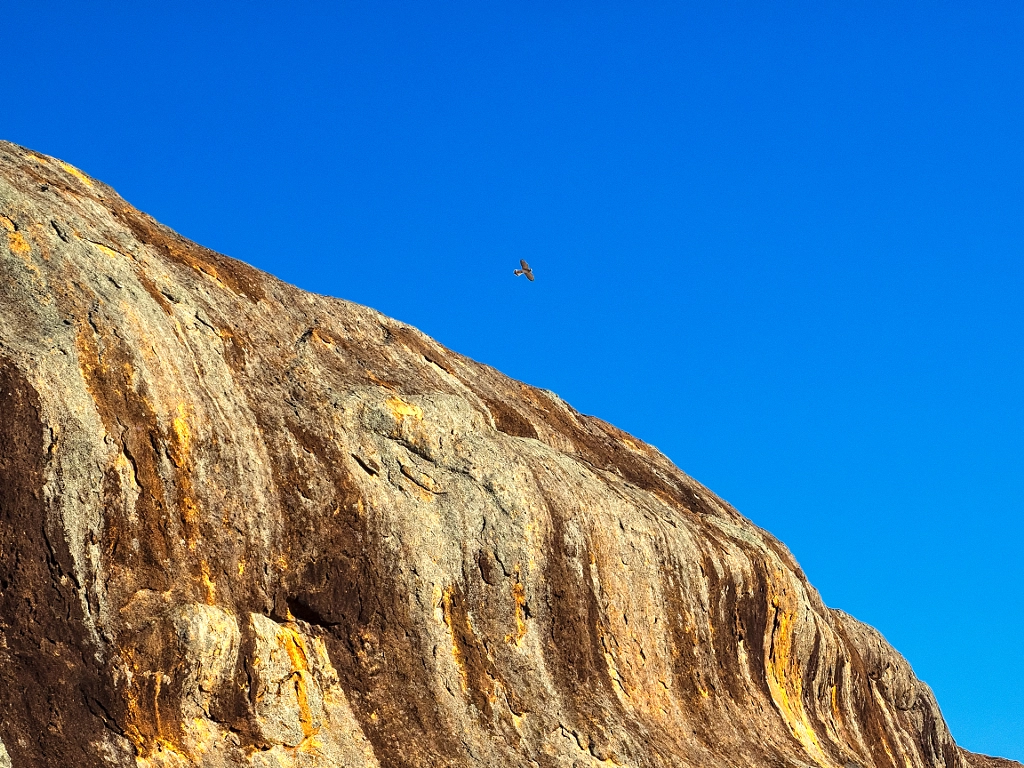
There are a couple of walks in the reserve – The Gamma Trail a 1.2km interpretative walk explains the significance of the area to the local Nyoongar people, and the Kalari Trail, a 1.6 Km trail climbs to the summit. The early morning walk to the summit was fantastic. There were kangaroos amongst clumps silver princess trees (Eucalyptus caesia), nankeen kestrels were riding the thermal currents looking for prey and there were hosts of wrens bathing in the shallow pools of water on the rock surface. You get the feeling that this is a place where everything has been stripped back to the elemental essentials. Time was standing still. Of course the moment was lost as the multitudes of tourists pulled up in the car park jumped out to grab a selfie in the cave and use the toilet, their chattering voices carrying up to the summit shattering the tranquility. For a brief couple of hours on top of the humps I was somewhere else quite magical.
Rock pool on the Humps. The Humps are a large granite outcrop to the north-east of Hyden, Western Australia. Olympus OMD EM1 mki with Olympus m.Zuiko 12-40mm f2.8 lens. Exposure: 1/640, f8 at ISO 200.
A nankeen kestral soaring the summit of the Humps. Hyden, Western Australia. Olympus OMD EM1 mki with Olympus m.Zuiko 12-40mm f2.8 lens. Exposure: 1/500, f9, ISO 200.
Mount Bakewell seen from the York Golf Course. Mount Bakewell is called Walwalling (place of weeping) in the Nyoongar language and features in their Dreamtime stories. Mount Bakewell is the most easterly extent of the Darling Ranges.
Earlier this week I was contacted by Moving Still Productions a video production company based in Perth Western Australia. They wanted to use the above photo in a production they were making. The email was pleasant with flattery about how beautiful the image is and what an important part it would play in the production. They were very generous with their offer, I would get a credit but no payment as there was no budget.
“We couldn’t afford to financially reimburse you, but we of course would credit you as the photographer. Your photo could really help us tell the story visually, and your assistance and generosity would be greatly appreciated.”
Vanessa Barnett, Senior Producer
Riiiiiight! So obviously the production crew are working for nothing as well? No there is a budget for the production crew. Ms Barnet went on to say in another email:
“We simply don’t have the budget to send a photographer to York, which is why we need your help! “
So it’s not that the photograph is really that good. You want my photo because it meets the criteria that you won’t have to spend any money thus maximizing your company’s profit. Thanks, but no thanks! I expect that Ms Barnett likes to be paid for her work, but it seems that she cannot see how that would extend to others.
In my last entry I mentioned that I would be going to Esperance, on the the south coast of Western Australia (next stop Antarctica!) and I’ve now returned home and have chance to process the pictures and reflect on the experience.
Twilight Beach, Esperance, Western Australia. Olympus EP2 and OLYMPUS M.12-50mm F3.5-6.3 lens.
Firstly I would like to say that this was not a photographic expedition, it was a holiday with a major focus on bush walking. Walking has been a big part of my life since my mid teens and I feel it is an excellent way to explore, to reconnect with myself and nature, and see things I might otherwise not see. Generally my long suffering partner is encouraging in my photographic endeavours but the one area which is an exception is when bushwalking as she hates hanging around while I fiddle around taking pictures. Fair enough. In 1986 we went to the Greek Island of Thira, more popularly known as Santorini. I took two SLRs, flash, filter system and a swag of lenses and fifty rolls of film in a shoulder bag. We decided to walk round the island, it is only small, but very quickly I wished that I had not got that stupid bag with me. It was a salutary lesson and ever since I’ve explored light weight alternatives and different ways of carrying. So my camera of choice was my Olympus EP-2. The EP-2 packs into a small bag (20cm x 18cm x 10 cm) and in that I can fit the camera, six batteries, 72GB of SD cards, two polarising filters, two variable neutral density filters, a SEMA-1 microphone and two zoom lenses that gives me the full frame equivalent of 24 – 300 mm coverage. I’ve found that I can shoot multiple exposure panoramics handheld and get reasonable results. The big let down for this trip was that I took no camera support so the handheld video footage I shot has been filed in the bin.
Lake Warden Wetlands Reserve, Esperance, Western Australia. Olympus EP-2 with OLYMPUS M.12-50mm F3.5-6.3 lens. Image created in Lightroom 3 with Niksoft HDR Efx Pro 2 and Silver Efx Pro 2.
Who, What, Where, When and Why
Esperance is a medium sized Aussie country town and is blessed with 16 beaches that are picture perfect and excellent for all manner of beach pursuits and are widely reputed to be the best in Australia. All but one of them are dog friendly. It is quite an isolated place and it is therefore very likely that you’ll able to get a beach to yourself. We didn’t go for the beaches but for Cape Le Grand National Park.
A bit of history about the area. Twenty thousand years ago the indigenous people of the south west of what is now Western Australia, the Wudjari group of the Nyoongar, inhabited the land they called “Kepakurl” or the place where the sea lies like a boomerang. It was a region blessed with a good climate, plenty of water and an abundance of wildlife and consequently they did not feel the need to roam very far. In 1627 a Dutch ship, the Gulden Zeepaerdt, captained by François Thijssen, sailed through the islands off the coast and so began the colonial era. In 1792 the next European visitors were two French ships, the Recherche and l’Esperance, under the command of Admiral Antoine Bruni d’Entrecasteaux, took shelter from a storm which nearly wrecked both ships. One of the crew, an officer by the name of Le Grand had spotted the anchorage and so it was named after him. In 1802 Matthew Flinders on HMS Investigator was charting the southern coastline of Australia and sailed through the Bay of Isles claiming it for King and country before those “Johnny foreigner” types could claim it for themselves. While sheltering from a storm he and his crew explored the area and named Lucky Bay, because they found safe anchorage there, and Thistle Cove after a Mr Thistle who was one of the crew. In the 1870’s the townsite of Esperance was established and the rest as they say is history.
Thistle Cove, Cape Le Grand National Park, Western Australia. Olympus EP-2 with OLYMPUS M.12-50mm F3.5-6.3 lens. HDR panorama of 12 shots blended using a combination of Photoshop CS5 and Niksoft HDR Efex Pro 2.
Cape Le Grand National Park is 631 km (392 miles) south-east of Perth and 56 km (35 miles) east of Esperance. Established in 1966 the park covers an area of 31,801 hectares (78,600 acres) and is made up of coastal heathland made up of dense thickets of showy banksia (Banksia speciosa) on the sand flats and scrub banksia (Banksia pulchella) on the gravel outcrops. This is punctuated by granite and gneiss peaks. There are beautiful bays with the most amazing white beaches where the sand squeaks underfoot, and the sea is the most breathtaking turquoise blue in colour. The most spectacular scenery is found in the south eastern corner of the park where is a chain of peaks that includes Mount Le Grand, Frenchman Peak and Mississippi Hill.
A mother and Joey from the famous mob of kangaroos that frequent the beach at Lucky Bay in Cape Le Grand National Park. Olympus EP-2 with OLYMPUS M.40-150mm F4.0-5.6 R lens. Exposure 1/4000 s at f/5.6 ISO 200.
All up the park is home to 1169 different species of animal and plant. The native mammals include western pygmy-possum, quenda, black flanked wallaby, bush rats, and honey possums. The park is a bit of a twitcher’s paradise with 110 species of birds and while there we saw a white-bellied sea-eagle, numerous types of wattlebirds, a wedged tailed eagle, emu, cuckoo shrikes, crested pigeon, and bronze wings.
Lucky Bay, Cape Le Grand National Park, Western Australia. Olympus E-P2, OLYMPUS M.12-50mm F3.5-6.3 lens, and circular polarising filter. Exposure 1/200 s at f/8.0 ISO 100.
There are a number of walks to do. The Coastal Trail is a 15Km (9.3 miles) one way trail that takes about 8 hours to complete. It has also been divided up into four sections. We chose to walk from Lucky Bay to Thistle Cove. Lucky Bay is famed as having the most beautiful beaches in Australia and somewhat incongruously you can as we did see kangaroos on the sandy beach. There is a campsite there with gas barbecues, toilets, picnic areas, water, and shade shelters. We chose to stay in Esperance rather than camp this time. The walk trail is clearly marked out and takes you round the headland giving views over the bays and inlets. I saw a pod of six dolphins playing in on of the inlets and I stayed and watched them until they decided to swim back out to sea. As you get to Thistle Cove there is a picnic table in the lee of a large rock that looks like an enormous mitten standing on end which provides a bit of necessary shade while you sit and take in your surroundings. Matthew Flinders thought that Thistle Cove was even better than Lucky Bay, I’m not sure I would agree but it is a very beautiful spot.
Frenchman Peak is a 262 metre granite outcrop that is part of a chain in the south-west of Cape Le Grand National Park. Olympus EP-2 with OLYMPUS M.12-50mm F3.5-6.3 lens. 15 exposure HDR panoramic created with a combination of Photoshop CS5 and Niksoft HDR Efx Pro2.
As mentioned earlier there are several peaks to bag; Mount Le Grand at 345 metres (1132 feet), Mississippi Hill 180 metres (590 feet), and Frenchman Peak at 262 metres(860 feet). Frenchman Peak was our choice as it has a clearly marked track to the top which is 3km or 1.8 miles return which is graded as hard and not recommended on wet and/or windy day. The peak did not get its name from the early French explorers but rather from explorer and prominent colonist John Forrest who passed through the area in 1870, in search of good country for pasture. The peak got its name because his brother, surveyor Alexander Forrest, thought its profile resembled a man wearing a Frenchman’s cap. The Aboriginal name for the peak was Mandooboornup and was a significant site for them. The Department of Parks and Wildlife who administer the park describe the route as being up the easy angled east slope. A better description to my mind would be up the not as hard east slope. At times the pitch of the slope is very steep, but thankfully the rock surface is very grippy in the dry and given a good pair of shoes and plenty of time it is very doable. The result is worth it as you’ll be rewarded with be rewarded with magnificent panoramic views of the park and islands in the Recherche Archipelago. The top of the peak has been eroded to form deep arch or cave which is not immediately obvious from looking up from the base and swallows make their nests in its walls and can be seen chasing insects as you climb up. The cave was formed 40 million years ago in the Eocene when sea levels were 300 metres (984 feet) higher than they are now and the top of the peak was under water. I don’t know about you but the geologic timescale just boggles my mind.
The walktrail up Frenchman Peak is a hard steep 3Km return walk. Cape Le Grand National Park.Views of the park and islands in the Recherche Archipelago from the top of Frenchman Peak. Cape Le Grand National Park, Western Australia. Olympus EP-2 with OLYMPUS M.12-50mm F3.5-6.3 lens.The cave on top of Frenchman Peak, Cape Le Grand National Park.
Did we enjoy our visits? Are the Kennedy’s gun shy? We will certainly visit again and aim to spend more time in the park, but we will go earlier in the spring so we can see more of the wildflowers and maybe even see some whales.
One of the famous kangaroos that frequent the beach at Lucky Bay in Cape Le Grand National Park. Olympus EP-2 with OLYMPUS M.40-150mm F4.0-5.6 R lens. Exposure: 1/2500 s at f/5.6 at ISO 200.
As always clicking on an image will take you through to my gallery for print purchases.










You must be logged in to post a comment.