Ambling in the Avon Valley – part 1

The Avon valley was officially discovered by Ensign Dale in 1830 when Governor Stirling saw that the newly established Swan River Colony was going to starve unless it found some decent arable land. Of course the Nyoongar people knew about its existence all along and the upper reaches of the Avon were very important to their dream time stories. As we drive out of Perth on the Great Eastern Highway it’s difficult to imagine how hard it was for Dale all those years ago. What takes us an hour today in a car took him nine days of sheer heart breaking slog. The going was so bad that his horses became bogged in mud and it took all day just to travel one mile or 1.6 Km and he named one spot the Vale of Misery. Ensign Dale opened up a parcel of land the size of Tasmania, although in many cases it was not until the 1860’s that the townsites were established. In the tradition of Nineteenth Century explores he named many of the places after his friends, family and places back in England where he grew up.

Standing on top of Mount Brown and looking across towards Mount Bakewell and the town of York in Western Australia’s historic Avon Valley. A 4 image stitch done in Adobe Photoshop CS5. Camera used Panasonic Lumix LX-5. Focal length equivalent to 35mm in full frame terms. Exposure: 1/800 s at f/4.0 ISO 80.

Ensign Robert Dale of the 63rd Regiment of Foot is perhaps one of the great unsung heroes of early colonial exploration. Everyone remembers Burke and Wills, and Leichhardt because they lost their lives and that heroic failure mythologized them. Ensign Dale’s exploration and surveying of the Avon Valley, the Canning River and Mount Barker region was of vital importance to the survival of the early settlers in Western Australia. His survey of King George’s Sound in Albany was considered an important work then and is seen as an important artistic and historical document today. While undertaking this achievement he never got lost, he did not loose any men and he maintained excellent relations with the local aboriginal population. In total he mounted seven official expeditions and the journals from them were published in 1833. He was appointed to the post of temporary assistant government surveyor and promoted to the rank of Lieutenant. He acquired a lot of property with two town allotments in Albany, a thousand hectares in York and a further 750 hectares in the Swan Valley. But as quickly as his star had risen it fell. He was placed under virtual house arrest by his commanding officer in mid 1832. Soon after he became embroiled in the ugly saga of Yagan’s murder where he was ordered to take Yagan’s pickled head back to England and explain the situation to the Colonial Office and they stripped him of his rank of Lieutenant. Disenchanted Dale resigned from the military and went into business with his brother Thomas importing mahogany. In 1853, at the age of forty-four, he died of tuberculosis in the English town of Bath on the banks of the River Avon.

Today tourists drive out to the Avon Valley to see historic heritage towns, atmospheric homesteads, rocky outcrops and to picnic along the banks of the River Avon. A pleasant spring time trip would be to drive out to Toodyay  and then follow the Avon down through Northam, York and Beverley returning to Perth via Westdale and the Brookton Highway. If time permitted you could arrange to stay overnight in Northam or York to get the most out of the trip.

Toodyay
Toodyay by Paul Amyes on 500px.com
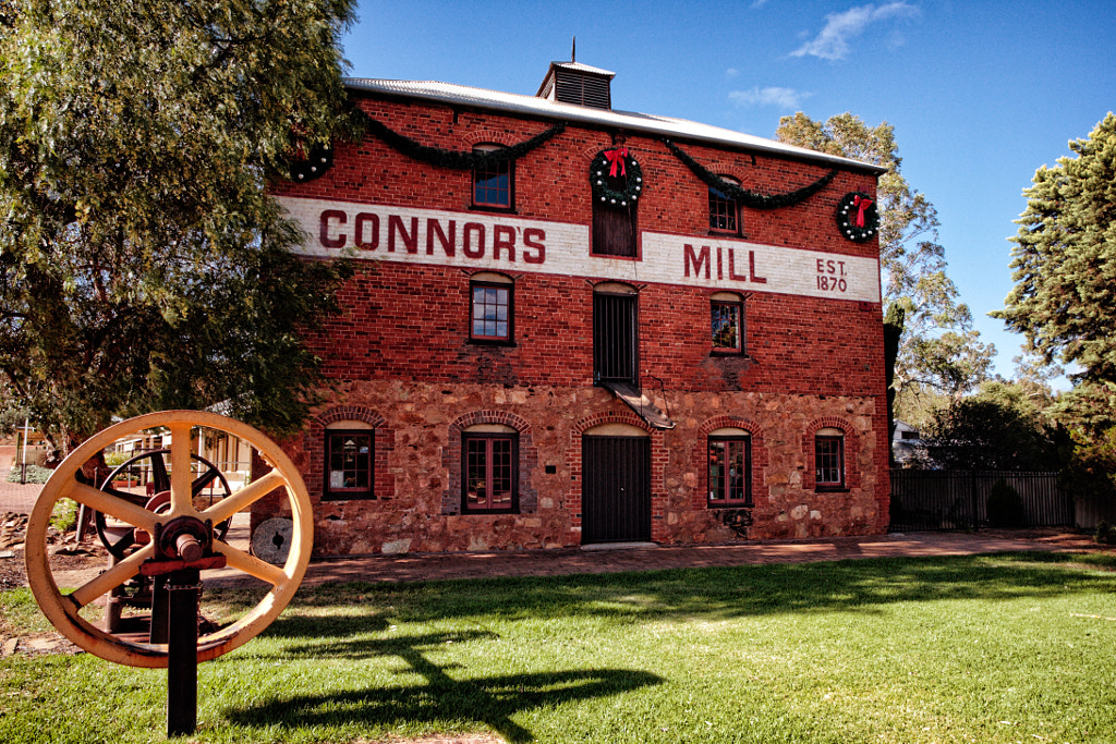
Connors Mill in Toodyay, situated in the Avon Valley of Western Australia.


85 km northeast of Perth Toodyay was settled in 1836 and named after the Nyoongar name for the area “Duidgee” which means place of plenty. The original townsite was prone to flooding so it was abandoned in the 1850’s and relocated 5 km and renamed Newcastle. In 1911 the name was changed back to Toodyay because people confused Newcastle in WA with Newcastle in NSW. The Heritage Council of WA list over one hundred places of historical significance in or around Toodyay. Some of these are:

  • Newcastle Gaol – this was constructed in the 1860’s using convict labour in response to Moondyne Joe’s repeated escapes .
  • Connor’s Mill on Stirling Terrace was built in 1870 and was as the name suggests a flour mill, it was then converted into an electricity generating plant, and is now the Toodyay Visitors Centre.
  • Toodyay Post Office – designed by George Temple-Poole and built in 1897
  • Toodyay Fire station – designed by Ken Duncan and built in 1938
 

Toodyay by Paul Amyes on 500px.com
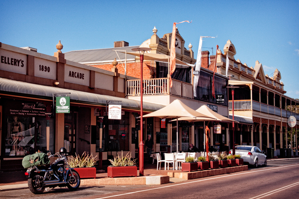
Stirling Street is the main drag in Toodyay and is full of colonial and federation architecture.


Toodyay plays host to several events throughout the year, the major ones are:

  • The Moondyne Festival is held on the first Sunday of May and celebrates Moondyne Joe’s life with re-enactments of Colonial life.
  • The Avon Descent – see the Northam entry for more details.
  • The Festival of Food coincides with the Avon Descent and provides culinary delights from all over the world, cooking demonstrations and free entertainment.
  • Theo’s Run is a convoy of classic cars and motorbikes that starts in Midland and travels to Dowerin via Toodyay.
Black powder demonstration. On the first Sunday of May the Avon Valley town of Toodyay celebrates Moondyne Joe’s life with the Moondyne Festival and the townsfolk re-enact the towns colonial past in the main street. The Perth Volunteer Rifle and Artillery Regiment 1860 is a Living-History group that seeks to portray the military and social life of a volunteer soldier in Western Australia during the period 1860 to 1901. Canon EOS5d with Canon EF28-135mm f/3.5-5.6 IS USM lens. Exposure 1/80 s at f/8.0 ISO 200.


Toodyay’s  Moondyne Festival is the story of Western Australia’s favourite Bushranger, Joseph Bolitho Johns, aka Moondyne Joe is a classic case of where truth is stranger than fiction. Transported to WA as a convict, given a ticket of leave and released, some would say that Johns was a victim of society while others would see him as a recidivist, but what ever your viewpoint it is a fascinating story of a man who is hard done by, has a disdain for authority, who makes repeated escapes from custody and ends up spending his last days in Fremantle Asylum suffering from dementia.


A convivial chat at the Moondyne Festival in Toodyay.


Moondyne Joe on the run up Stirling Street in Toodyay.


The Toodyay Moondyne Festival has Joe and his gang running riot in the streets of Toodyay. He holds people up, consorts with floozies, avoids the incompetent police and the annoying temperance ladies, is arrested, put on trial and escapes. With local people dressing up in period costume the end result is a gigantic al fresco pantomime with heaps of audience participation (chants of “Free Joe” and “Behind you” ). Alongside the theatrical mayhem there are bush poets, market stalls, displays from the 1860 Regiment, vintage cars and mustache and cleavage competitions. A brilliant day out for all the family.

Northam

Hot air balloons flying over the Avon River at Northam in Western Australia.


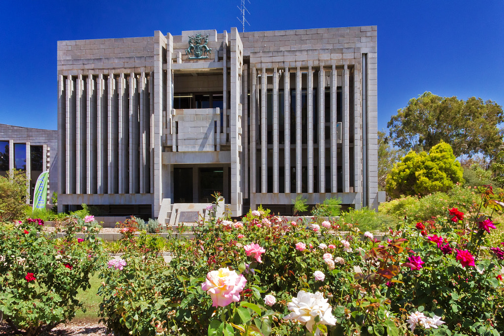
Northam is 98 Km from Perth on the Great Eastern Highway and it is the largest town in the Avon Valley. With its central location in the valley it makes the perfect base from which to explore. Up until 1891 it was the poor relation to York, but this changed with the coming of the railway linking Perth with the Goldfields and the town became an important staging post. During the 1940’s and 50’s Northam became an important centre  for housing displaced European refugees and migrants, in fact the Northam Accommodation Centre was the third largest such facility in Australia. By the time it closed some 23,000 people had passed through its gates. There is a photographic exhibition telling the story at the Northam Visitor Centre. There is a historic town walk that enables visitors to experience the town’s history, some of the significant places on the trail are Morby Cottage  – home of the founder of Northam and built in 1836 – and the Old Railway Museum which was built in 1886. More details for both venues can be had by contacting the Visitor Centre. The town hall on Fitzgerald Street is a wonderful example of concrete carbuncle architecture from the 1970’s.

 

A Yellow-billed Spoonbill (Platalea flavipes) flying back to its nest on the Avon River. Northam, Western Australia.


Northam's Concrete Carbuncle by Paul Amyes on 500px.com
Northam’s Concrete Carbuncle. The town hall on Fitzgerald Street is a wonderful example of concrete carbuncle architecture from the 1970.


Northam is also the eastern terminus of the Kep Track a 75 km long mountain bike and walking trail that starts in Mundaring and follows the water pipeline the engineering genius CY O’Connor built to take water out to the Goldfields of Western Australia. The name Kep comes from the local Nyoongar word for water. The Golden Pipeline Heritage Trail  follows the pipeline in its entirety all the way from Mundaring Weir to Kalgoorlie 650 km to the east, and it also passes through Northam.


The paddlers get ready to start the Avon Descent. Northam, Western Australia.

Northam is the staring line for The Avon Descent, which was first held in 1973, and there were only forty nine competitors. The event has grown so much now that this year there were over 800 competitors and 2000 plus support crew. In more ways than one it deserves the title the “world’s greatest white water event”. The 134 km two day event starts at Northam and finishes at the Riverside Garden in Bayswater with an over night stop at the Boral Campsite just outside Toodyay. For the majority of entrants the aim is just to complete the course, but for the elite athletes it is a chance of competing in a unique endurance race. The race happens on the first weekend of August every year. It kicks off on the Friday night in Northam with a float parade and firework display. On Saturday morning the event kicks off proper.
Meandering Along The Murray – part 2

Mandurah by Paul Amyes on 500px.com
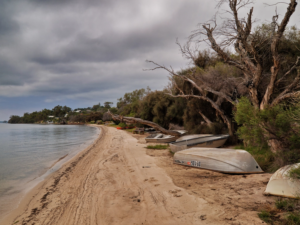
Boats pulled up onto the beach on the Peel Inlet. Mandurah, Western Australia.


The Murray River flows westwards past Pinjarra and into the Peel Inlet, which is a roughly circular body of water covering an area of 75 sq. Km (approx. 29 square miles). Although around 75% of the surrounding land has been cleared for farming or housing the inlet is incredibly rich in wildlife. The Inlet is home to crustaceans such as blue swimmer crabs and  king prawns, and fish species include black bream, tailor and cobbler. Birdlife International has designated it an Important Bird Area because it supports large populations of Fairy Terns and 1% of the world’s population of Red Necked Stints, Sharp Tailed Sandpipers, Banded Stints, Red Necked Avocets and Red Capped Plovers. At the northern end of the inlet a channel passes through Mandurah and runs out into the ocean and this allows dolphins to visit. At the southern end the inlet combines with the Harvey Estuary. The combined waterway covers 136 km², or 52 square miles, and is extensively used for recreational purposes particularly fishing, crabbing, and sailing (including house boating). Because it is sheltered from the sea by a line of very large sand dunes the beaches and bays are popular with families for picnics and barbecues.

Mandurah by Paul Amyes on 500px.com
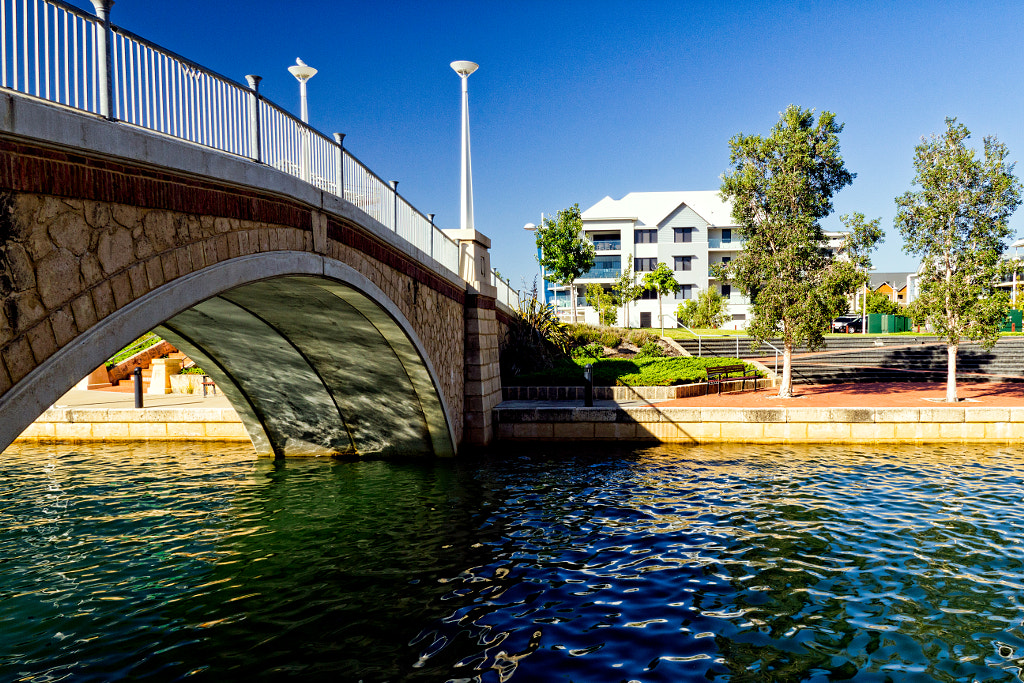
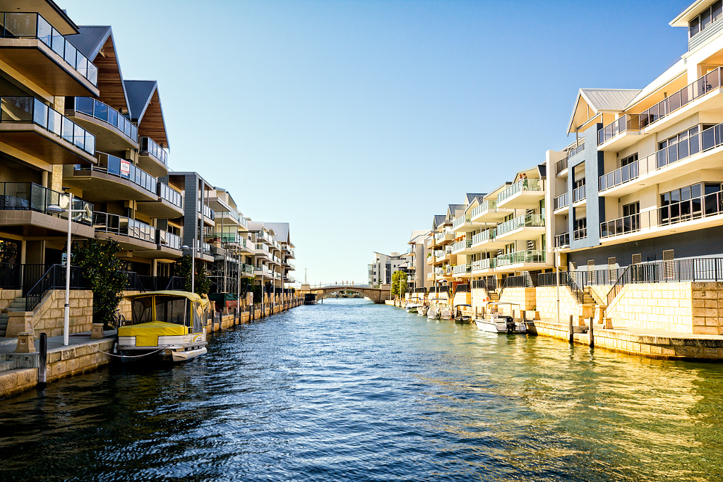
The canal deveolments and waterways around Mandurah make for a very attractive city.


Mandurah by Paul Amyes on 500px.com
The canal deveolments and waterways around Mandurah make for a very attractive city.


As previously stated the city of Mandurah sits at the top of the Peel Inlet. The name is thought to have come from an Anglicized variant of the Nyoongar word mandjar, which translates as meeting place. European settlement commenced in 1828 when Robert Peel and his workmen arrived from England. Initially the settlement grew very slowly and by 1898 was comprised of 160 people. A mining and industrial boom saw Mandurah grow rapidly from a sleepy beach resort to one of the fastest growing suburbs in Australia. One of the notable features is the canal developments. If nearby Kwinana and Rockingham are synonymous with working class bogan culture then Mandurah is home to the CUB, or Cashed Up Bogan. This can be evidenced by taking a cruise around the Mandurah canals and seeing the opulent houses that line the banks complete with swimming pools, expensive boats, barbecue pontoons and Balinese themed gazebos. In the high-rise developments of the marina precinct it is not unusual to see on a weekend residents dropping a fishing line from their luxury apartment balcony while enjoying a coldie.


Mandurah by Paul Amyes on 500px.com
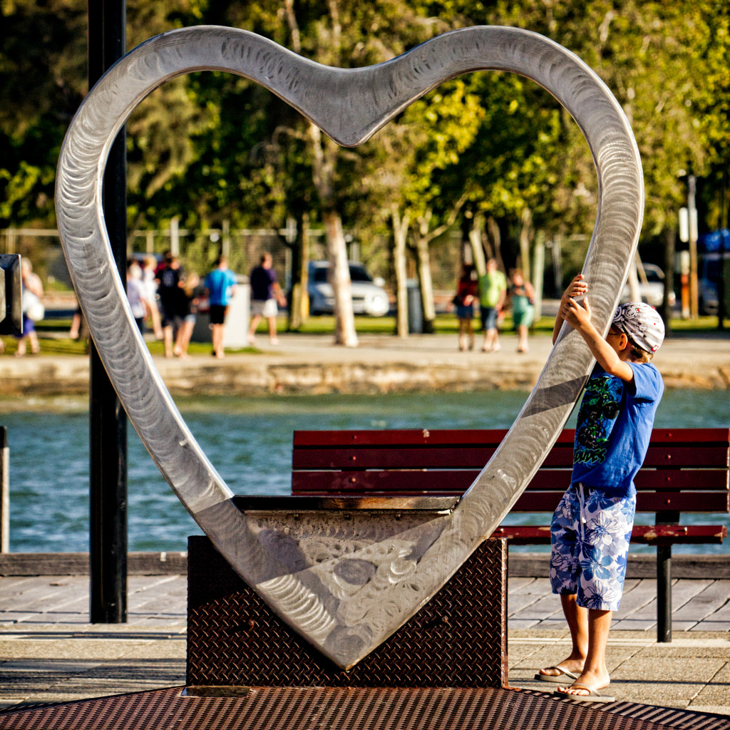
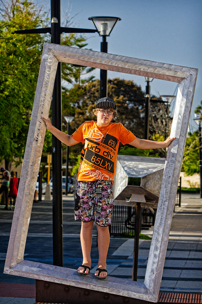
Kids playing on the sculptures on Mandurah’s Broadwalk.

Mandurah by Paul Amyes on 500px.com


Mandurah is now a major tourist destination in Western Australia and is heavily marketed as the gateway to the state’s popular South West Region. Apart from fishing there are also dolphin cruises and the more energetic can hire boats, canoes or jet skis to explore the water ways. In the culinary department there is everything from the usual fast food joints to the finest waterfront dining where it possible to eat locally caught seafood and drink local wines and boutique beers. The Mandurah Performing Arts Centre, near the marina and foreshore, not only plays host to some of the world’s top performing artists but also puts on exhibitions and hosts workshops for the visual arts as well. Take a walk through time with the inner City Heritage walk trail (maps are available from the tourist centre) and see and learn about the notable people and places that shaped Mandurah into what it is today. There is also a public art walk trail along the foreshore and marina that is fun and interactive. Through the year there are several major events that fun for the family to visit, the main one being The Channel Seven Mandurah Crab Fest  that while ostensibly being about enjoying the locally caught crabs actually show cases all that Mandurah has to offer on one glorious day in March. There are cooking demonstrations, arts competitions, children’s stage shows, music and the International Waterski & Wakeboarding Federation (IWWF) World Cup competition which attracts the best competitors from all around the world. For those wishing to visit any time of year is good, but summer is when it all really happens and it seems as if the whole population of Perth comes out to play over the Christmas and New Years holidays and the city basks in its brash exuberance.


Mandurah by Paul Amyes on 500px.com
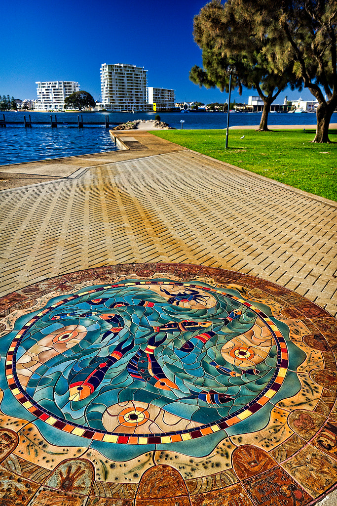
The Foreshore Heritage Trail tells the history of Mandurah’s pioneer settlers and Mandurah’s indigenous cultural history, showing places of historical and cultural interest and community art installations.


Mandurah by Paul Amyes on 500px.com
The Mandurah Foreshore and Inner City Heritage Trail in Mandurah.


The Foreshore Heritage Trail tells the history of Mandurah’s pioneer settlers and Mandurah’s indigenous cultural history, showing places of historical and cultural interest and community art installations.

A journey down the Murray River to the sea is like seeing a microcosm of Western Australia. You have the ancient culture of the indigenous Nyoongar, the story of European settlement, mining and agriculture booms, amazing scenery with incredible biodiversity, and fantastic recreational activities. All this just lies on the southern doorstep of Perth.


Mandurah by Paul Amyes on 500px.com
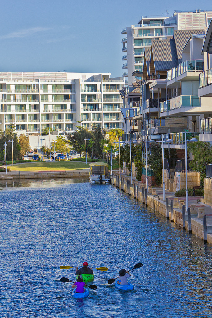
Kayaking along the Mandurah canals.


Mandurah by Paul Amyes on 500px.com
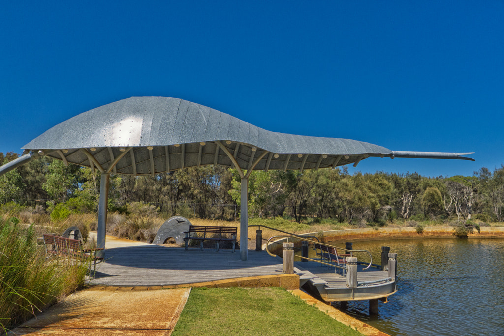
The head of tiger snake sculpture provides shelter in Coodanup Reserve in Mandurah.


Meandering Along The Murray – part 1

A little known fact is that there are two Murray Rivers in Australia. The one in the Eastern States is often billed as the “Mighty Murray” and gets most of the attention. Western Australia’s Murray River, approximately 80 Km south of Perth, while not as mighty played a vital role in the life of the Nyoongar people (the indigenous people of the South West corner of Western Australia), and again when the British arrived it played an important role in the early history of the Swan Colony. The river rises in the Wheatbelt near Pingelly and flows westwards through the Darling Range around Dwellingup to emerge on the coastal plain at Pinjarra, from where it flows to enter the sea in the Peel Estuary.

In November 1829 Dr Alexander Collie and Lieutenant William Preston set out to explore the Murray Delta. The then governor of the fledgling colony James Stirling named the new river after his boss in England Sir George Murray. Thomas Peel opened up the newly found lands for settlement and Pinjarra was founded in the late 1830’s as the upper most limit of navigable water along the Murray. It was also an important fording place for travelers heading south. Pinjarra is named after the Pindjarup people who lived in the area. The rich loamy soils around Pinjarra and the cooler climate and high rainfall made the Murray very attractive for farming. Dwellingup was established as a townsite in 1910 after it was decided to locate the terminus of the Pinjarra-Marrinup Railway there, the name is a Nyoongar word said to mean “place of nearby water”. Dwellingup  became an important centre for the timber industry, and it is now home to the largest bauxite mine in the world which supplies ore to the Pinjarra and Kwinana refineries.

Dwellingup

Situated amidst the jarrah forest of the Darling Range near the Murray River Dwellingup a one time timber town is now establishing itself as WA’s outdoor adventure capital and eco destination. It is easy to see why – thousands of hectares of pristine jarrah forest, the Bibbulmun Track and the Munda Bindi Mountain Bike Trail passing through the town and the nearby Lane Pool Reserve on the banks of the Murray.

lane pool reserve by Paul Amyes on 500px.com
The Murray River pass through the Lane Pool Reserve, which is the largest national park in the northern jarrah forest of Western Australia at 54,000 hectares


Lane Pool is 16 Km south of Dwellingup on Murray Valley Road, it is the largest park in the northern jarrah forest at 54,000 hectares and the Murray River flows through the park and has water in all year round. In summer the river looks slow and torpid, but after the winter rains the river flows quickly and the levels are high enough for it to become a canoeists playground. The fishing on the river and its major tributaries is good and it is possible to catch yabbies, marron, trout, red fin perch and cobbler.
In 1910 the WA Government Railways opened the No. 1 Mill in Dwellingup and this then brought about a timber boom that saw the town’s population rapidly increase. By 1914 the population reached 1300 and to provide for them there was a baker, two butchers, three general stores, a newsagent, a tobacconist (remember those) a police station and a hotel. Over the years the timber industry went through several expansions and contractions, but by the start of World War Two in 1939 a major decline had set in and several mills had permanently shut. The war also brought about severe labour shortages as all able-bodied men went off to fight in the war. So in 1942 a prisoner of war camp was built at nearby Marrinup and the German and Italian prisoners were put to work. After the war new technologies and the beginnings of a regulated timber industry caused more mills to shut, and this decline has continued to this day. Today Dwellingup has a population of 850 people and although some vestiges of the timber industry remain  it is bauxite mining that is the big money spinner in the area. Tourism has also come to play a large part in the local economy.

Dwellingup by Paul Amyes on 500px.com
Dwellingup Tourist Centre


The tourist Centre has mud maps for a series of walking and cycling trails:

  •  Bygone Buildings – a 1.5 Km walk around the township looking at the history of the town and its buildings.
  • Holyoake Hike – 6.5 Km walk following the Bibbulmun Track  as it runs beside the railway track down to the site of the old Holyoake Settlement.
  • The Early Days – takes you on a 3.9 Km walk that explores the timber industry when the town was founded.
  • Cage In The Bush – is a 4.5 Km walk around the Marrinup Settlement and the No. 16 Prisoner of War Camp. There is an informative display in the Tourist Centre that tells the story of the POW camp and seeing it would add to the enjoyment of the walk.
  • Marrinup Falls – a 1.4 Km walk around the waterfalls at Marrinup.
  • Marrinup Cycle Trail – a 7.9 km mountain bike trail suitable for riders of all abilities.
  • Turner Hill Cycle Trail – is an 8.9 Km MTB trail that is rated as moderate with a long uphill section followed by a steep downhill.

The Captain Fawcett Commemorative 4×4 Track is an easy to medium grade 105 Km track that passes through some of the best Jarrah Forest on the Darling Scarp. The map and trail notes are available from the Tourist centre. If you are more of an aquatic person then the Swamp hen Trailis a 15 Km long canoe trail along the Murray River.

Dwellingup by Paul Amyes on 500px.com
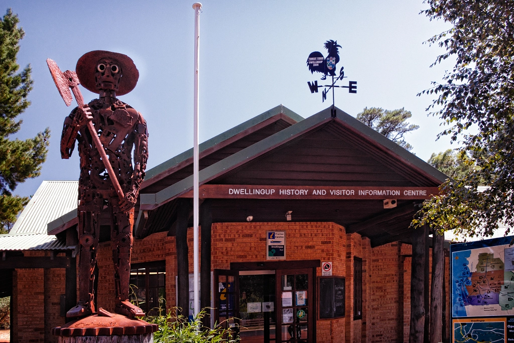
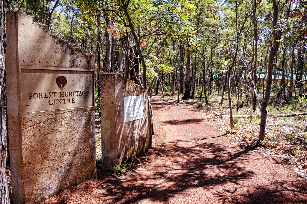
The entrance to the Forest Heritage Centre


Dwellingup by Paul Amyes on 500px.com
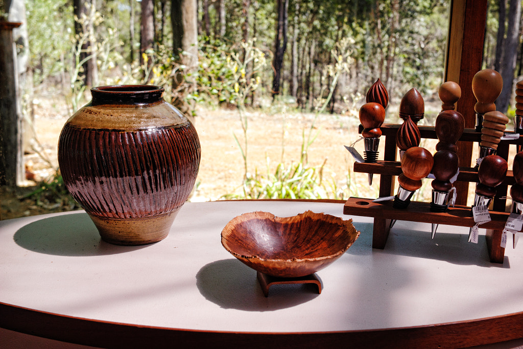
The Forest Heritage Centre contains a gallery which showcases uniquely crafted timber furniture and a shop selling giftware.


The Forest Heritage Centre is housed in an amazing jarrah leaf-shaped rammed earth building set in native bushland. The building contains a gallery which showcases uniquely crafted timber furniture, a shop selling giftware and a school where you can study all aspects of furniture design and building. In the grounds there is the Yokine Binda wildflower trail, a viewing platform and guided tours that tell how the timber industry worked and visits an active jarrah saw mill.

Dwellingup by Paul Amyes on 500px.com
The Hotham Valley Railway


Dwellingup by Paul Amyes on 500px.com
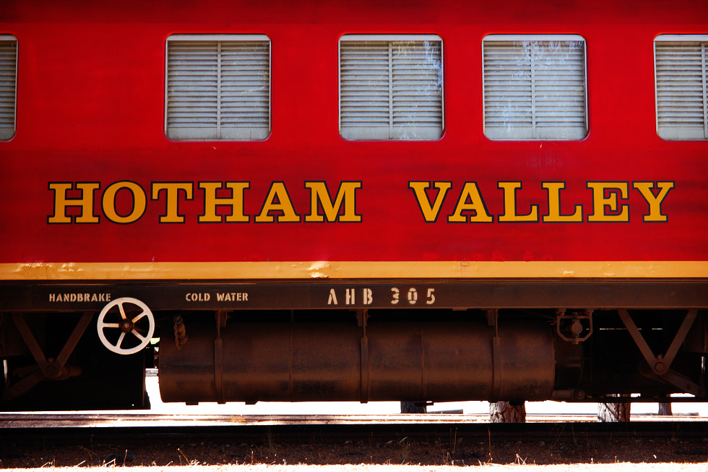
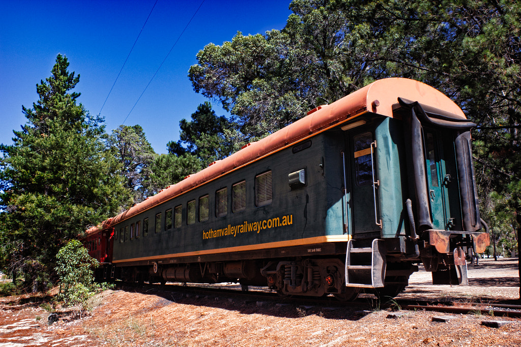
Hotham Valley Railway rolling stock


By 1984 the Dwellingup rail line had ceased to operate, but a group of railway enthusiasts saw the potential to create something unique and formed the Pinjarra Steam And Hills Railway Preservation Society. Not the catchiest of names so it was changed to the Hotham Valley Tourist Railway. The operation is totally staffed by volunteers and they run three basic tours.

  •  Steam Ranger – runs between Pinjarra and Dwellingup
  • The Restaurant Train – leaves the Dwellingup Station and passengers enjoy a five course meal as the train travels through the forest at night. Pick up can be arranged from Perth and Armadale at extra cost.
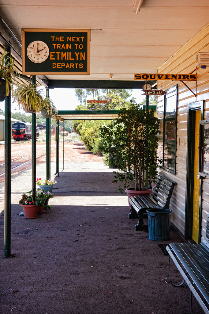
  • The Dwellingup Forest Train takes passengers from Dwellingup to Etmilyn. On the way is a running commentary about the railway and the timber industry. At Etmilyn there is a thirty minute stop over which gives passengers chance to stretch their legs on the walk trail there.
Dwellingup by Paul Amyes on 500px.com
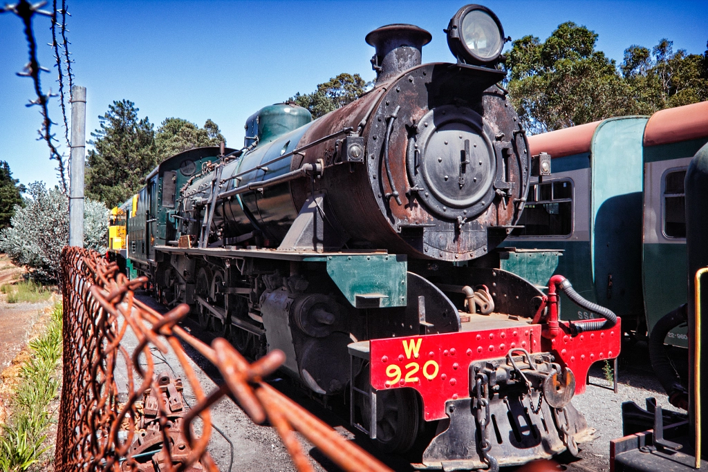
Pinjarra steam Locomotive


Dwellingup by Paul Amyes on 500px.com
The railway yard at Dwellingup.


Dwellingup by Paul Amyes on 500px.com
The railway platform for the Hotham Valley Railway at Dwellingup.


Beside there being a station in Dwellingup there is also a small rail depot with engine sheds that house engines and rolling stock. Just looking at them brings out the inner twelve-year-old, but this is better than a Hornby railway set because the railway is always looking for volunteers, so you could get the chance to drive the trains.

Dwellingup by Paul Amyes on 500px.com
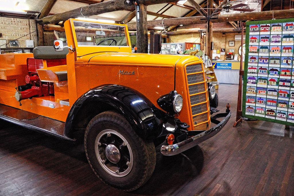
Dwellingup Bush Fire Museum


Western Australia’s worst bush fire began with several lightning strikes some 15 miles outside of Dwellingup, within two days the town was a burning inferno. The residents had to evacuate to the town oval as 132 houses and many other buildings were destroyed by the flames. Eight hundred people were left homeless, many left town never to return, but those that stayed on rebuilt the town and carried on. There is an exhibit telling the story in the Tourist Centre

Pinjarra

Pinjarra by Paul Amyes on 500px.com
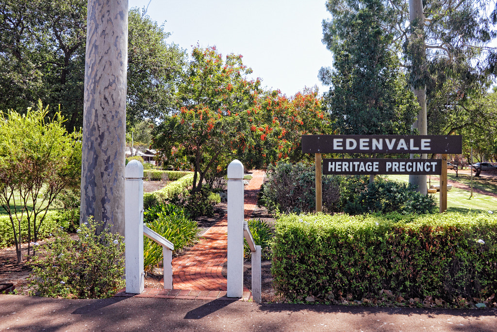
Edenvale Homestead, Pinjarra


Pinjarra by Paul Amyes on 500px.com
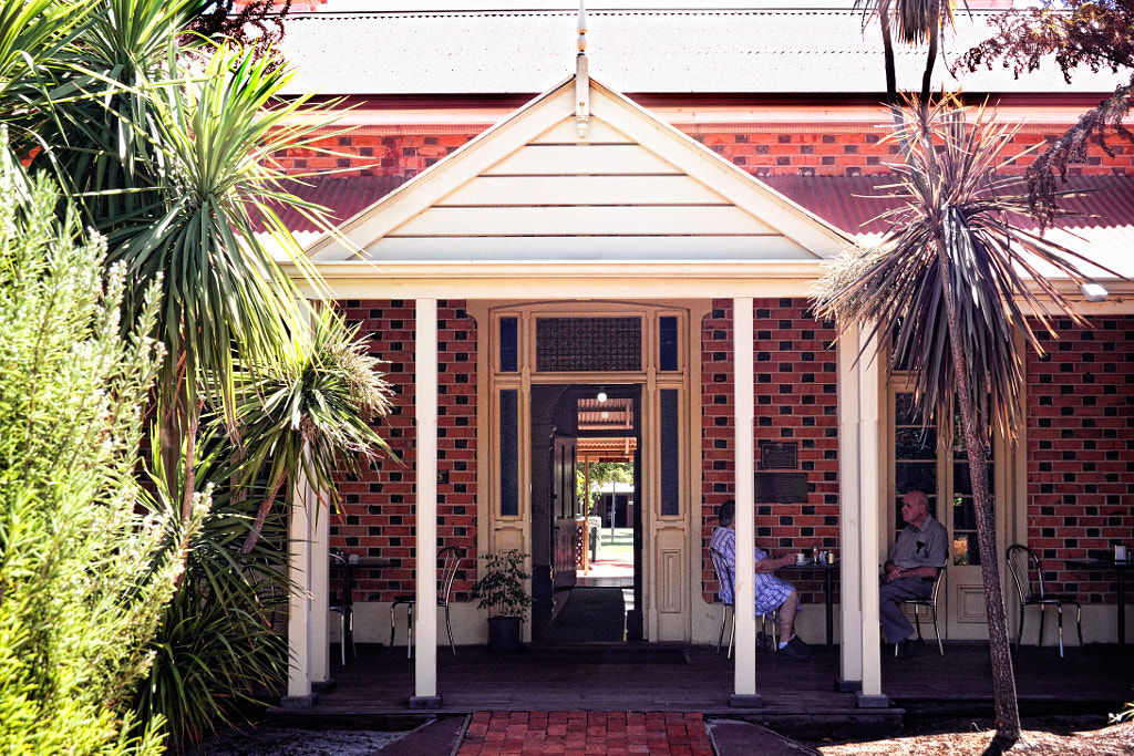
Having tea on the veranda at the tearooms based Edenvale House.


Pinjarra by Paul Amyes on 500px.com
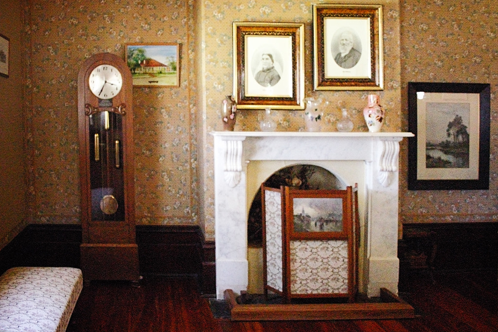
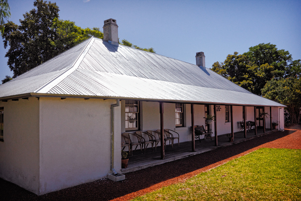
Edenvale Homestead was built-in 1888 by Edward McLarty, and his son Sir Robert McLarty who became state premier lived much of his life there. The dinning rooms have photos, documents and other artefacts from the McLarty family.


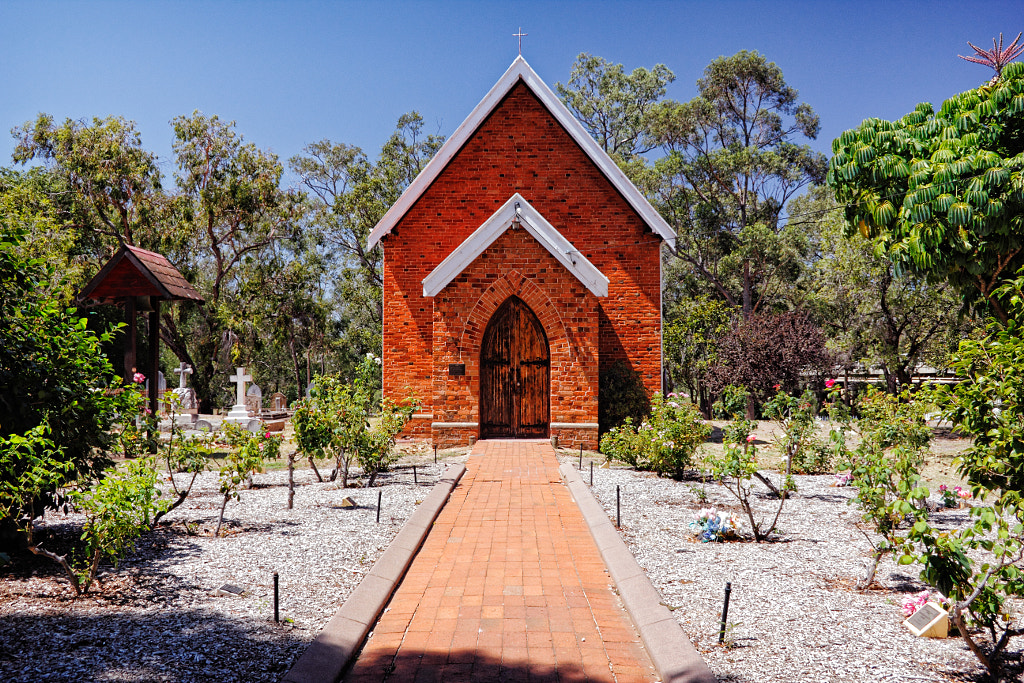
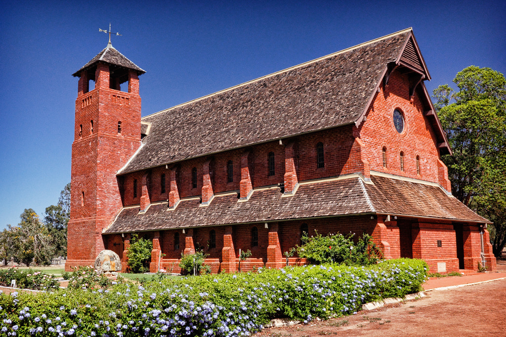
One of the oldest settlements in Western Australia and consequently it has loverly old buildings that are well worth looking at, and  Edenvale Homestead is the finest of them. Located in the centre of Pinjarra the house was built-in 1888 by Edward McLarty, and his son Sir Robert McLarty who became state premier lived much of his life there. The dinning rooms have photos, documents and other artefacts from the McLarty family. The outbuildings are now used by a number of different groups and are well worth exploring. The Barn and Art And Craft Centre displays a large variety of locally produced artworks which are available for purchase. They also hold art workshops in the building on a regular basis. Liveringa is perhaps the oldest building on the site and dates from the late 1860’s. Today it is being used as an art gallery. The Roger May Museum is named after a local collector of old engines and vehicles dating from 1918 and onwards. The collection was rescued from Fairbridge in 1993 and they have been lovingly restored by local volunteers so that they all work. Next door to Edenvale is St John’s Church which was built-in 1863 to replace the 1848 whitewash wattle and daub building. The current building is in the Victorian rustic style, and much of the wooden fittings were made by convicts in Fremantle Prison. Close by is the Heritage Rose Garden which has a collection of 400 roses, many are wild varieties which are the ancestors of todays varieties. The Old School House (built-in 1896) now houses the Pinjarra Quilters Group and has items on display and for sale. The Heritage Tearooms – ever popular, you can enjoy morning or afternoon tea here, or a light meal at lunch times while sitting either inside Edenvale or outside in the courtyard or on the verandah. Opening times are 9 am to 4 pm.

Pinjarra by Paul Amyes on 500px.com
St John’s Church, Pinjarra.


For many people Pinjarra is synonymous with the Battle of Pinjarra. In 1829 the leader of the Pindjarup people was Calyute, a brave and resourceful man. When Lt William Preston first made contact with the Pindjarup around the Peel Inlet there was no conflict and relations were amicable. This did not  last for long the influx of settlers put pressure on the Pindjarup and their traditional hunting lands. To save his people from starvation Calyute led a peaceful raid on Shenton’s Mill in South Perth to take bags of flour. Thomas Peel was affronted by the audacity and called for reprisals. He feared that if this went unpunished that settlers would not want to buy his land in Mandurah and this would stop him from making a buck. The press at the time called it the “Battle of Pinjarra”, but it was more like shooting fish in a barrel. The soldiers attacked the twenty mia mias (humpys or simple temporary shelters) on the banks of the Murray early in the morning. The men armed with spears and clubs tried to hold the soldiers off so the women and children could escape. Unfortunately the only place to go was the river which at this point is thirty meters wide and very shallow and offered no chance of escape. It was said by Robert Menli Lyon an advocate for indigenous rights in the colony that the soldiers “would as soon shoot an Aboriginal as shoot a kangaroo”, and they kept shooting until all had been killed. Sixty to seventy men, women and children were killed, eight women ad children were taken prisoner, no male prisoners were taken, all the wounded were shot. Only two settlers were wounded. Governor James Stirling made a pretty penny out of the whole affair as he took ownership of all the Pindjarup land in the Harvey District. There is a memorial park but it is a bit of a sorry affair, hopefully the proposed plan to put up a sculpture will lend it a bit of dignity and gravitas.

Pinjarra by Paul Amyes on 500px.com
Old Blythewood ,Pinjarra


Just outside Pinjarra is Old Blythewood.  Built in 1860 by John and Mary McLarty. This dynamic couple farmed 6100 acres, and ran a hotel and post office at the house. Later John would expand his business interests into bridge building and road maintenance. The house contains period furniture, some of it from the McLarty family and has a beautiful garden.

Pinjarra by Paul Amyes on 500px.com
Fairbridge Village


Also outside Pinjarra and set in thirty hectares of picturesque bushland is the 100-year-old Fairbridge Village is comprised of sixty buildings. Facilities include an art gallery, museum, cafe, pool, and walking trails. All money raised here helps support the charity run traineeships, apprenticeships, and specialized training for indigenous and disabled young people. There are guided historical tours of the village which tell how Kingsley Fairbridge while on a trip to England to visit relatives was shocked by the poverty he saw. In 1909 he established the Child Emigration Society and in July 1912 Fairbridge Farm School was established. From January 1913 to March 1983 Fairbridge helped 3580 children establish a better life in Australia. Other activities include canoe tours on the Murray River, mountain biking at Lane Pool and walks on the Bibbulmun Track. The art gallery runs a constantly changing exhibition programe and prides itself on selling more artwork than any other art gallery in the Peel region. There is also an artist in residence, workshops and an annual photo competition that culminates in an exhibition. Fairbridge Village also plays host to the annual three-day Fairbridge Festival of World and Folk Music. The event is a popular family camping festival that takes place in April. As well as a wide range of different musical styles (folk, roots, blues, Celtic, world music) there is a children’s festival, workshops, street theatre and a vibrant market.

Pinjarra by Paul Amyes on 500px.com
Kingsley Fairbridge while on a trip to England to visit relatives was shocked by the poverty he saw. In 1909 he established the Child Emigration Society and in July 1912 Fairbridge Farm School was established. From January 1913 to March 1983 Fairbridge helped 3580 children establish a better life in Australia.


Monkey Business

Currently I’m laid up at home recovering from shoulder surgery and consequently I haven’t been able to get out and about so I thought I would dig deep into the archives and post material that I wrote and photographed a while ago for a book project that got canned by the publishers because of the GFC (and I don’t mean Geelong Football Club).

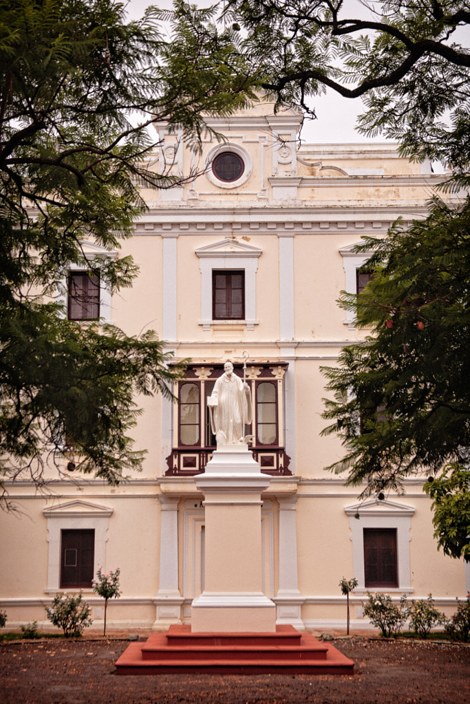
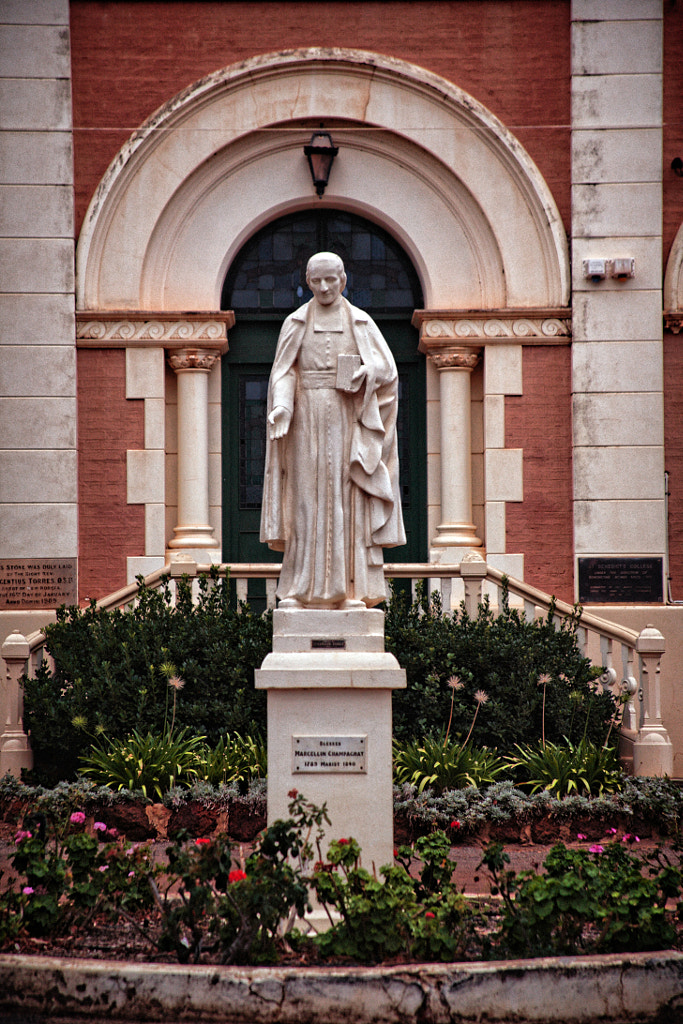
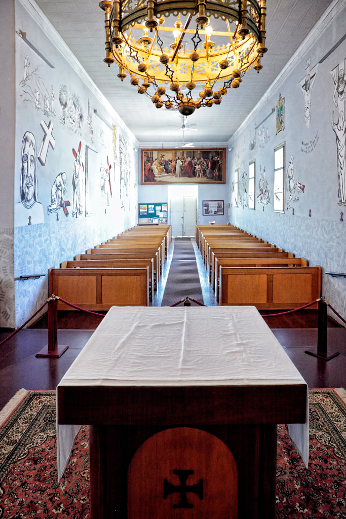
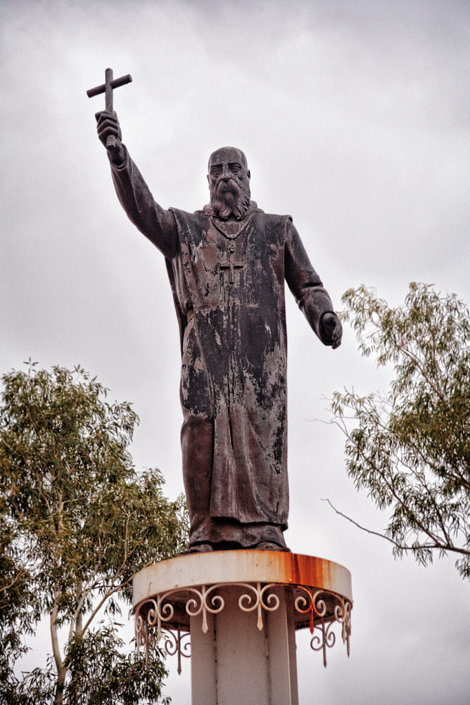
The monastic town of New Norcia is 132 Km north of Perth and as you drive into it you could be convinced that you had driven into a little bit of Spain. The monastery was founded by the Spanish Benedictine Monk Dom José Benito Serra in 1847. His vision was to create an evangelical Christian self-sufficient agricultural community for the local indigenous people. By 1860 the Nyoongar population had been decimated by disease and the emphasis of the mission changed to one of educating Aboriginal children from all over the state. New Norcia was unique for its time because although like other Nineteenth Century missions had the goal of “civilizing” and evangelizing the Aboriginals, Dom José Serra chose to do it in such a way that sympathetic to their culture. At its height the monastery had eighty members, most of whom were Spanish lay brothers. Presently there are now just eight monks, none of whom are Spanish, and there are seventy staff who work on the farm and in the other related businesses that support the monastery.

New Norcia - Australia's only monastic town by Paul Amyes on 500px.com


New Norcia - Australia's only monastic town by Paul Amyes on 500px.com


New Norcia - Australia's only monastic town by Paul Amyes on 500px.com


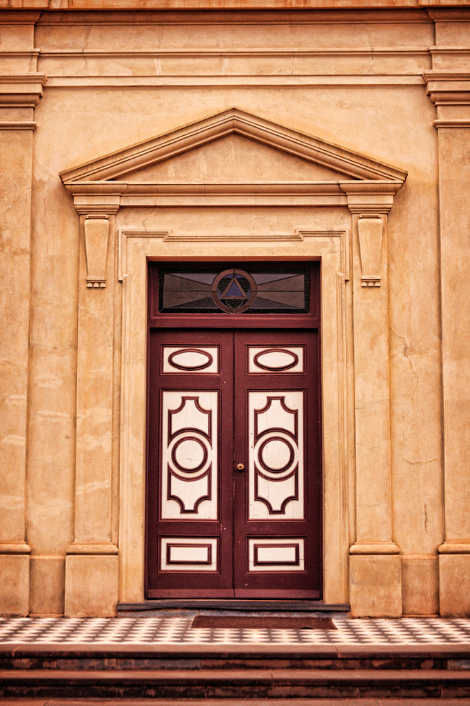
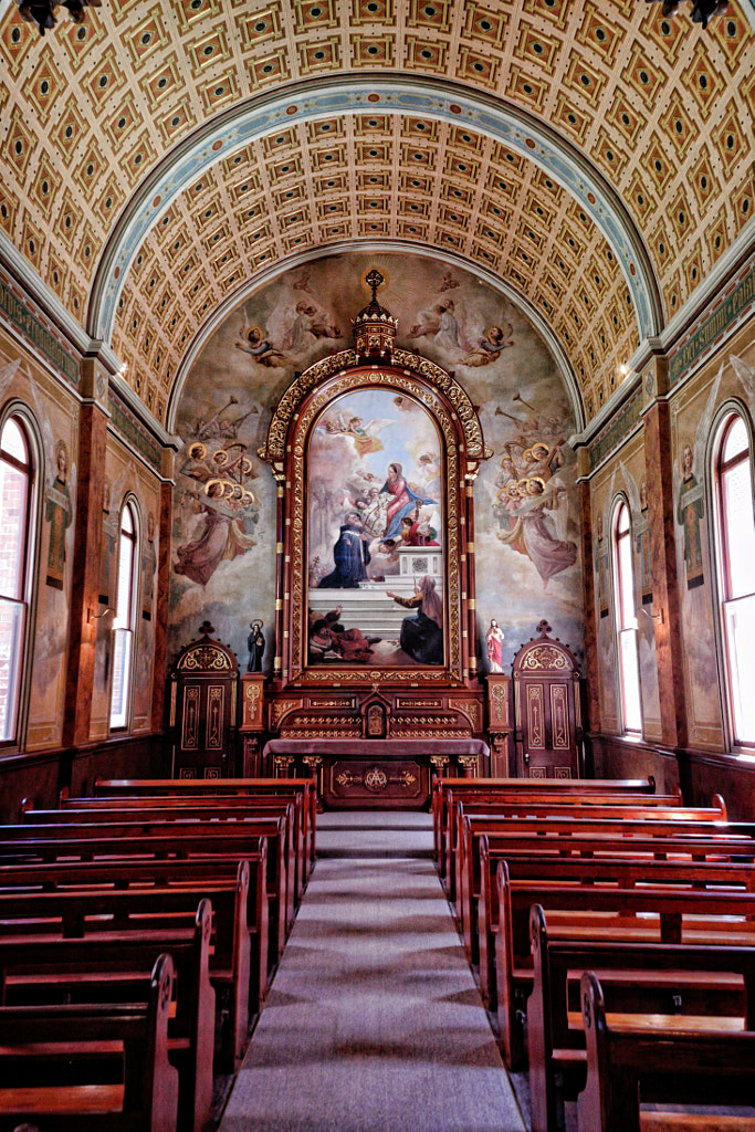
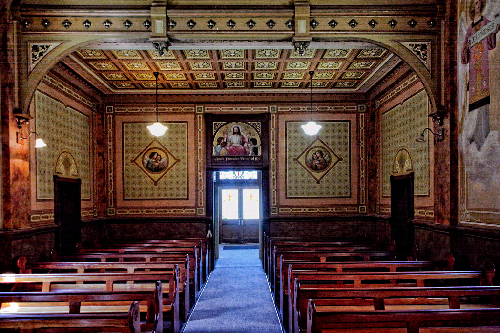
The best way to see the town is to take the two-hour town tour (11 am and 1:30 pm daily) and tickets can be purchased at the Visitor Centre. On the tour you visit the various buildings that make up the monastic complex, visit the monk’s own chapel, the Abbey Church and get to see the amazing Baroque style interiors of the college chapels which are not otherwise open to the public. While on the tour you will hear about the history of New Norcia, the life of Dom José Serra and learn something about the life of a Benedictine monk. There is also a self guided walk around the New Norcia Heritage Trail. This is a 2km walk suitable for people of all abilities that takes you around the buildings but not in them as the walk has been structured so as to have minimal impact upon the life of the monks. The walk starts at the Museum and Art Gallery and follows a marked trail with information boards around the town. Thee is an optional side trail, The River Trail, which adds an extra 1.7km to the walk that takes you out to the Bishop’s Well and onto Bishop Torres Beehouse. The River Walk is not suitable for prams or wheelchairs. Allow a leisurely 2-3 hours to do the whole walk.

New Norcia - Australia's only monastic town by Paul Amyes on 500px.com


New Norcia - Australia's only monastic town by Paul Amyes on 500px.com


New Norcia - Australia's only monastic town by Paul Amyes on 500px.com


New Norcia - Australia's only monastic town by Paul Amyes on 500px.com


The Museum and Art Gallery has one of the largest collections of moveable religious art in Australia. There are many fine religious painting here that range from pre-Renaissance pieces by European masters to contemporary Australian art. In the museum there are fascinating artefacts that tell of the founding of the monastery and what life was like for the monks and the Nyoongar population. There is also a gift shop selling a variety of souvenirs and religious paraphernalia. Some of the goods on sale have been produced at New Norcia and these include olive oil, bread, biscotti, nut cake, wines, religious art and music. The monastery runs a program of retreats where you can stay in the Guesthouse with the aim of regaining and renewing a sense of balance and spiritual peace. There are a range of spiritual and cultural events that members of the public can participate in as well. The details for these can be found on the website.

The New Norcia Hotel was built in 1927 to provide accommodation for an anticipated visit from the then Queen of Spain, who later had to cancel her trip. The hotel offers old world European hospitality with accommodation, coffee on the terrazzo, the chance to sample some of the monastery’s wine or beer in the bar and enjoy fine food in the restaurant.

New Norcia - Australia's only monastic town by Paul Amyes on 500px.com
Commemorative statue of Dom José Serra the founder of New Norcia.


In the early days of New Norcia the only way to get there from Perth was by walking and Dom José Serra and the other monks did this regularly. The Camino Salvado is a project to turn that walk into a modern-day pilgrimage. The trail starts at St Joseph’s Church in Salvado Road Subiaco and traverses the 160 Km out to New Norcia over seven days. If you fancy the idea of becoming a modern-day pilgrim see www.caminosalvado.com for more details.

Read the book see the movie

Tasmanian Tales has now been released as a movie on YouTube and as a book through Blurb.

Tasmania. Australia’s island state. It’s the little bit off of the south-eastern coast that most people forget about. So what’s it all about then? Join me as I travel the island and make written and photographic observations as I do so.

Salamanca Markets

More Tales from Tasmania

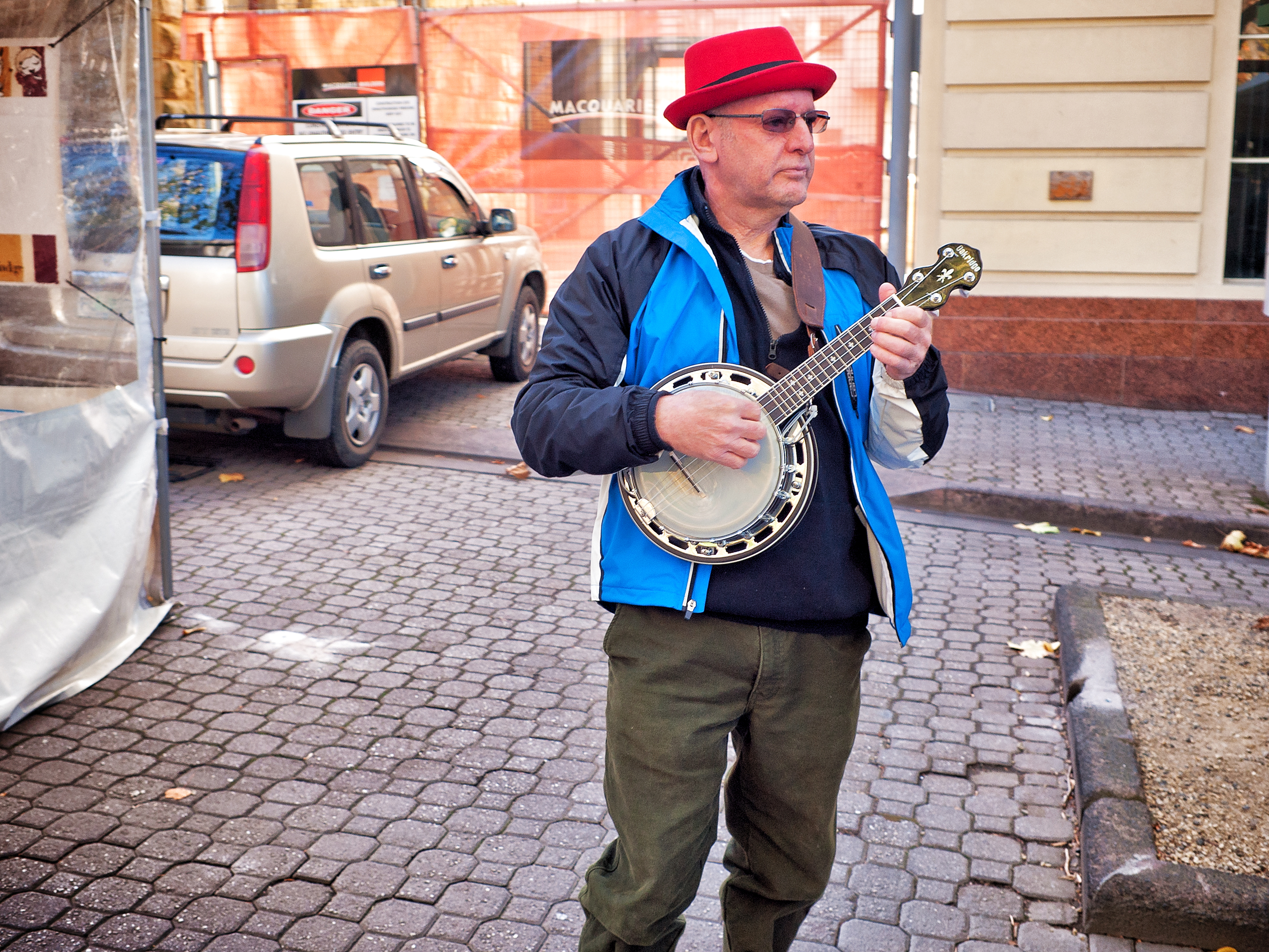
Salamanca Busker


Salamanca Place – this row of old colonial warehouses are the remnant of Hobart’s whaling history and were built in the 1830’s. The area was originally called the Cottage Green, but after the Duke of Wellington defeated 40,000 French men in forty minutes at the Battle of Salamanca in 1812 it was renamed in a fit of patriotic pride. Wellington was very popular in Hobart, he also gave his name to the mountain. As usual with anything historic or cultural in Australia the area fell into disuse and ruin and things stayed that way until the 1970’s when the penny dropped and someone realized that if the place was regenerated it might bring in some money. By the 1990’s the old quarry site behind the warehouse was also developed into a sheltered public square with shops and cafe and now the whole area is really the cultural and social area for tourists and locals alike.

Cary Lewincamp’s pitch at the Salamanca Market in Hobart.


In 1972 the town council thought that a Saturday market in Salamanca place would be just great. So the first market opened with just 12 stalls. Today there are some 300 stalls and it is reckoned that the market attracts 25,000-40,000 visitors every Saturday. The first stalls were granted on a temporary first come first served basis but now the permanent stallholders can pay up to $100,000 AUD for their occupancy rights.


Rainbow Headbands by Paul Amyes on 500px.com

Rainbow headbands on a stall in Salamanca Markets.


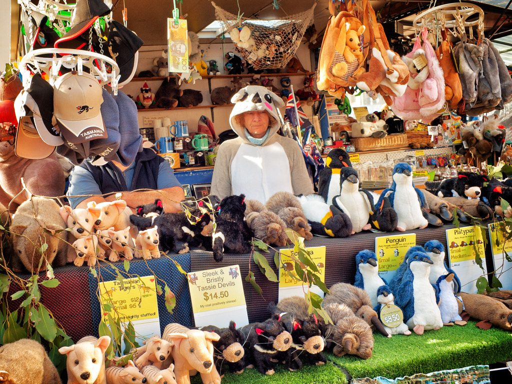
Stuffed by Paul Amyes on 500px.com
Stuffed. Souvenir plushies. Salamanca Market, Hobart.


The stalls now sell hippyware, tourist tack, fruit and veg, craft ware, art, secondhand clothes and all manner of other stuff most of which is exorbitantly priced, but with leases going for so much they’ve got to make a living somehow. To add to all this there is whole host of enthusiastic and energetic buskers who make up for a lack of talent with volume of sound. If all this sounds as if I’m down on the place, I’m actually not because what all this means is that the market is a Mecca for people watchers. Never mind the weather, its on every Saturday. As the saying goes “Be there or be square.”.


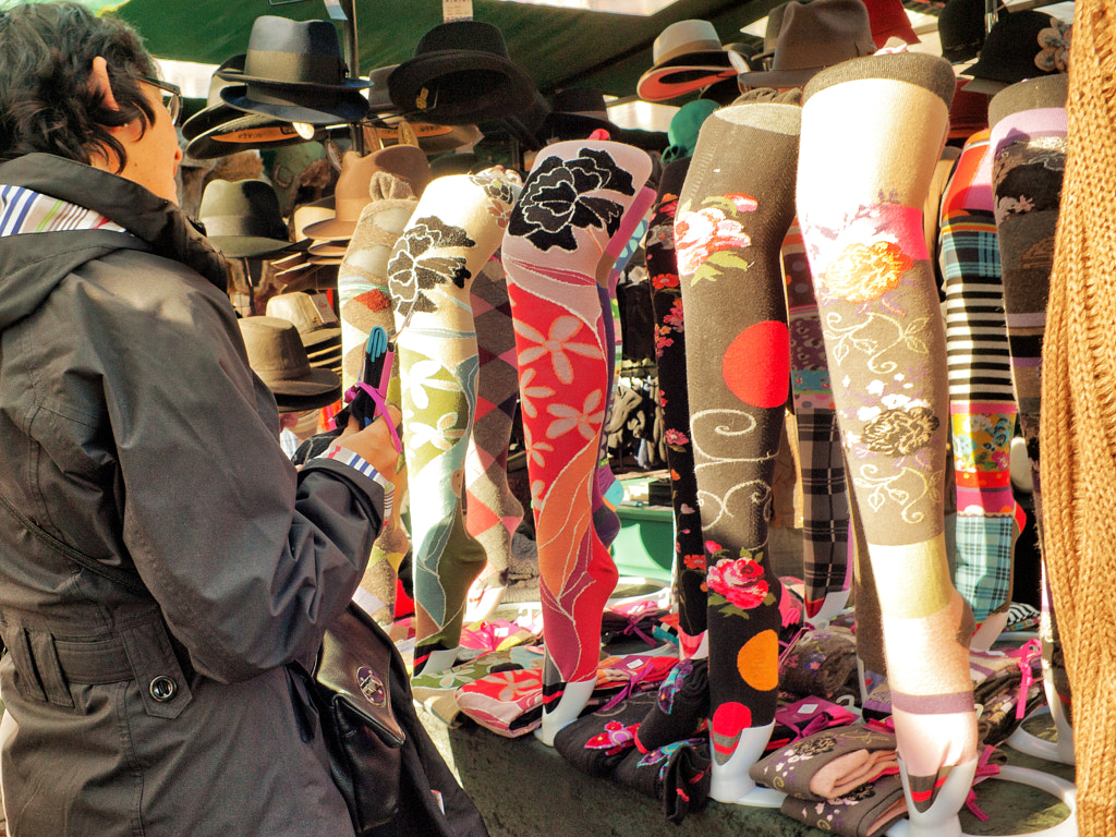
Legs by Paul Amyes on 500px.com

Legs. Colourful hosiery on sale at the weekly market in Salamanca Place.

Mount Wellington

Mt Wellington by Paul Amyes on 500px.com
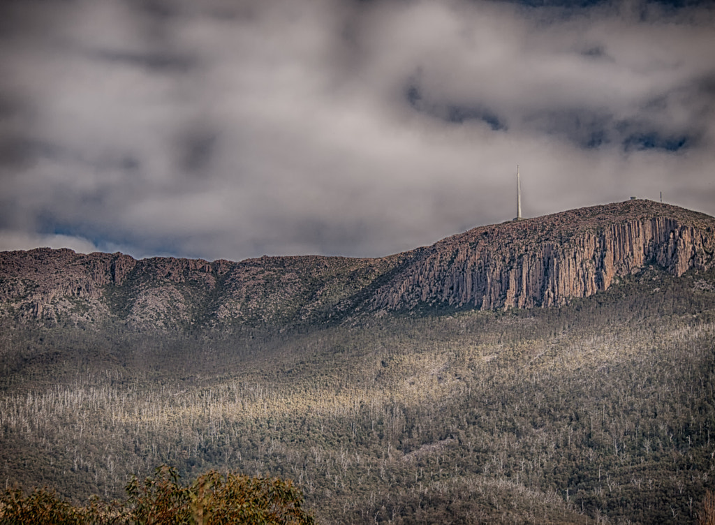
At 1270m Mt Wellington makes its presence known over the city of Hobart.


Hobart, the capital city of Tasmania, sits at the feet of Mount Wellington. At 1270m, or 4166 feet it certainly has a presence. When the frequent rain or storm clouds gathering round its summit it has a brooding almost menacing presence, yet when the sun’s setting rays are reflected off the face then it appears gold, magnificent and verging on benevolent. It is quite something to behold.


Mount Wellington by Paul Amyes on 500px.com
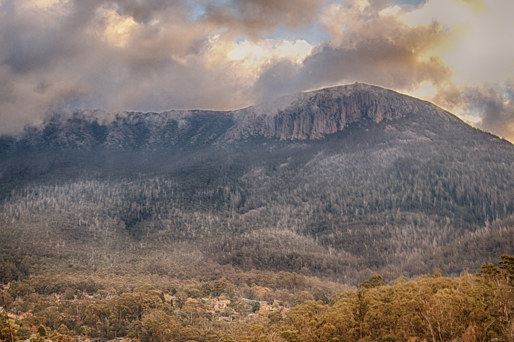
This was the view out of the window of our accomodation in South Hobart. The scene was constantly changing due to the clouds and light.


During our recent visit to Tassie we spent a while in Hobart and our digs gave us magnificent views of the mountain. It was what we woke up to in the morning, and what we went to bed with at night. I never tired of the infinite variations on the view as the clouds and the sun interplayed with the surface. Tasmania also has a lot of deciduous trees and so we were also treated to a golden autumnal display. It was a challenge to try to capture the majesty of the mountain, the glorious colours, and the ever-changing cloudscape, especially with limited equipment, I had no tripod nor neutral density graduated filters, and the m4/3 Olympus Pen EP-2 has a limited dynamic range. So it was a case of bracketing exposures and shooting like crazy. It also meant that I had no real feed back on how my images were on the rear LCD screen as they weren’t  representative of the final image.


Mount Wellinton, by Paul Amyes on 500px.com
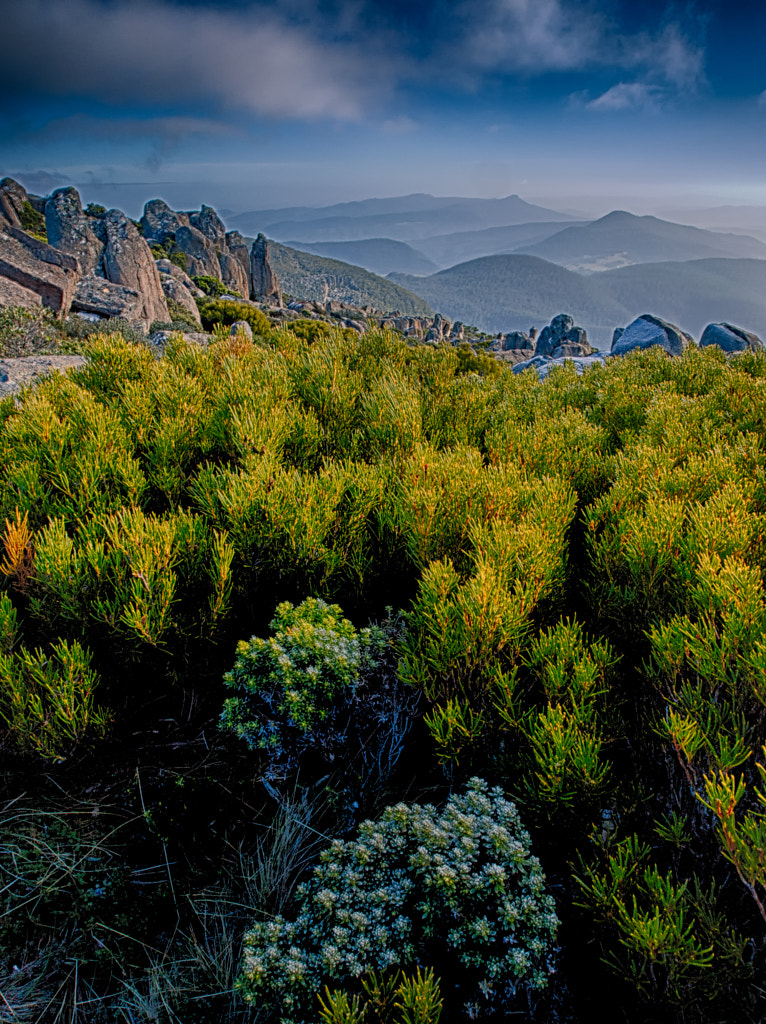
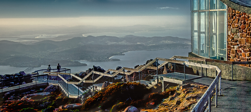
Depending on the weather you can get views out over the World Heritage Area of Southern Tasmania.


The mountain is criss crossed with walking tracks, but we took the easy option and drove to the summit, or the Pinnacle as it is officially known. There is a viewing deck that gives magnificent panoramic views out over the city and further, but, and there is always a but, the weather has to be good for this with no cloud cover. We were lucky and were rewarded with stunning vistas. Be warned it is also a lot colder on top of the mountain than in the city, according to the weather bureau 8℃ cooler, so on a winter’s day like we had it can be bitterly cold. The white patches in the shot below is ice and it was around midday.


The Pinacle by Paul Amyes on 500px.com
At the top of Mount Wellington is The Pinacle an observation deck that provide views over Hobart and towards the east coast.


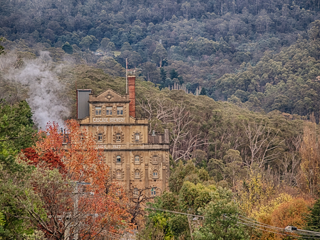
Also near where we were staying was the Cascade Brewery, a magnificent piece of Tasmania Gothic architecture, and it seemed perfectly placed – a majestic building under a majestic mountain.


Cascade Brewery by Paul Amyes on 500px.com
The Cascade Brewery at the foot of Mount Wellington.


I’ve now finished all the photo processing so blog posts won’t be so few and far between now. Having said that I haven’t even looked at the video footage yet.