What A Relief!

OLYMPUS DIGITAL CAMERA
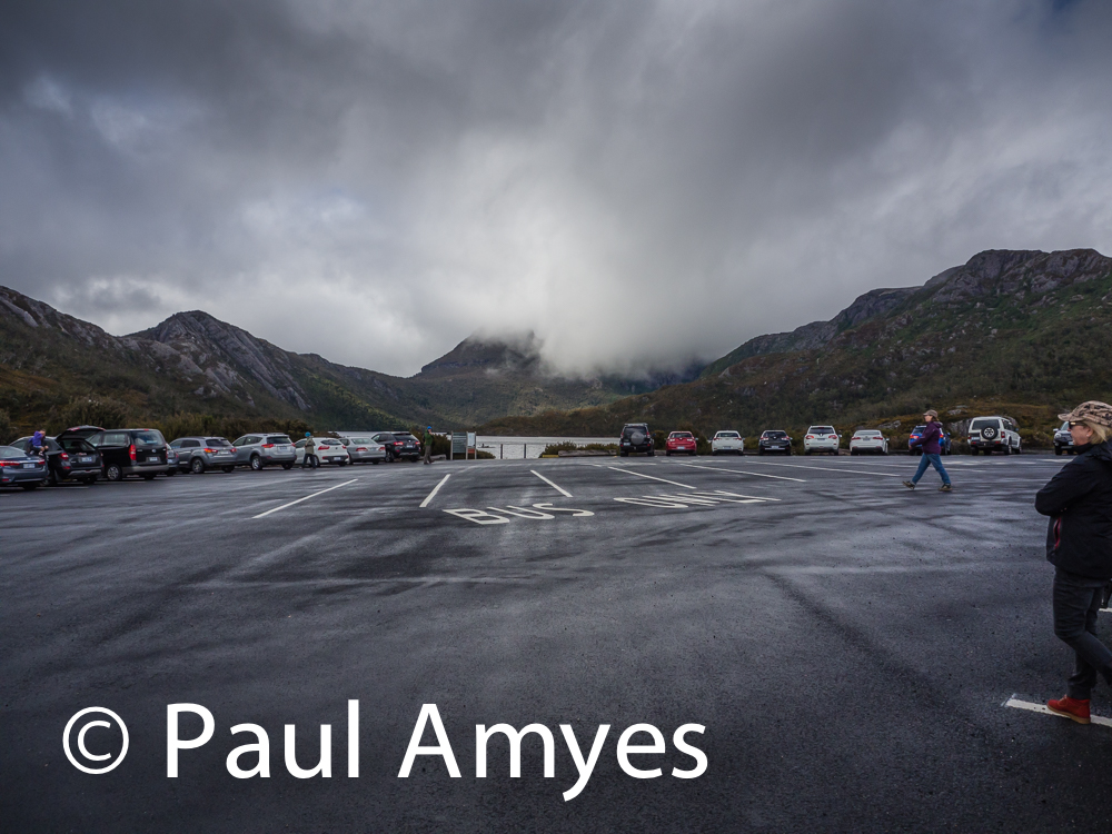
The Car Park at Dove Lake, Cradle Mountain. It may not be art, but it showed my camera was working.


The other day we were staying at Cradle Mountain National Park and we decided to walk around Dove Lake which is one of the iconic short walking trails in Tasmania. So we drove into the park proper and up to Rommy Creek in the hope of seeing a wombat or two. We walked around the creek and I fell fulcrum over apex and landed on a big clump of button grass. I didn’t hurt myself and I was remarkably unscathed, not even dirty, but my camera wouldn’t work. Blimey! Here am I in one of the most photogenic places in the world and my camera packs up. This was the first time I’ve gone on a trip with only one camera body. All sorts of thoughts run through my head like drive back home to get another camera (a seven hour round trip), or drive to Launceston to buy a new one. I frantically mashed a few buttons in the hope it would respond – nothing. I took the battery out and replaced it with a fresh one, still nothing. Oh bugger! I took the battery out and unmounted the lens and we drove the rest of the way up to Dove Lake with Helen trying to console me and saying not to fret. While she visited the loo I signed us in for the walk track. On getting back to the car I tried one last time to get the camera to work, I put a genuine Olympus battery in and immediately heard the IBIS whir into action, I looked through the viewfinder, took a couple of frames of the car park and everything seemed to be working. What a relief! The pictures were not anything great but I have never been so relieved to see a photo.


Entropic Boats

Opossum Bay
Opossum Bay

On Thursday we drove down to the South Arm Peninsular and visited Opossum Bay. It is a beautiful bay with great views across the water to Mount Wellington. Like many such places in Tasmania it has become a popular spot for beachside holidays and retirement. Unlike many Australian beachside settlements the housing is not flat but tiered up the dunes, the resulting vernacular architecture is like a cross between Australian beach culture and Greek Island chic.

Beach House
Beach House, Opossum Bay, Tasmania.
Beach Hut
Beach Hut, Opossum Bay, Tasmania.

As I was walking up and down the beach admiring the view and looking at the houses I noticed something. A lot of the gardens had a row-boat or a tiny in the garden. In many cases the boat was almost new and in good condition. The boat represents a dream to spend time in this beautiful spot and go out on the water fishing – an antidote to the stress and bustle of the world many of us live in.

Garden Rowing Boat #1

After a while the boat doesn’t get used that much, time commitments probably prevent the owners getting out to the beach house as often as they like. Slowly the garden plants start to encroach upon the boat.

Garden Rowing Boat #2. Over time and with lack of use the boat starts to be covered by the shrubs and bushes in the garden. Opossum Bay, Tasmania.

Eventually the holiday or retirement dream of spending time at the beach house fishing in the bay becomes a long forgotten idea and nature reclaims the boat and it becomes as though it had never existed as either an idea or a physical reality.

Garden Rowing Boat #3
Garden Rowing Boat #3. Eventually the materials from which the boat is made begin to rot and break down and it becomes a dim and distant memory of what it once was. Opossum Bay, Tasmania.

The Tasman Peninsular


There was no post last weekend as I was wagging web duties and out on the Tasman Peninsular. The peninsular is the sticky out bit on the bottom of the eastern coast of Tasmania. It is an area of outstanding beauty, it has a wild and dramatic coastline, incredible wildlife and an emotionally charged colonial history. It is a photographers paradise with seemingly unlimited possibilities. If you are visiting this part of the world please don’t do the usual tourist itinerary – visit Port Arthur, the Tasmanian Devil Park at Taranna and then head back that afternoon to Hobart. Certainly visit the afore-mentioned attractions, and also treat yourself to the Pennicott Tasman Island Cruise (which is just brilliant), but take a few days to explore the region and you will be rewarded with a memorable experience.


Maingon Bay
The view from Maingon Bay Lookout. Tasman National Park. Olympus Pen EP-5 with OLYMPUS M.12-50mm F3.5-6.3 lens. Exposure: 1/160 s at f/8.0 ISO 400.


Brown Fur Seals
Male brown fur seals sun bathing on the rocks of Tasman Island. When the breeding season starts they will swim north up to the breeding sites in Bass Strait. Olympus OMD EM-10 with OLYMPUS M.40-150mm F4.0-5.6 R lens. Exposure: 1/500 s at f/8.0 ISO 200.


New Zealand Fur Seals
New Zealand fur seals sunning themselves on rocks. Only a small number of New Zealand fur seals breed on remote islands off the south coast. The total population in Tasmania is 350-450. Tasman National Park, Tasmania. Olympus OMD EM10 with OLYMPUS M.40-150mm F4.0-5.6 R lens. Exposure: 1/400 s at f/8.0 ISO 200.


Fortescue Bay
Fortescue Bay in the Tasman National Park. Tasmania, Australia. Olympus OMD EM-10 with OLYMPUS M.12-50mm F3.5-6.3 lens. Exposure: 1/400 s at f/8.0 ISO 200.


Fortescue Bay
Fortescue Bay in the Tasman National Park. Tasmania, Australia. Olympus OMD EM10 with OLYMPUS M.12-50mm F3.5-6.3 lens. Exposure: 1/320 s at f/8.0 ISO 200.


Fortescue Bay
The Rough With The Smooth. Fortescue Bay in the Tasman National Park. Tasmania, Australia. Olympus OMD EM10 with OLYMPUS M.12-50mm F3.5-6.3 lens. Exposure: 1/200 s at f/8.0 ISO 200.


As always clicking on an image will take to my online gallery.

A Walk Back Through Time – the Hobart Rivulet

Hobart has a fascinating colonial history which on many levels can be seen from the the buildings of the era, but they don’t really tell what life was like during that period. Wouldn’t it be great if you could go back through time and see Hobart and how the people lived? Well you can – sort of. No this doesn’t involve travelling back through time à la Doctor Who, but rather a short walk of just over 5.5Km (or 3.4 miles) return and a morning of your time.

Hobart Rivulet Park
Following Hobart Rivulet upstream from the city to the foot of kunanyi / Mount Wellington, this trail has a gentle uphill grade and is well suited to bikes and dogs on lead.

The starting point for our time travelling adventure is the Collins Way Car Park situated on the corner of Molle and Collins Streets. Walk through the car park to the start of the Hobart Linear Park and then follow the sign for the Hobart Rivulet Walking Track. The Hobart Rivulet was crucial to the establishment of Hobart as a city. Back in 1803 the Van Dieman’s Land colony was first established upon the banks of the Derwent’s eastern shore at what is now Risdon Cove. Its purpose was to a be a place where Nineteenth Century Britain could send its convict population and a defence against possible French colonial intentions in the region. Fresh water was a problem and after approximately twelve months the settlement was moved to its present location because of what Lieutenant-Governor David Collins described as ‘a run of clear, fresh water’ flowing down off of Mount Wellington (kunanyi, Unghbanyahletta or Poorawetter in the local aboriginal languages) into the River Derwent. The settlement, initially known as Hobart Town or Hobarton, was named after Lord Hobart, the then Colonial Secretary. From 1804 to the 1860’s the rivulet was Hobart’s primary source of drinking water, drain and sewer. Industry quickly established itself upon its bank using the force of the descending water to power the factories. In 1816 Robert Nash, was a miller who was convicted of breaking and entering (or B and E in the parlance) and had his death sentence commuted in favour of transportation for life to Norfolk Island and was then lucky enough to earn a full pardon and be moved to Hobart, established a flour mill near the Gore Street Weir. The mill had a short working life due to the high costs of maintenance and was closed in 1818 to be replaced by a windmill.


Hobart Rivulet
The site of one of the many sluices that were used to control the flow of the water so it could power the many factories that had set up on the banks of the Rivulet.


Milton House
Milton was originally the residence of George Wilson who settled in Hobart in 1831 with his family. Wilson opened Hobart’s first tobacconist and snuff shop. The house is a good example of Georgian colonial architecture.


After walking just over 500m you can see a rather nice specimen of colonial Georgian architecture on you right hand side. Milton House was originally built on a one acre allotment which was originally granted to George Wilson soon after his arrival in Hobart Town 1831. George Wilson was born in England in 1801 and he was, by trade, a tobacconist and snuff maker in partnership with H.B.Tonkin. Wilson was on his way to Sydney in 1831 with his wife and two daughters, but during his stopover in Hobart he was so taken with the colony that he decided to settle in Hobart. A few years later his partner arrived from England and they set up the first tobacco and snuff shop in Tasmania. Owning the colony’s first baccy shop was obviously a nice little earner for George.


Mount Wellington
Just before reaching Wynard Street you get the first uninterupted view of Mount Wellington.

At the 1Km point you get the first uninterrupted views of the summit of Mount Wellington if the weather is cooperating. By 1820 there were four or five tanneries operating along this stretch of the Rivulet. Leather was an essential commodity in the colony and was used not only for saddles, horse tack, belts, and shoes it also was used to replace metal in the manufacture of buckets and hinges amongst other things. Leather tanning is a water intensive process and after it was finished with it was returned to the Rivulet along with the tanning agents it had dissolved. Now there is only one tannery in existence which supplies leather to Blundstone the Tasmanian boot maker.


Hobart Rivulet Park
Until the 1860s Hobart Rivulet was the main source of fresh water for the new settlement and so the colony grew up along its banks.

Walk past the C3 Church complex, or if you’re in need have a drink at the Rivulet Cafe (open Monday to Fridays between 8:30 am and 4:30 pm) and on to Degraves Street. Here on your right is the Cascades Female Factory. Back in the penal colony days the male prisoners were segregated from the female ones and initially the women were held at the Macquarie Street Gaol. This was only seen as a temporary arrangement and the facility soon became over crowded. Between 1788 and 1853 around 12,000 women were shipped to Tasmania, mostly for what we would now consider petty crime and anti-social behaviour. But in 1823 it was a big problem and the Cascades Female Factory was set up as a workhouse and it remained in operation until 1856. There is not much left of the original buildings, just the matron’s cottage really, but it is worth going in and having a look. Take the tour and learn about what happened to these poor women and the depravations they lived with while there.


Cascades Female Factory
The entrance to the Cascades Female Factory Historic Site in South Hobart. The factory was essentially a workhouse where female convicts were held, educated, put to work and finally placed in indentured labour for the term of their prison sentence.


Cascades Female Factory
Just inside the main gate of the Yard 1. The guide is explaining what happened when the women first walked through the gates. This is where the women would be processed. The words on the wall are descriptions of the prisoners taken from their prison records.


Cascades Female Factory
The matrons quarters at the Cascades Female Factory. Originally built in 1850 the it was a simple four room cottage. Three of the rooms were assigned to the matron – the parlour, bedroom, and kitchen – the fourth was used messengers. It is the only surviving building from the convict era on the site.
Cascades Female Factory
The parlour of the matron’s cottage in the Cascades Female Factory.

On leaving the Female Factory keep walking up Degraves Street until you get to Cascade Gardens and the Cascades Brewery. The brewery was opened in 1832 as an adjunct to the Macintosh and Degraves Sawmills. The early history of the venture would probably make the basis of a good TV drama. Hugh Macintosh was a retired East India Company officer who migrated to Australia in 1824 with his brother-in-law Peter Degraves. Degraves was a bit of a rotter and scoundrel being a thief and an undischarged bankrupt. The law catches up with Degraves and from 1826 to 1832 he ends up in debtors prison. Macintosh does the right thing by him and dissolves the partnership and pays out the debts and then moves to New Norfolk to farm. Degraves on his release takes over running the brewery. All fairly amicable and straight forward at this stage. Unfortunately Hugh Macintosh dies in 1834 and his share in the business passes to his son William who was in Madras, India. The dastardly Degraves offers to buy William’s inheritance off of him and run the booming business himself. Degraves reneges on the deal and poor William dies a pauper in 1840. Degraves rewrote the history of the firm saying that he was the sole founder of the company and that remained that until 2011 when historian Greg Jefferys discovered the truth. The brewery is now owned by Fosters and produces a range of beers, homebrew, apple cider and non-alcoholic beverages including apple juice, blackcurrant syrup and carbonated beverages. The brewery has a visitor’s centre and runs two tours: the brewery tour which takes you round the brewery and have a tasting; the heritage tour takes you round the gardens and museum and it is more family orientated.


Cascade Gardens
Cascade Gardens. Autumn is probably one of the best times to do the walk as the tree leaves start turning a wonderful golden colour.


Cascade Brewery
Australia’s oldest brewery situated near the Rivulet, the stream that was the reason Hobart was built.


Cascade Brewery
Cascade Brewery


Go West – part 2

Russell Falls
Russell Falls in Mount Field National Park. Tasmania.


Lady Baron Falls
Lady Baron Falls in Mount Field National Park, Tasmania.


Mount Field National Park is one of Tasmania’s oldest and most popular parks. The reason why is that within the park there are rain forest, alpine moorland, glacial lakes and snow gums. In summer the park is a blaze with flowers and in autumn it is a glorious golden hue as the vagus trees (Tasmanian deciduous beech) prepares to shed its leaves. There are a variety of walks within the park that go from being just a 30 minute stroll to 8 hours Alpine walks which require cross country skies in winter. The Russell Falls walk is one one of the most popular walks in Tassie, it takes you through a forest of ferns, eucalypts and myrtles on the way out to the water fall. It is only takes 25 minutes return and is suitable for for wheelchairs and prams. Another popular walk is the Russell Falls / Horseshoe Falls / Tall Trees Circuit / Lady Baron Falls walk. An unwieldy name for for a very pleasant 2 1/2 hour walk that connects three waterfalls and the Tall Trees Walk. It requires a bit more effort but is worth it as it gives you a very good look at the ecosystem of the lower park. My favourite walks the Pandani Grove Nature Walk which is located on the Mawson Plateau in the alpine areas of the park. This is the best way to experience the alpine ecosystem of the park and as you walk around the glacially formed Lake Dobson you pass through a forest of pencil pine and and pandani. This walk takes about 40 minutes. Last time we went to the park we did the Pandani but also tacked on a side trip to Platypus Tarn in the hope of seeing a platypus. This adds another 20 minutes on the walk but takes you on a quite steep and rough path and I’d recommend it only if you have proper walking boots and are prepared for cold and wet weather. We didn’t see any platypuses, but nothing in life is guaranteed.

Forest At The Mountain's Feet
The look out point on the drive up to the Mawson Plateau in Mount Field National Park, From here you can look out over the Derwent Valley and see how the forest changes from dry eucalypt (which is the typical Australian bush) to the wet eucalypt forest which is dominated by trees that can grow up to 90 metres.


Lake Dobson
The Pandani Grove Nature Walk follows the shoreline of Lake Dobson. Mount Field National Park, Tasmania.


Bennetts Wallaby
Bennetts Wallabies regularly can be found grazing near the picnic areas of Mount Field National Park. This was was seen near the information hut on the shore of Lake Dobson on the Mawson Plateau in Mount Field National Park.


What can you see in the park? Well Bennetts Wallaby and pademelon can often be seen grazing in the late afternoon and early evening at the picnic areas. Barred bandicoots are seldom seen in daylight hours but can be seen around the campsite and picnic areas at night looking for insects and worms. Also active at night are brush, ringtail, and pigmy possums. In the more remote areas of the park it may be possible to see Tasmanian Devils, eastern quolls and spotted tailed quolls. Again these animals are only active at night. All of Tasmania’s snake species are active within the park and caution should be exercised if you should see one as they are all venomous. A lot of bird species inhabit Mount Field, with the majority being found in the eucalyptus forest. Here you can see green rosellas, yellow tailed black cockatoos, yellow wattle birds, crescent honeyeaters, grey shrikes and currawongs. Harder to see, but still present in the undergrowth are scarlet and dusky robins and blue wrens. If you are lucky and in the alpine areas you may see wedge tailed eagles soaring on the thermals looking for prey. In terms of flora – basically you have three distinct ecosystems, dry eucalyptus forest, wet euclaypt forest (or rain forest) and the alpine heath. Below 670m you see dry eucalyptus forest which is your typical Australian bushland and is identified by the tall growing trees such as the swamp gum (the tallest hardwood tree in the world growing up to 100m tall) the white gum and the stringy bark. The understory comprises of native musk, and hazel or dogwood. Up to 940m is either closed rainforest or in the transition areas mixed forest. This is dominated myrtle-beech and sassafras with an understory of native laurel. In the gullies formed by the numerous creeks are several species of tree ferns and it is these most people think of when they hear the term temperate rainforest. At 880m and above the Tasmanian snow gum starts to dominate the sub-alpine forest. Past this and you see alpine heath of the pandani which with its palm tree looks can grow to heights of 9m. As you explore the areas around the lakes or tarns ( a tarn is a lake that was formed during the ice age when a glacier created a cirque, corrie or cwm which later fills with water) many shrubs grow mountain berries which introduce a splash of colour to the undergrowth.

Pandani Grove
Walking through the wet forest on the Pandani Grove Nature Walk you can see the stands of pandani for which the walk is named. Pandani (Richea pandanifolia) can grow as tall as 9 metres


Snow Berries
Snow Berries (Gaultheria hispida), Mount Field National Park, Tasmania.


If you want to spend more than a day in the park there is a campground for vehicle based campers near the visitor centre. It has a camp kitchen, shower block with laundry and barbecues. There are some basic huts for walkers in the alpine area, and these have basic facilities such as running water, a wood heater, and bunks with mattresses. All accommodation can be booked through the visitors centre on (03) 6288 11149. There is also some private accommodation outside the park.


20150417Mount_Field-0019_HDR-2.jpg
Pandani Grove Nature Walk


Lake Dobson
Lake Dobson


Coal Mines Historic Site

Coal Mines Historic Site
The entrance to the Coal Mines Historic Site on the Tasman Peninsula.

For the majority of tourists coming to the Tasman Peninsula the only reason visit is the Port Arthur Historic Site with its colonial convict history. Some will venture to Taranna for the Tasmanian Devil Conservation Park, and a few others will head out to bush walk in the national park. Very few tourists head out past Salt River to the Coal Mines Historic Site on the North West of the Peninsula on Norfolk Bay.

Driving out through the little hamlet of Salt River I was struck by the beauty and serenity of the place. Even now in the Twenty First Century this is an isolated spot, it seems light years away from Hobart. How it must have appeared to the first settlers and convicts in early Nineteenth Century one can only surmise that it must have seemed like the very ends of the world and that home and family in England were something they would never see again. As I walked down the path into the site one could be lulled into thinking it was some kind of Antipodean Garden of Eden. There were Bennett’s wallabies grazing on the grass, small birds flew amongst the low-lying bushes, and a possum wandered lazily up to within a meter of me to check me out before shambling off to a nearby tree seemingly without a care in the world. This quickly evaporated as I started exploring the ruins.


Coal Mines Historic Site
The Coal Mines Historic site does not receive as many visitors as the Port Arthur site. Consequently the animals that live around the site almost appear to be surprised when the see visitors. This Brushtail Possum (Trichosurus vulpecula) took a good look at me before casually walking off along the ground seemingly without a care in the world. Tasman Peninsular, Tasmania.


The whole reason why convicts were brought here was to punish them. It wasn’t enough that they’d been sent to the Hell hole of Port Arthur and put to spirit crushing hard labour in horrendous conditions. No a new more terrible fate had to be used for those prisoners who bucked the regime. Coal was found here, if you walk along the beach you can see it just lying on the surface, smooth, black and shiny among the other pebbles lying in the sand. That meant that the seams would have been just below the surface which meant that you didn’t need complicated pit heads with lifts and pumping stations. All you needed were men with picks and shovels and a few people to supervise them. It must have seemed the perfect plan – put your trouble makers out to an even more remote spot, make them labour in incredibly harsh conditions with a horrific punishment system for those who wouldn’t toe the line, and then have them mine something that was needed badly in colony so that the scheme would pay for itself. Very ingenious. So in 1833 the coal mines were opened up. The interpretive panels tell of some of the heart wending stories of those who were sent there and the deprivations that they suffered. as I read more and more about the site the beauty of the location receded into the background and was replaced by story of man’s incredible cruelty to his fellow-man. Even in colonial times government was not capable of running an economic enterprise and making money, so in 1848 the mine was privatized, but the logistics of running such a business in such a remote location were so difficult that it was never economically viable and in just another ten years, 1858, the mine working were shut down. Some of the infrastructure was dismantled the rest was left to decay in the harsh conditions with the wooden buildings and fittings being destroyed by bush fires. The building which were constructed from stone fared better than those that were made from convict brick, which because it was not fired at high enough temperatures was soft and crumbly.


Coal Mines Historic Site
As you walk along the path the first buildings you see are the remains of the ‘the settlement’ or ‘square’. This was where the stores, the chapel, the prisoners accommodation and the punishment cells were located.


Coal Mines Historic Site
The reason that the site was established was coal. On the beach you can see lumps of coal just lying on the surface. The seams were not very deep.


Port Arthur, just down the road receives most of the tourist attention – and in many cases quite rightly so as the scale of the place, it’s location, and many of the buildings are still intact making it a tourist experience par excellence. But for me it is the Coal Mines Site that typifies the brutality of the convict era. It’s sole purpose was to strike fear into an existing convict population and to punish and brutalize them even more. Most of the colonial penal systems victims were people whose only crime was to try to alleviate the crushing poverty they were born into with criminal acts that were incredibly petty by nature – stealing food, stealing small items to exchange for food, vagrancy, non-payment of debt etc. Now nearly two hundred years later their history, their lives, their suffering has been made into a tourist industry to entertain people. What is even more puzzling is that in today’s Australia it is now considered very desirable to be able to show that you are descended from convict stock. Perhaps this should be something to ponder as we visit Tasmania’s convict heritage sites.


Coal Mines Historic Site
The Settlement at the Coal Mines Historic Site overlooks Little Norfolk Bay on the Tasman Peninsula.


Visitors to the site should take care to stay on the paths as some old shafts are still open and others have caved in leaving sink holes that unwary could fall into.

Simply Sublime

I know I’ve said in the past that I’m not a great fan of MONA but just lately I’ve been going up there a bit because I’ve signed up to study a unit in Art Theory at University of Tasmania (UTas).  I got up extra early to see an installation by American artist James Turrell called Amarna. There’s not a lot I can say about this work except that it is gob smackingly beautiful and very serene.

Here are a few stills.

MONA Dawn
Wim Delvoye’s Seventeenth Century Flemish Baroque style.Truck and James Turrell’s Amarna at dawn. MONA, Hobart, Tasmania.
Amarna At Dawn
Amarna At Dawn
Amarna At Dawn
James Turrell’s Amarna at dawn. MONA, Hobart, Tasmania.

Technical notes: the time-lapse sequence was made with a Sony ActionCam HDR AS20. The stills were shot using an Olympus OMD EM-10 with either an Olympus mZuiko 17mm f2.8 or an Olympus mZuiko 25mm f1.8 lens.

Bicycle Race

The Victorian era was a time of incredible innovation and some of the inventions and processes are still practiced in their original form. In the field of photography despite the march of technology some photographers like Sally Mann and Robb Kendrick use antiquated processes in a modern context to express themselves. Well besides my interest in all things photographic I am also interested in cycling. A little after I migrated to Australia I heard about the Australian National Penny Farthing Championships which are held at the historic Tasmanian town of Evandale and I put on the bucket list of things to see. Well the other week I noticed in the upcoming events column of the Mercury newspaper that the races were on and I just had to go. The whole idea that anyone wants to race, let alone ride, a penny farthing is to me totally mad while at the same time seems a perfectly logical steampunk  activity.

Evandale is a pretty colonial era town just south of Launceston in the north of Tasmania. Every year in February, since 1983, the town puts on The Evandale Village Fair in conjunction with the penny farthing championship. This means that the town is a bustling hive of activity that attracts visitors not only from all over Tasmania but also from the Big Island, also known as the Australian Mainland.The fair has market stalls, live musical entertainment, Morris Dancing, vintage cars, costume parades and even a genuine old-time Punch and Judy show.

That's The Way To Do It
That’s The Way To Do It

But there is no doubt, the star attraction is the penny farthing racing which attracts riders from all over Australia.The event lasts a weekend with the Saturday hosting the main short course events that are held on a course in the township itself. On the Sunday the longer distance races are held, including the Century Ride, which is a penny farthing tradition that goes back to the 1880’s, which is a 162 Km race or 100 miles. Totally bonkers!!

Shadow
Shadow


It's All A Bit of a Blur
The bikes maybe old-fashioned but the riders can certainly shift while on the 1 mile 91.6 Km) course. Evandale National Penny Farthing Championship.


Nice Moustache
Having a perfectly groomed handlebar moustache is a requirement for the successful penny farthing racer. 2015 Evandale Village Fair and national penny farthing championship. Tasmania, Australia.


The details for next years event has already been posted on the website. If you want a fun, action packed and unusual day out then go to Evandale in February 2016.


The Man In Black
The Man In Black

As always clicking on an image will take you through to my online store.

Regular readers are aware that I my blogs have musical references to them and so here is the pop video for this entry.


The Highlands of Tasmania

ST ANDREWS RICHMOND HIGHLAND GATHERING


Now according to Wikipedia the Highlands of Scotland are:

“…north and west of the Highland Boundary Fault, although the exact boundaries are not clearly defined, particularly to the east. The Great Glen divides the Grampian Mountains to the southeast from the Northwest Highlands. The Scottish Gaelic name of A’ Ghàidhealtachd literally means “the place of the Gaels” and traditionally, from a Gaelic-speaking point of view, includes both the Western Isles and the Highlands.”


ST ANDREWS RICHMOND HIGHLAND GATHERING


The other day I knew that I was in the Georgian Town of Richmond in Tasmania, Australia, but you could be forgiven for looking out over the Coal River Valley at the distant hills and imagining that you had suddenly been transported 17,324 km (10764 miles) to the Scottish Highlands. This was particularly reinforced when the skirl of the pipes was to be heard floating across the valley. The reality was not that I had been suddenly swept up in Gaelic daydream and astral planed to a far off land but I was at the St Andrews Richmond Highland Gathering where all things Scottish were being celebrated. According to their Facebook page:

“The St Andrew Society Hobart Incorporated was formed in 1960 by a group of people who wanted to keep alive the traditions, dancing, music, sports and literature of Scotland. The motto of the Society is “Cairdeas”, a Gaelic word meaning “Friendship”. Membership of the Society is open to persons who are interested in fostering the objectives of the Society. “


ST ANDREWS RICHMOND HIGHLAND GATHERING


The Scots are the third largest migrant group in Tasmania and they were numerous among the early settlers lured across by the prospect of farming in the Midlands of Tasmania which reminded them of their homelands. Prior to 1830 most Scots who migrated were farmers and landowners who were trying to escape the economic recession of the 1820’s. Other Scots came because they had served in the British Colonial forces and they stayed on when their term of service ended. From the 1830’s onwards the working poor joined the diaspora and they headed for Hobart to work in the industries there. This rate of migration has remained steady throughout the Twentieth Century and into the Twenty First.


ST ANDREWS RICHMOND HIGHLAND GATHERING


So it was no wonder that as we pulled up in Richmond that the town was positively heaving with visitors. Now Richmond is well and truly on tourist route number 1 in Tasmania and can be busy throughout most of the year, especially so in summer. But nothing prepared us for this. I struggled to find a parking space, but luckily after a slow lap of the town I found a spot down by the Coal River and just a short walk from the village green where the action was happening.


ST ANDREWS RICHMOND HIGHLAND GATHERING


At this point I feel compelled to make a public disclosure. When I was a young lad I had been exposed to the bagpipes through attending things like the The Royal Tournament at Earls Court in London. At that point I was fairly bagpipe neutral – I neither liked or disliked them. Then in December of 1987 we were in Kathmandu, Nepal, during the wedding season. Part of the wedding ceremony is to have a procession through the streets which is led by a marching (and I use the term loosely here as most seemed rather shambolic) band. Here I was subjected to bag pipe-playing of the most hideous nature. There are not words in the English language that adequately describe how bloody awful it was. The nearest I can get is to imagine a cat with a soprano voice being fed through a mangle while gargling on razor blades whilst having its nether regions probed by red-hot pokers and that doesn’t nearly describe the aural torture that I experienced. Ever since then I would rather slide down a banister rail made out of razor blades using my testicles as brakes rather than listen to bagpipes. It was, then, with some trepidation that I approached the green. The first thing I saw was the Scottish dancing with young tartan clad girls deftly defying gravity as they leapt and pranced on the stage. A walk around the perimeter of the green found a plethora of stalls selling on manner of Scottish items ranging from Celtic crosses to your clan’s genealogy. In the centre of the green there were competitions for the best pipe band, the best piper, the best pipe major, the best dressed band, demonstrations of Scottish country dancing and a choir. The strange thing was that I really enjoyed it. There was no sound of screaming mangled cats – it was all a thoroughly enjoyable experience.


ST ANDREWS RICHMOND HIGHLAND GATHERING


ST ANDREWS RICHMOND HIGHLAND GATHERING


ST ANDREWS RICHMOND HIGHLAND GATHERING


ST ANDREWS RICHMOND HIGHLAND GATHERING


ST ANDREWS RICHMOND HIGHLAND GATHERING


ST ANDREWS RICHMOND HIGHLAND GATHERING


So if you ever find your self in Southern Tasmania in February nip up to Richmond for the Highland Gathering its a fun day out.


 

ST ANDREWS RICHMOND HIGHLAND GATHERING